Eureka AIR delivers breakthrough ideas for toughest innovation challenges, trusted by R&D personnel around the world.

Cloud platform-based mangrove forest remote sensing rapid and accurate extraction method

An extraction method, a technology of mangroves, which is applied in image data processing, instruments, character and pattern recognition, etc., can solve the problems that remote sensing technology cannot quickly and accurately identify and obtain the distribution of mangroves, so as to improve the accuracy and reliability, fast and accurate Identify and acquire, reproducible and robust effects

Inactive Publication Date: 2022-04-01
CHINA FORESTRY STAR BEIJING TECH INFORMATION CO LTD
View PDF0 Cites 8 Cited by
  • Summary
  • Abstract
  • Description
  • Claims
  • Application Information

AI Technical Summary

Problems solved by technology

[0004] In order to solve the problem that the existing remote sensing technology cannot quickly and accurately identify and obtain the distribution of mangroves, the present invention provides a method for quickly and accurately extracting mangroves based on cloud platform

Method used


Image

  • Cloud platform-based mangrove forest remote sensing rapid and accurate extraction method
  • Cloud platform-based mangrove forest remote sensing rapid and accurate extraction method
  • Cloud platform-based mangrove forest remote sensing rapid and accurate extraction method

Examples


specific Embodiment approach 1

[0044] A cloud-based remote-sensing rapid and accurate extraction method for mangroves of the present invention is applied to the rapid and accurate extraction of mangrove spatial distribution information in Fujian Zhangjiang Estuary Mangrove National Nature Reserve, specifically comprising the following steps:

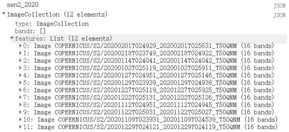
[0045] (1) Use the Google Earth Engine cloud platform to screen the Sentinel-2MSI images of the study area, that is, the Zhangjiang Estuary Mangrove National Nature Reserve in Fujian from January to March and October to December, and the cloud cover is less than 10%. An image set is formed; after calculation, there are 12 eligible images in the study area in 2020, and the image screening results are as follows: figure 1 shown.

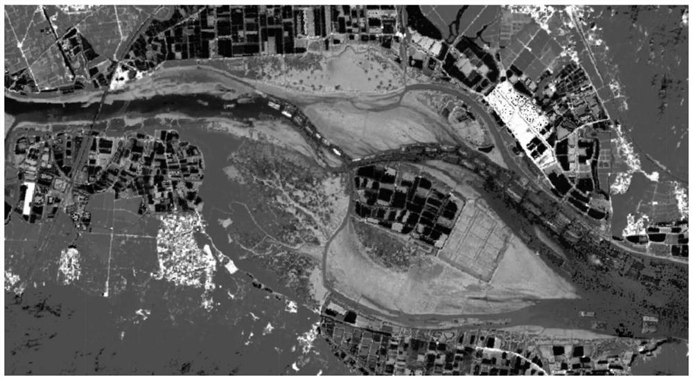
[0046] (2) Calculate the vegetation index (NDVI) of each image in the image set to obtain the spatial NDVI image, and combine the NDVI image as a band into the original image. The calculation formula of vegetation index NDVI is:

[0047] NDV...


PUM


Abstract

The invention discloses a mangrove forest remote sensing rapid and accurate extraction method based on a cloud platform, and relates to the field of mangrove forest distribution diagram manufacturing, and the method comprises the steps: firstly, screening Sentinel-2 images with good quality through a Google EarthEngine cloud platform, and forming an image set; calculating a vegetation index NDVI of each image in the image set to obtain an NDVI image in space; forming a low-tide image formed by the maximum NDVI pixels; erasing an area without vegetation by using a mask function; utilizing an MFVI index to identify mangrove forest space distribution information; and erasing a non-mangrove forest region by using a mask function to obtain a spatial distribution diagram of the mangrove forest. According to the method, the difficulty of mangrove forest remote sensing interpretation caused by periodic tidal water submerging is overcome, and the problems that the submerged mangrove forest is missed to be painted and inland vegetation is wrongly divided into mangrove forests are solved. The mangrove forest interpretation method is fast and effective, improves the precision and credibility of mangrove forest interpretation, and has repeatability and robustness.

Description

technical field [0001] The invention relates to the technical field of making mangrove distribution maps, in particular to a cloud-based remote sensing method for quickly and accurately extracting mangroves. Background technique [0002] As one of the most vital marine natural ecosystem elements, the mangrove wetland ecosystem plays an important role in purifying the environment, maintaining biodiversity, preventing wind and waves, and sequestering carbon. In August 2020, in order to comprehensively strengthen the protection and restoration of mangroves, the Ministry of Natural Resources and the National Forestry and Grassland Administration formulated the "Special Action Plan for the Protection and Restoration of Mangroves (2020-2025)", which clearly pointed out that the use of satellite remote sensing and other high-tech Using technical means to timely grasp the dynamic changes of mangrove resources, biodiversity, important ecological functions, and environmental quality s...

Claims


Application Information

Patent Timeline
Patent Type & Authority Applications(China)
IPC IPC(8): G06V20/10G06T5/50G06V10/764
CPCG06T5/50G06T2207/10032G06T2207/20221G06F18/241
Inventor 刘盼任春颖王宗明宋开山宫文彦黄艳金
Owner CHINA FORESTRY STAR BEIJING TECH INFORMATION CO LTD
Why Eureka
Eureka Blog
Learn More