
Multi-attitude all-terrain geographic information surveying and mapping device

A technology of geographic information and surveying and mapping equipment, which is applied in the direction of surveying equipment, surveying and mapping and navigation, and surveying instruments. It can solve problems that affect the use of devices, burnout of surveying and mapping instruments, and reduce the service life of surveying and mapping instruments, so as to achieve the effect of enhancing the cleaning effect.

Inactive Publication Date: 2022-04-12
王春辉
View PDF0 Cites 0 Cited by
  • Summary
  • Abstract
  • Description
  • Claims
  • Application Information

AI Technical Summary

Problems solved by technology

[0003] After the existing surveying and mapping instrument works for a period of time, a large amount of heat is generated inside it. If the surveying and mapping instrument is not dissipated in time, it will cause the surveying and mapping instrument to be burned, thereby reducing the service life of the surveying and mapping instrument. Most of them have heat dissipation holes on the outer wall, so that the outside air can enter the interior to achieve the purpose of cooling the device, but when the air enters the interior of the device, it will carry a lot of dust into the interior of the device. And then seriously affect the use of the device

Method used


Image

  • Multi-attitude all-terrain geographic information surveying and mapping device
  • Multi-attitude all-terrain geographic information surveying and mapping device
  • Multi-attitude all-terrain geographic information surveying and mapping device

Examples


Embodiment Construction

[0027] The following will clearly and completely describe the technical solutions in the embodiments of the present invention with reference to the accompanying drawings in the embodiments of the present invention. Obviously, the described embodiments are only some, not all, embodiments of the present invention. Based on the embodiments of the present invention, all other embodiments obtained by persons of ordinary skill in the art without making creative efforts belong to the protection scope of the present invention.

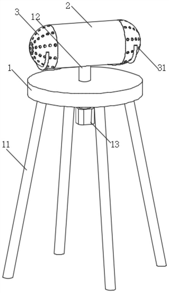
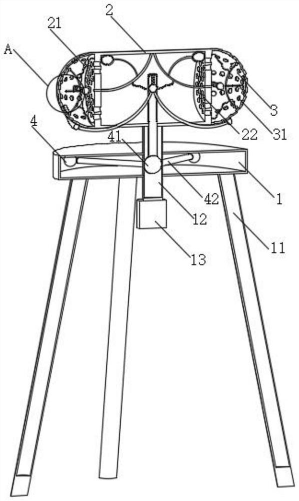
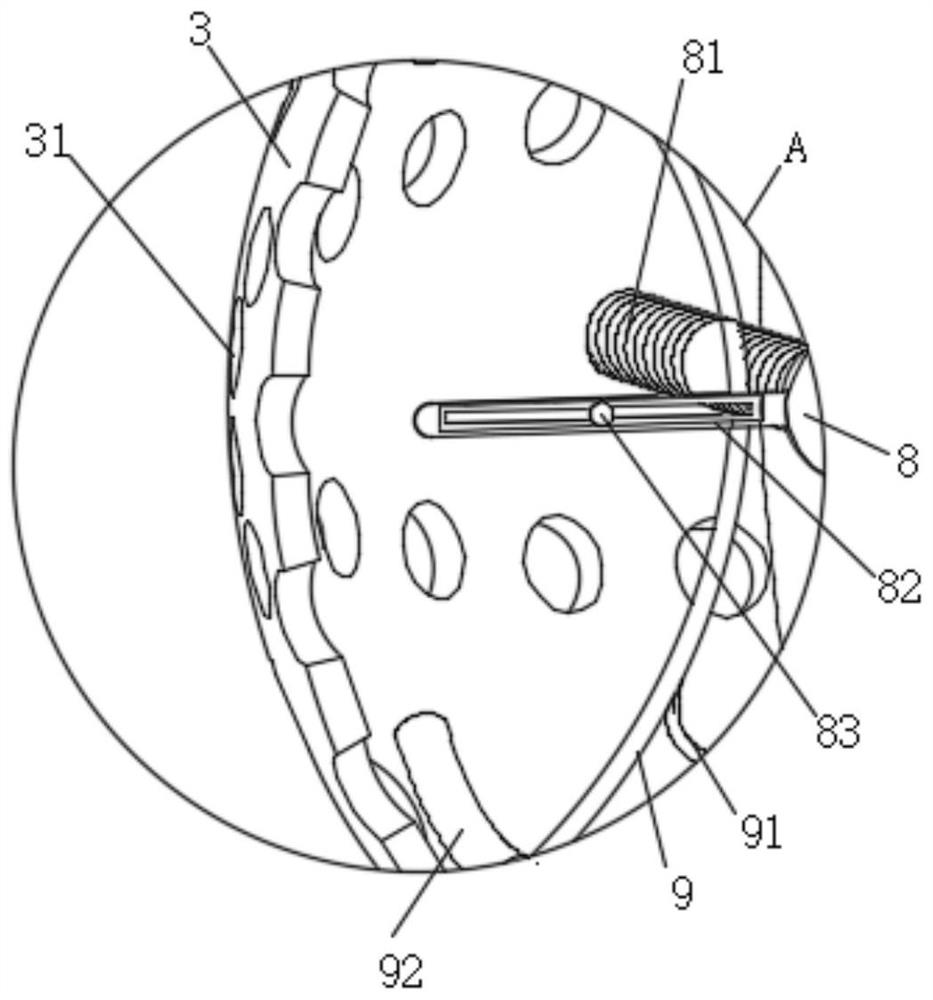
[0028] see Figure 1-7 , the present invention provides a technical solution: a multi-posture all-terrain geographical information surveying and mapping device, including a base 1, the purpose of which is set up in this way is to facilitate the installation of a surveying and mapping control box 2, and the bottom outer wall of the base 1 is fixedly connected with supporting legs 11, so that The purpose of setting is to facilitate the support of the whole devic...


PUM


Abstract

The invention relates to the technical field of surveying and mapping equipment, and discloses a multi-attitude all-terrain geographic information surveying and mapping device which comprises a base, according to the multi-attitude all-terrain geographic information surveying and mapping device, when a surveying and mapping angle needs to be adjusted, a motor drives an adjusting rod to rotate, a movable collision rod collides with a collision ball, and then under the collision effect, the surveying and mapping angle is adjusted. The movable collision rod can move towards the interior of the adjusting rod so as to extrude the extrusion deformation ball, deformation of the extrusion deformation ball under the extrusion effect can drive the lifting rod to move up and down, and then under the effect of inertia force, the inertia ball can drive the movable ring to move up and down repeatedly along the outer surface of the lifting rod. And the movement of the arc-shaped elastic pull rod enables an auxiliary extrusion rod to extrude an extrusion air bag, so that dust on the dustproof cover is cleaned by internal gas, and the situation that the outer surface of the dustproof cover adsorbs too much dust, and consequently heat dissipation of the whole device is affected is prevented.

Description

technical field [0001] The invention relates to the technical field of surveying and mapping equipment, in particular to a multi-attitude and all-terrain geographic information surveying and mapping device. Background technique [0002] Surveying and mapping equipment refers to instruments and devices such as data acquisition, processing, and output designed and manufactured for surveying and mapping operations, and various orientation, distance measurement, angle measurement, Instruments for height measurement, mapping and photogrammetry. The current surveying and mapping equipment includes a supporting platform, a surveying and mapping instrument and a surveying and mapping bracket. The bottom of the supporting platform is hinged with three surveying and mapping supports in its circumferential direction. The surveying and mapping instrument is fixedly installed on the top of the supporting platform. For geographic information, the operator can deploy and support the three...

Claims


Application Information

Patent Timeline
Patent Type & Authority Applications(China)
IPC IPC(8): G01C15/00B08B7/00F16M11/22F16M11/08F16M11/18
Inventor 王春辉朱彬刘强
Owner 王春辉
Learn More