Resource data library building management method for digital twin cities
A resource data and database technology, which is applied in electronic digital data processing, digital data information retrieval, database indexing, etc., can solve the problem that associated fields do not have any meaning, cannot quickly and accurately locate 3D data points, delete, modify, and unfavorable data linkage maintenance and maintenance. Update and other issues to achieve the effect of reducing labor management costs and improving management
- Summary
- Abstract
- Description
- Claims
- Application Information
AI Technical Summary
Problems solved by technology
Method used
Image

Examples
Embodiment 1
[0035] A resource data library management method for a digital twin city, comprising the following steps:
[0036] 1. Construction of 3D model
[0037] 1. Data collection
[0038] Collect oblique images of the city's main buildings, landmark buildings, and key landscapes; use aerial photography to collect laser point cloud data, including: positioning and orientation data (POS data): differential GPS data, IMU data; laser scanning ranging data: ranging Data, scan angle, echo intensity image; calibration data: system parameters (instrument placement parameters); calibration data.
[0039] 2. Model construction
[0040] Automatically construct 3D models using laser point cloud data and oblique images.
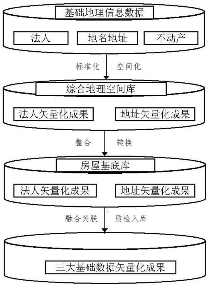
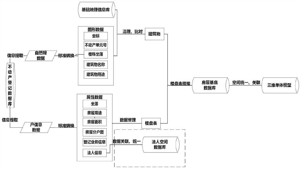
[0041] 2. Vector spatialization of standard place name address data
[0042] The standard place name address database, real estate registration data, administrative division data, planning status data, and natural resource geospatial data are fused and correlated, and the fus...
PUM
 Abstract
Description
Claims
Application Information
 - Generate Ideas
- Intellectual Property
- Life Sciences
- Materials
- Tech Scout
- Unparalleled Data Quality
- Higher Quality Content
- 60% Fewer Hallucinations
Browse by: Latest US Patents, China's latest patents, Technical Efficacy Thesaurus, Application Domain, Technology Topic, Popular Technical Reports.
© 2025 PatSnap. All rights reserved.Legal|Privacy policy|Modern Slavery Act Transparency Statement|Sitemap|About US| Contact US: help@patsnap.com