Land space planning topographic survey device

A technology of space planning and topographical measurement, which is applied in the directions of measuring devices, photogrammetry/video metrology, transportation and packaging, etc., can solve the problems of camera pollution, affecting the quality of aerial photography, etc., so as to reduce the occupied space, facilitate portability, reduce height effect

Inactive Publication Date: 2022-05-06
王秀芹
View PDF1 Cites 1 Cited by
  • Summary
  • Abstract
  • Description
  • Claims
  • Application Information

AI Technical Summary

Problems solved by technology

Although the device has many beneficial effects, the following problems still exist: when the device takes off upwards, the propeller will drive the flow of gas, causing the dust on the ground to rise upwards, causing the mirror surface of the camera to be polluted by dust, which affects the quality of aerial photography

Method used


Image

  • Land space planning topographic survey device
  • Land space planning topographic survey device
  • Land space planning topographic survey device

Examples


Embodiment Construction

[0029] Please refer to Fig. 1-7, the present invention provides a kind of technical scheme:

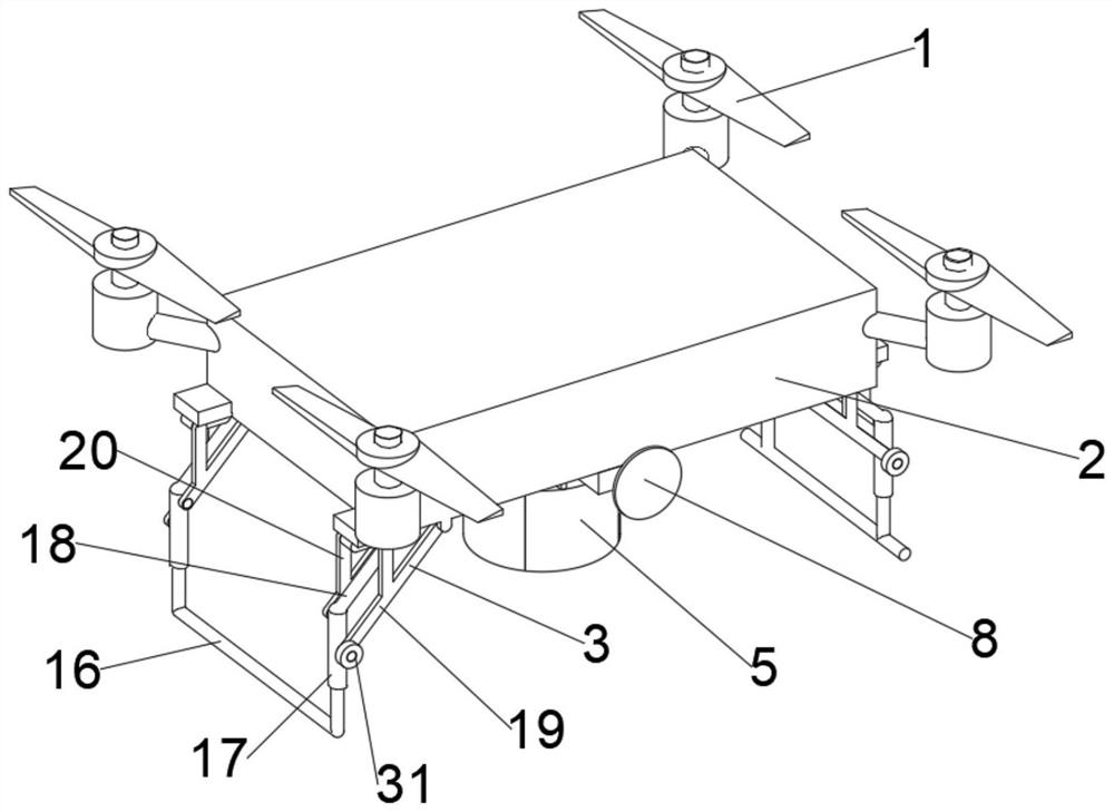
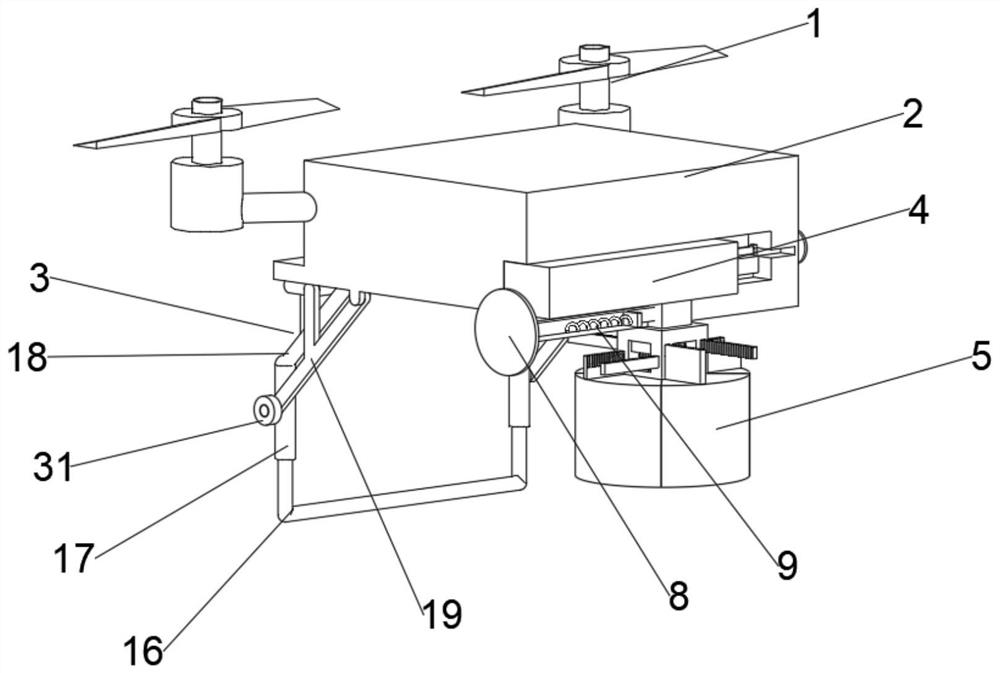
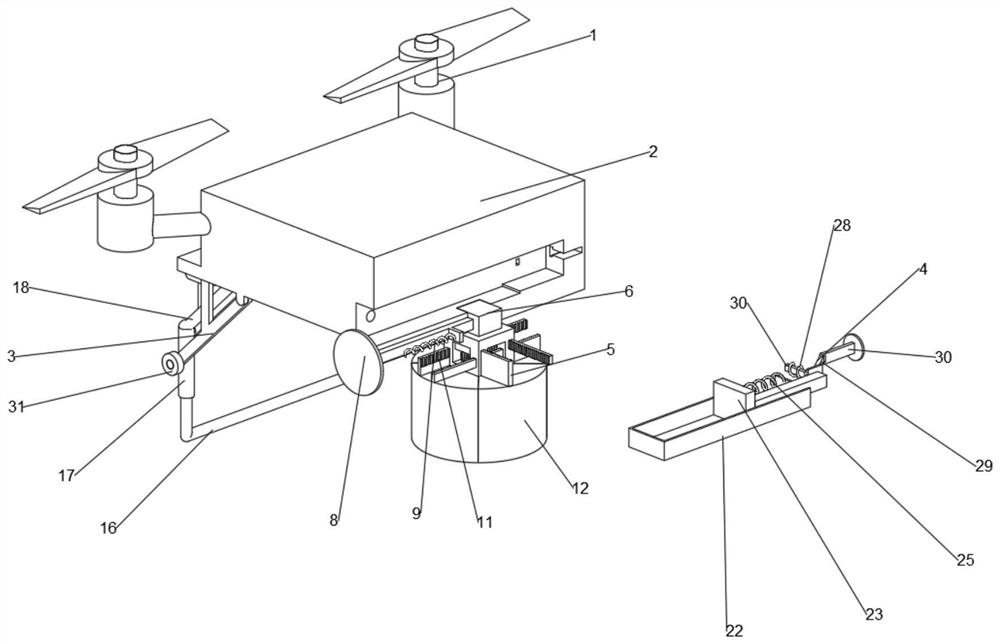
[0030] A topographic measurement device for national land space planning, such as figure 1 As shown, it includes a remote control aircraft main body 1, and the remote control aircraft main body 1 includes a housing 2, two support mechanisms 3 are symmetrically arranged on both sides of the housing 2, a buffer mechanism 4 is provided at the bottom of the housing 2, and a protective mechanism is provided below the housing 2 5.

[0031] The device can effectively protect the camera 13 .

[0032] Specifically, such as image 3 and Figure 4 As shown, the protection mechanism 5 includes a mounting frame 6, and a limit groove 7 is provided on the top of the mounting frame 6, and a limit rod A8 is provided on one side of the limit groove 7, and two springs A9 are symmetrically arranged on both sides of the limit rod A8, and the mounting frame 6 A gear A10 is arranged in the middle, a plu...


PUM


Abstract

The invention discloses a territorial space planning topographic survey device, and belongs to the technical field of photogrammetry. A territorial space planning topographic survey device comprises a remote control aircraft body, the remote control aircraft body comprises a shell, a plurality of supporting mechanisms are arranged at the bottom of the shell, each supporting mechanism comprises a supporting frame, and the supporting frames are used for supporting the remote control aircraft body; a camera is arranged at the bottom end of the shell, a protection mechanism is arranged on the outer side of the camera and comprises a plurality of protection shells arranged on the outer side of the camera, at least one protection shell is connected with an external drive, and the protection shell moves relative to the other protection shell under the action of the external drive so that the camera can be exposed. The device can effectively ensure the quality of aerial photography.

Description

technical field [0001] The present invention relates to the technical field of photogrammetry, and more specifically, relates to a topographic measurement device for national land space planning. Background technique [0002] As my country's economy continues to grow rapidly and industrialization and urbanization are accelerating, great changes have taken place in the country's land and space. This change has strongly supported economic development and social progress, but there are also some problems that must be paid close attention to, such as too much and too fast reduction of cultivated land, excessive resource development intensity, prominent environmental problems, and degradation of ecosystem functions. Therefore, it is necessary to make overall plans for the strategic pattern of future land space development and form a scientific land space development orientation. [0003] The patent document with the existing publication number CN112747720A provides a topographic...

Claims


Application Information

Patent Timeline
Patent Type & Authority Applications(China)
IPC IPC(8): B64C25/60B64C25/62B64C25/10B64C39/02B64D47/08G01C11/00
CPCB64C25/60B64C25/62B64C25/10B64D47/08B64C39/02G01C11/00B64U2101/30B64U10/10
Inventor 王秀芹
Owner 王秀芹
Why Eureka
Try Eureka