Check patentability & draft patents in minutes with Patsnap Eureka AI!

Vehicle navigation path planning method

A route planning and vehicle navigation technology, which is applied in navigation, surveying and mapping, road network navigator, etc., can solve the problems of increasing traffic pressure, congestion, and clustering effect of navigation information, so as to reduce traffic pressure and avoid congestion , to avoid the effect of clustering effect

Pending Publication Date: 2022-05-13
WUHAN UNIV
View PDF0 Cites 0 Cited by
  • Summary
  • Abstract
  • Description
  • Claims
  • Application Information

AI Technical Summary

Problems solved by technology

However, a single navigation information will often lead to clustering effect, resulting in congestion, thereby increasing the pressure of traffic control, and it is difficult to meet the personalized travel needs of users. At the same time, most of the driving habits of users show a certain stage, and they are not always the same. of

Method used


Image

  • Vehicle navigation path planning method
  • Vehicle navigation path planning method
  • Vehicle navigation path planning method

Examples


Embodiment 1

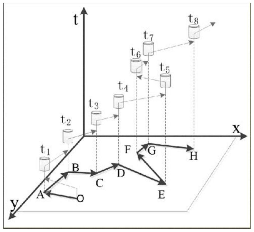
[0023] Provide a kind of vehicle navigation path planning method, it is characterized in that, comprising the following steps:

[0024] Read several log trajectories of the vehicle, and divide the log trajectories into several vector elements containing driving characteristics;

[0025] Establish the three-dimensional clustering coordinate system of the road in the log track with respect to time, economy, and comfort performance, obtain the driving feature vector value through the vector element clustering screening, and obtain the personalized performance value of the road through the quantitative analysis of the driving feature vector value;

[0026] Push down the navigation path based on road individual performance values.

[0027] Based on the log trajectory of the vehicle to which the user belongs, the user's driving characteristics are extracted, and on the other hand, personalized route planning is performed from the user's perspective, that is, personalized navigation ...


PUM


Abstract

The invention discloses a vehicle navigation path planning method, which comprises the following steps of: reading a plurality of log trajectories of a vehicle, and dividing the log trajectories into a plurality of loss elements containing driving characteristics; establishing a three-dimensional clustering coordinate system about time, economy and comfort performance of the road in the log trajectory, performing clustering screening on the loss elements to obtain a driving feature vector value, and performing quantitative analysis on the driving feature vector value to obtain a personalized performance value of the road; and deducing a navigation path according to the personalized performance value of the road. The driving characteristics of the user are extracted based on the log trajectory of the vehicle to which the user belongs, and personalized path planning is carried out from the view of the user, so that personalized navigation can be realized, the navigation route conforming to the driving habit of the driver can be selected, the clustering effect caused by single navigation information is avoided, congestion is avoided, and the user experience is improved. Therefore, the traffic dispersion pressure is reduced.

Description

technical field [0001] The invention relates to the field of vehicle route navigation, in particular to a vehicle navigation route planning method. Background technique [0002] With the vigorous development of the modern automobile industry, the number of self-driving cars is growing day by day, and the traffic pressure on the road network is increasing day by day, which cannot meet the growing needs of users for driving comfort. The current navigation system uses the geographic information provided by the Global Positioning System (GPS) or the Beidou system and the electronic map to detect the location of the vehicle, and then provide popular "distance-turn" navigation services. However, a single navigation information will often lead to clustering effect, resulting in congestion, thereby increasing the pressure of traffic control, and it is difficult to meet the personalized travel needs of users. At the same time, most of the driving habits of users show a certain stage,...

Claims


Application Information

Patent Timeline
IPC IPC(8): G01C21/34G06F16/28G06F16/29
CPCG01C21/3484G06F16/29G06F16/285
Inventor 陈胤良梁良马彦昭巫世晶
Owner WUHAN UNIV
Features
  • R&D
  • Intellectual Property
  • Life Sciences
  • Materials
  • Tech Scout
  • Unparalleled Data Quality
  • Higher Quality Content
  • 60% Fewer Hallucinations
Learn More