AIS-based meteorological sea condition data fusion processing system and method in ship navigation process
A data fusion and processing system technology, applied in the direction of electrical digital data processing, special data processing applications, database indexing, etc., to achieve the effect of ensuring navigation safety
- Summary
- Abstract
- Description
- Claims
- Application Information
AI Technical Summary
Problems solved by technology
Method used
Image
Examples
Embodiment 1
[0046] This embodiment provides an AIS-based meteorological and sea state data fusion processing system during ship navigation, including a meteorological and sea state data receiving module, a meteorological and sea state data parsing module, a meteorological forecast module, a ship route visualization module, and a database,
[0047] The meteorological and sea state data receiving module is used to receive all the meteorological and sea state data on each navigation route, and transmit all the received meteorological and sea state data to the meteorological and sea state data analysis module;
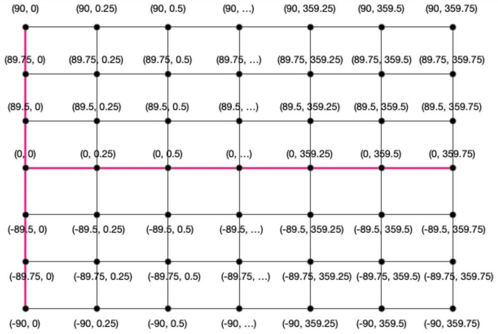
[0048] The meteorological and sea state data analysis module converts the received meteorological and sea state data into a grid formed by latitude and longitude through a grid format conversion method, and writes the grid coordinates and time as retrieval indexes into the database;
[0049] The weather forecast module predicts the future weather conditions of the route to be queried; ...
Embodiment 2
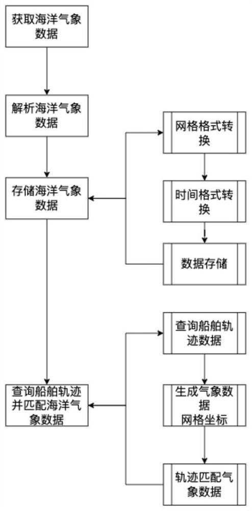
[0061] This embodiment provides an AIS-based method for fusion processing of meteorological and sea state data during ship navigation, which is implemented based on the AIS-based system for fusion processing of meteorological and sea state data during ship navigation described in Embodiment 1, such as figure 1 shown, including the following steps:
[0062] S1, using the meteorological and sea state data receiving module to receive all meteorological and sea state data on each navigation route, and transmitting all the received meteorological and sea state data to the meteorological and sea state data analysis module;
[0063] All meteorological and sea state data are stored in nc file format, including forecast time time, longitude longitude and latitude latitude;
[0064] S2, using the meteorological and sea state data analysis module to convert the received meteorological and sea state data into a grid formed by latitude and longitude through grid format conversion, and use ...
PUM
 Abstract
Description
Claims
Application Information
 - R&D
- Intellectual Property
- Life Sciences
- Materials
- Tech Scout
- Unparalleled Data Quality
- Higher Quality Content
- 60% Fewer Hallucinations
Browse by: Latest US Patents, China's latest patents, Technical Efficacy Thesaurus, Application Domain, Technology Topic, Popular Technical Reports.
© 2025 PatSnap. All rights reserved.Legal|Privacy policy|Modern Slavery Act Transparency Statement|Sitemap|About US| Contact US: help@patsnap.com


