
Unmanned aerial vehicle surveying and mapping device for mountainous area

A surveying and mapping device and UAV technology, which is applied in the field of UAV surveying and mapping, can solve the problems of rough ground, time-consuming and labor-intensive, easy to shake storage boxes, etc., and achieve the effect of easy installation and disassembly, and easy portability

Pending Publication Date: 2022-06-21
浙江容大电力工程有限公司
View PDF0 Cites 2 Cited by
  • Summary
  • Abstract
  • Description
  • Claims
  • Application Information

AI Technical Summary

Problems solved by technology

[0003] At present, the terrain in mountainous areas is complex, and it is difficult to find suitable take-off and return landing sites for surveying and mapping UAVs. Stable placement, the ground is relatively rough, and the storage box is easy to shake when placed

Method used


Image

  • Unmanned aerial vehicle surveying and mapping device for mountainous area
  • Unmanned aerial vehicle surveying and mapping device for mountainous area
  • Unmanned aerial vehicle surveying and mapping device for mountainous area

Examples


Embodiment Construction

[0027] In order for those skilled in the art to better understand the solutions of the present invention, the technical solutions in the embodiments of the present invention will be clearly and completely described below with reference to the accompanying drawings in the embodiments of the present invention. Obviously, the described embodiments are only These are some embodiments of the present invention, but not all embodiments. Based on the embodiments of the present invention, all other embodiments obtained by persons of ordinary skill in the art without creative efforts shall fall within the protection scope of the present invention.

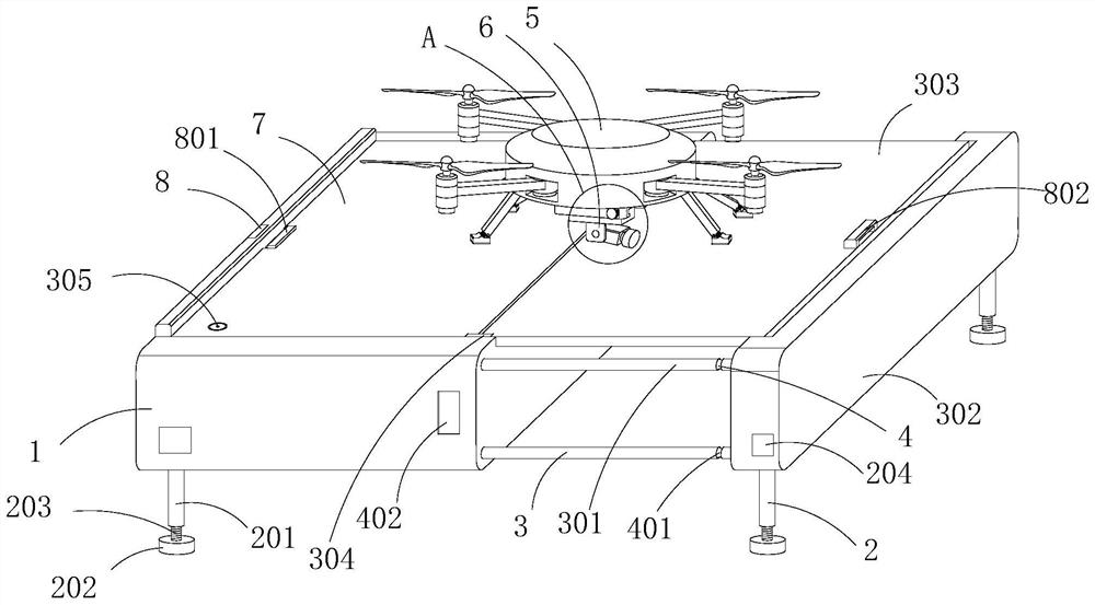
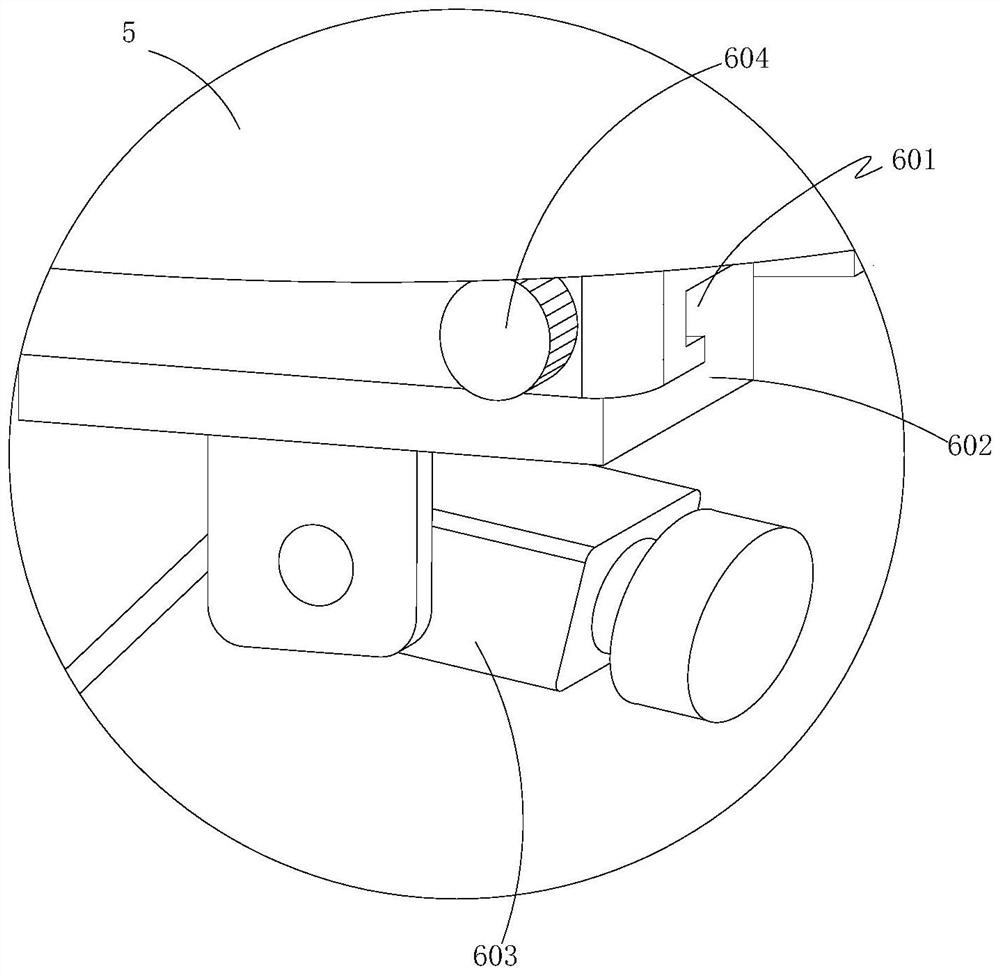
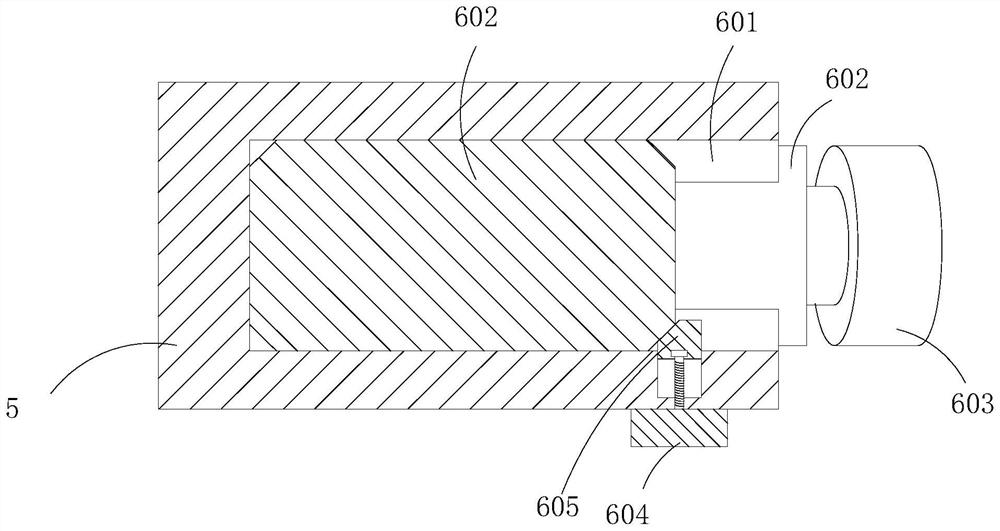
[0028] like Figure 1-9 As shown, a UAV surveying and mapping device for mountainous areas includes a surveying and mapping UAV 5 and a storage box 1, an assembly structure 6 arranged on the surveying and mapping drone 5 for assembling, and an assembly structure 6 arranged on the storage box 1 for assembling. A support structure 2 for suppo...


PUM


Abstract

The invention discloses a mountainous area unmanned aerial vehicle surveying and mapping device which comprises a surveying and mapping unmanned aerial vehicle, a storage box, an assembly structure arranged on the surveying and mapping unmanned aerial vehicle, a supporting structure arranged on the storage box, a bearing structure arranged on the storage box, a limiting structure arranged on the storage box, a locking structure arranged on the bearing structure and a storage structure arranged on the storage box. The surveying and mapping assembly is convenient to assemble through the assembling structure, the assembling structure and the surveying and mapping unmanned aerial vehicle are convenient to store and carry through the storage structure, and the bearing structure and the storage box are convenient to support through the supporting structure, so that the bearing structure and the storage box are in a horizontal state; a stable landing platform can be formed through the bearing structure and the storage structure, so that takeoff and homeward flight landing of the surveying and mapping unmanned aerial vehicle are facilitated, and the bearing structure is conveniently limited through the locking structure and the limiting structure.

Description

technical field [0001] The invention relates to the technical field of unmanned aerial vehicle surveying and mapping, in particular to an unmanned aerial vehicle surveying and mapping device for mountainous areas. Background technique [0002] UAV surveying and mapping is to scan the surveying and mapping area through surveying and mapping drones and surveying and mapping radars, thereby recording the terrain and topography. When surveying and mapping mountainous areas, it is necessary to find a stable take-off and return landing site for the surveying and mapping drones. [0003] At present, the terrain of the mountainous area is complex, and it is difficult to find a suitable place for the take-off and return landing of the surveying and mapping drone, which is time-consuming and labor-intensive. Stable placement, the ground is relatively rugged, and the storage box is easy to shake when placed. SUMMARY OF THE INVENTION [0004] In order to overcome the deficiencies of ...

Claims


Application Information

Patent Timeline
IPC IPC(8): B64F1/00
CPCB64F1/007B64F1/00B64U10/10B64U30/20B64U2101/00B64U70/00B64U80/70
Inventor 张霞许若冰顾凌云王海锋王富源李赢亮厉威
Owner 浙江容大电力工程有限公司
Learn More