Multi-scene flood inundation analysis method and device based on GIS (Geographic Information System)

An analysis method and multi-scenario technology, applied in the field of GIS-based multi-scenario flood submersion analysis, can solve problems such as high data requirements, narrow application range, and long calculation time, and achieve simplified calculation, small data requirements, and expanded application range effect

Pending Publication Date: 2022-07-08
CHINA UNIV OF PETROLEUM (BEIJING)
View PDF0 Cites 0 Cited by
  • Summary
  • Abstract
  • Description
  • Claims
  • Application Information

AI Technical Summary

Problems solved by technology

[0005] This application provides a GIS-based multi-scenario flood analysis method and device to solve the problems of hig

Method used


Image

  • Multi-scene flood inundation analysis method and device based on GIS (Geographic Information System)
  • Multi-scene flood inundation analysis method and device based on GIS (Geographic Information System)
  • Multi-scene flood inundation analysis method and device based on GIS (Geographic Information System)

Examples


Example Embodiment

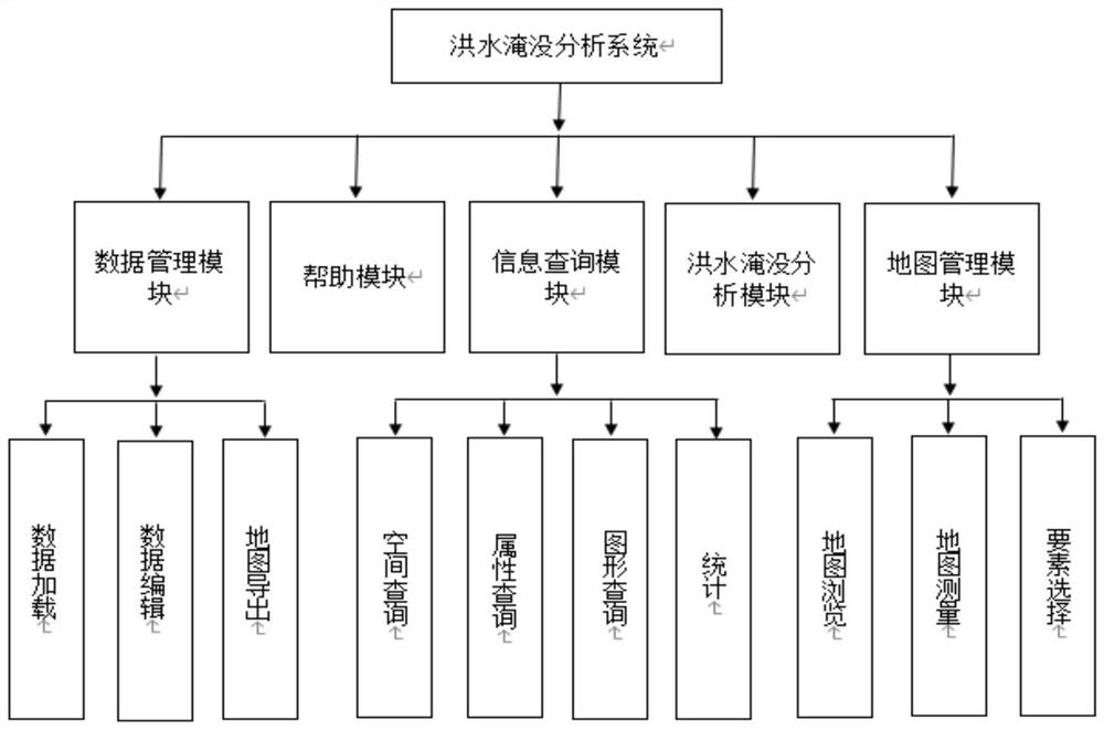
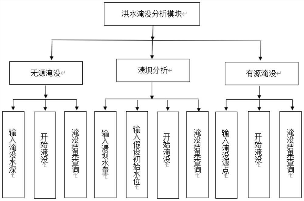
[0068] Exemplary embodiments will be described in detail herein, examples of which are illustrated in the accompanying drawings. Where the following description refers to the drawings, the same numerals in different drawings refer to the same or similar elements unless otherwise indicated. The implementations described in the illustrative examples below are not intended to represent all implementations consistent with this application. Rather, they are merely examples of apparatus and methods consistent with some aspects of the present application as recited in the appended claims.

[0069] First, the terms involved in this application are explained:

[0070] Digital Elevation Model (DEM), referred to as DEM: refers to the digital simulation of ground terrain through limited terrain elevation data, and is a solid ground model that represents ground elevation in the form of a set of ordered numerical arrays.

[0071] The digital elevation model can be expressed as a function:...


PUM


Abstract

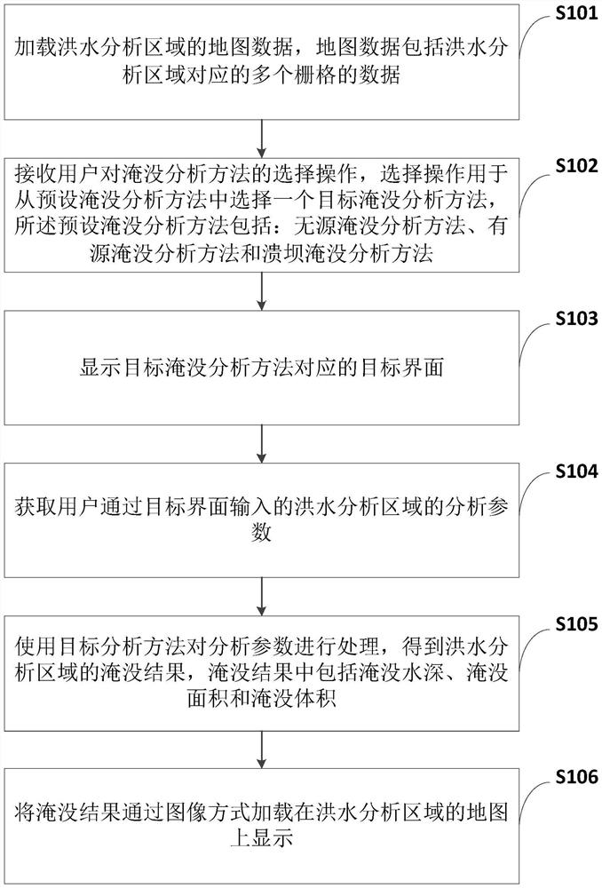
The invention provides a multi-scene flood inundation analysis method and device based on a GIS (Geographic Information System). The method comprises the steps that map data of a flood analysis area is loaded, user selection operation is received, and preset submerging analysis methods are selected, and the preset submerging analysis methods comprise a passive submerging analysis method, an active submerging analysis method and a dam break submerging analysis method. Analyzing parameters, input by a user through the target interface, of the flood area are obtained, the analyzing parameters are processed through the selected target analyzing method, a submerging result is obtained, and the submerging result comprises the submerging water depth, the submerging area and the submerging volume; and loading the flooding result on a map of the flood analysis area in an image form for display. According to the method, the requirement for data in flood inundation analysis can be lowered, the calculation time is shortened, and the flood inundation analysis range is widened.

Description

technical field [0001] The present application relates to the technical field of hydraulic engineering, and in particular, to a multi-scenario flood inundation analysis method and device based on a GIS (Geographic Information System, geographic information system). Background technique [0002] Larger floods have caused great losses to people's lives and properties, so it is very important to carry out flood inundation analysis, formulate flood control policies scientifically, and take flood control measures. [0003] Flood inundation analysis based on hydrodynamic model is a commonly used flood inundation method. Corresponding data are obtained by collecting geographic data, hydrological data, historical flood disaster data, etc., and a hydrodynamic model is constructed and solved according to the collected data to obtain the submerged water depth. Water depth analysis of submerged extent and submerged volume. Commonly used hydrodynamic models include MIKE model, JFLOW mod...

Claims


Application Information

Patent Timeline
IPC IPC(8): G06F30/22G06F30/28G06Q50/26G06F113/08
CPCG06F30/22G06F30/28G06Q50/26G06F2113/08Y02A10/40
Inventor 曾勇李佳奇
Owner CHINA UNIV OF PETROLEUM (BEIJING)
Why Eureka
Try Eureka