
Remote sensing image scene classification method for multi-component GAN reconstruction

A technology for scene classification and remote sensing images, which is applied in the field of remote sensing image scene classification, can solve problems such as poor classification effect, achieve the effect of improving classification effect, improving classification effect, and improving generalization ability

Pending Publication Date: 2022-07-19
WUHAN UNIV OF SCI & TECH
View PDF0 Cites 0 Cited by
  • Summary
  • Abstract
  • Description
  • Claims
  • Application Information

AI Technical Summary

Problems solved by technology

[0007] The present invention proposes a remote sensing image scene classification method reconstructed by multi-component GAN, which is used to solve or at least partially solve the technical problem of poor classification effect existing in the prior art

Method used


Image

  • Remote sensing image scene classification method for multi-component GAN reconstruction
  • Remote sensing image scene classification method for multi-component GAN reconstruction
  • Remote sensing image scene classification method for multi-component GAN reconstruction

Examples


Embodiment Construction

[0070] The purpose of the present invention is to provide a multi-component GAN reconstruction for the technical problem of poor classification effect caused by inaccurate component positioning due to insufficient representation of remote sensing image scene features for intra-class diversity and inter-class similarity in the prior art The remote sensing image scene classification method, so as to achieve the purpose of improving the classification accuracy and classification effect.

[0071] In order to realize the above-mentioned technical effect, the main idea of ​​the present invention is as follows:

[0072] A method for classifying remote sensing image scenes reconstructed by multi-component GAN is provided. First, the scene data set is randomly divided into training set and test set according to the proportion; secondly, the data set is preprocessed, and the preprocessed remote sensing scene image data is The real image; then obtain multiple potential encoding input gen...


PUM


Abstract

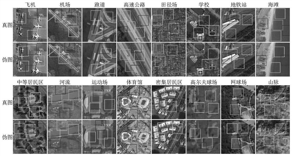
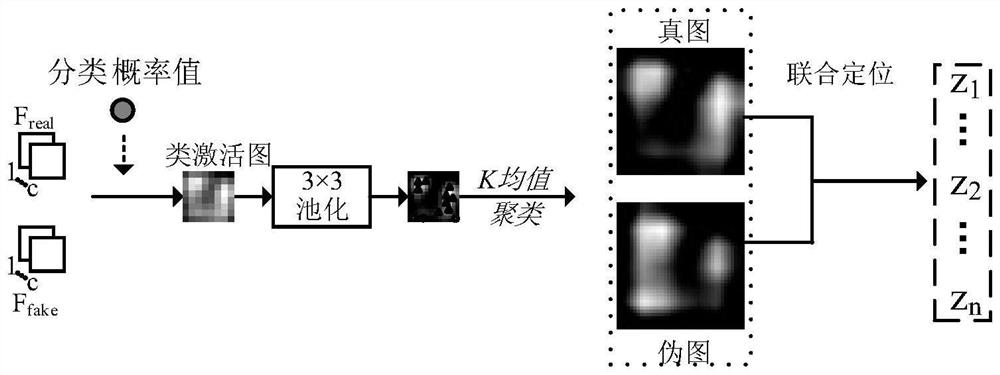
The invention provides a remote sensing image scene classification method for multi-component GAN reconstruction. The method comprises the following steps: firstly, randomly dividing a scene data set into a training set and a test set in proportion; secondly, preprocessing the data set, wherein the preprocessed remote sensing scene image data is a real image; acquiring a plurality of potential coding input generator networks in a random initialization manner to obtain a pseudo graph; then jointly inputting the true image and the pseudo image into a feature extraction and joint positioning module, and participating in joint positioning to obtain a plurality of information components; the information components are used for updating a plurality of potential codes and then participate in image-level classification and component-level classification respectively by using full-image features and component features to obtain an optimal classification model; and finally, inputting the test set into the optimal positioning network and the optimal classification model to obtain a final prediction result. The method can improve the positioning accuracy and classification effect of a plurality of parts.

Description

technical field [0001] The invention relates to the technical field of remote sensing image scene classification, in particular to a remote sensing image scene classification method reconstructed by multi-component GAN. Background technique [0002] Remote sensing image scene classification task, as an important branch of remote sensing image processing technology, is of great significance in both military and civilian fields. Scene classification aims to automatically predict a semantic category for each scene image through a learned classifier. However, affected by different times, seasons, regions, and imaging conditions, remote sensing images have rich variations in translation, viewpoint, object pose and appearance, spatial resolution, illumination, background, and occlusion, exhibiting high intra-class diversity Sex and low inter-class variance. Therefore, remote sensing scene classification still faces severe challenges. [0003] The performance of image classifica...

Claims


Application Information

Patent Timeline
Patent Type & Authority Applications(China)
IPC IPC(8): G06V20/00G06V10/46G06V10/762G06V10/764G06V10/82G06K9/62G06N3/04G06N3/08
CPCG06N3/08G06N3/047G06N3/045G06F18/23213G06F18/2415Y02T10/40
Inventor 边小勇刘卓邓鹤杨博盛玉霞李波喻国荣张晓龙
Owner WUHAN UNIV OF SCI & TECH
Learn More