
Urban agglomeration comprehensive traffic evaluation method

An evaluation method and technology of urban agglomeration, applied in traffic flow detection, data processing applications, instruments, etc., can solve problems such as insufficient consideration of regional economic integration, and achieve the effect of promoting coordinated and high-quality development

Active Publication Date: 2022-08-09
CHANGAN UNIV
View PDF6 Cites 2 Cited by
  • Summary
  • Abstract
  • Description
  • Claims
  • Application Information

AI Technical Summary

Problems solved by technology

[0003] The purpose of this invention is to provide a comprehensive traffic evaluation method for urban agglomerations, which is used to solve the problem that the comprehensive traffic evaluation of urban agglomerations did not fully consider regional economic integration in the past

Method used


Image

  • Urban agglomeration comprehensive traffic evaluation method
  • Urban agglomeration comprehensive traffic evaluation method
  • Urban agglomeration comprehensive traffic evaluation method

Examples


Embodiment Construction

[0056] The technical solutions of the present invention will be further described below with reference to the accompanying drawings and embodiments.

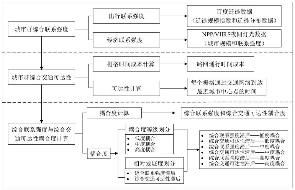
[0057] like figure 1 In the comprehensive traffic evaluation of urban agglomerations, the comprehensive connection strength of urban agglomerations is first calculated based on the travel connection strength and economic connection strength between cities, and then the comprehensive traffic accessibility time between cities is calculated based on the grid method and normalized. Finally, the coupling degree of comprehensive connection strength and comprehensive traffic accessibility time is calculated, and the coupling level is divided.

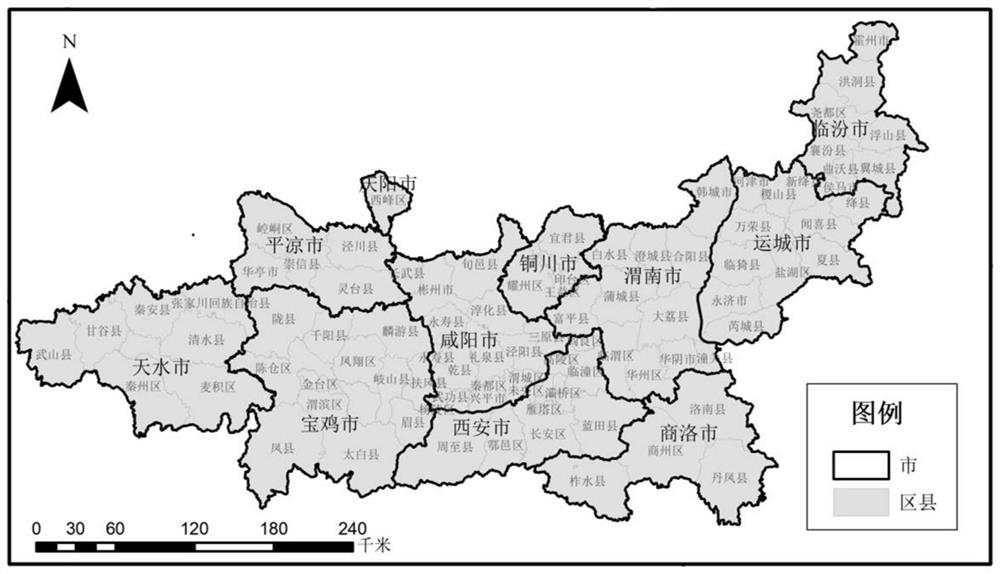
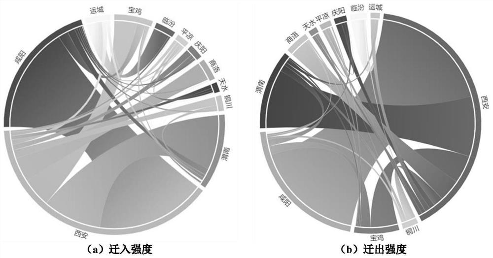
[0058] like figure 2 As shown, the method of the present invention is split and explained in detail based on the data of the Guanzhong Plain urban agglomeration. Among them, Baidu migration data comes from the migration scale index and migration distribution data of Baidu Map in 2019; socioec...


PUM


Abstract

The invention discloses an urban agglomeration comprehensive traffic evaluation method. The method comprises the following steps: S1, calculating urban agglomeration comprehensive connection strength based on travel connection strength and economic connection strength between cities; s2, calculating comprehensive traffic reachability time among cities based on a grid method, and performing normalization processing; and S3, calculating the coupling degree of the comprehensive connection strength and the comprehensive traffic reachability time, and dividing coupling grades. By adopting the evaluation method, the mutual relation between the comprehensive connection strength and the comprehensive traffic accessibility of the urban agglomeration can be more comprehensively represented, and the high-quality development of the comprehensive traffic of the urban agglomeration is realized.

Description

technical field [0001] The invention relates to the technical field of comprehensive transportation, in particular to a comprehensive transportation evaluation method for urban agglomerations. Background technique [0002] Urban agglomeration is a form of spatial organization in the mature stage of urban development, and it mainly undertakes the two major tasks of new urbanization construction and coordinated regional economic development. In the context of the integrated and coordinated development of urban agglomerations, it is of great significance to study the relationship between the strength of economic links and accessibility of urban agglomerations. In the existing technology, gravity models, improved gravity models, weighted average travel time, etc. are often used, and combined with the network analysis function of GIS technology, the relationship between the accessibility of urban agglomerations and the strength of economic connections is calculated. In this type...

Claims


Application Information

Patent Timeline
Patent Type & Authority Applications(China)
IPC IPC(8): G08G1/01G06Q50/26G06Q10/06
CPCG08G1/0104G08G1/0125G06Q10/0639G06Q50/26Y02A30/60
Inventor 王建军卢霄娟柳倩郑诗禹程思晨王赛马驰骋
Owner CHANGAN UNIV
Learn More