Method for rapid transformation of geographical coordinate projection in navigational system

A navigation system and geographic coordinate technology, which is applied in the field of efficient and fast conversion from GPS latitude and longitude coordinates to GIS graphic coordinates, and can solve the problems of cumbersome, high cost and slow navigation data collection

Inactive Publication Date: 2005-03-16
WUHAN HONGXIN TELECOMM TECH CO LTD
View PDF0 Cites 27 Cited by
  • Summary
  • Abstract
  • Description
  • Claims
  • Application Information

AI Technical Summary

Problems solved by technology

[0010] If the above geographic coordinate projection conversion method is adopted, it will be a...

Method used


Image

  • Method for rapid transformation of geographical coordinate projection in navigational system
  • Method for rapid transformation of geographical coordinate projection in navigational system

Examples


Embodiment Construction

[0023] Further illustrate the present invention below in conjunction with accompanying drawing.

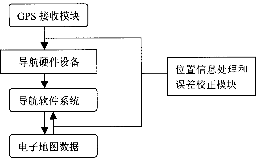
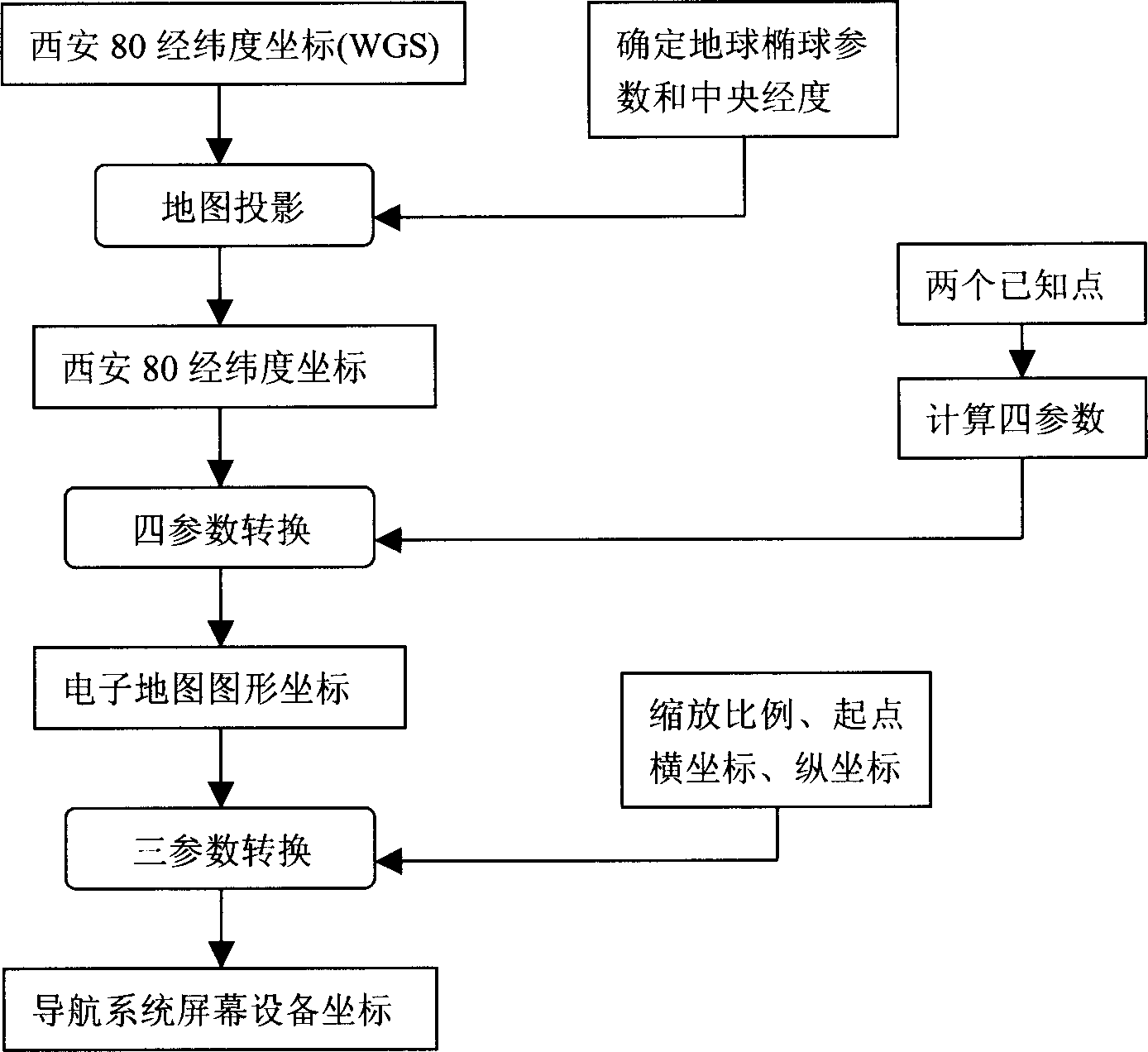
[0024] Depend on figure 1 It can be seen that the position information required for navigation is first obtained through the GPS receiving module, and then the position information is processed by an independent position information processing and error correction module to obtain the standard format WGS latitude and longitude coordinates. The navigation system receives the WGS latitude and longitude coordinates, and the navigation software The system then calls the position information processing and error correction module, where the WGS latitude and longitude coordinates are directly regarded as Xi’an 80 latitude and longitude coordinates, and the Xi’an 80 latitude and longitude coordinates are converted into Xi’an 80 plane coordinates through Gaussian projection, and then the Xi’an 80 plane coordinates are converted into an electronic map The graphic data of the electronic map...


PUM


Abstract

This invention provides a rapid geological coordinates project conversion method applied in the guide system, which comprises GPS signal receiving module, guide soft and hard wares system, electrical map, position information process and error correction module though which can rapidly match the position information of the moving object into the displays of the guide system. Comparing with the old conversion method, this invention lowers the guide data collection cost and has a good compatibility and can convert the moving object position information into various forms of the electrical maps.

Description

technical field [0001] The present invention relates to the fields of geographic information system (GIS) and global positioning system (GPS), in particular to an efficient and fast method for converting GPS latitude and longitude coordinates to GIS graphic coordinates, which can quickly and accurately display GPS moving targets on a graphic screen . Background technique [0002] In the information society, 80% of the information is related to location information, so systems specially used to process location information (such as GIS system, GPS system) are now widely used. The navigation system is an application of the location information system. The first problem to be solved in the navigation system is to match the specific location of the moving target in the real world with the content of the electronic map in the system. The real-time specific position of the moving target is determined by the GPS signal receiving module, which is a kind ...

Claims


Application Information

Patent Timeline
IPC IPC(8): G01C21/26G01C21/32
Inventor 廖德祥周训飞吴玲琦章文涛谢骏
Owner WUHAN HONGXIN TELECOMM TECH CO LTD
Why Eureka
Try Eureka