Calibration of a surveying instrument

A detection instrument and technology of instruments, applied in the field of calibration of detection instruments, can solve the problems of increasing calibration errors, reducing the overall accuracy of instruments, not considering instrument errors, etc., and achieving the effect of rapid calibration

Active Publication Date: 2007-01-10
TRIMBLE JENA
View PDF0 Cites 54 Cited by
  • Summary
  • Abstract
  • Description
  • Claims
  • Application Information

AI Technical Summary

Problems solved by technology

Another shortcoming of Huang's method is that it still does not account for instrument errors, such as vertical axis error and lateral collimati

Method used


Image

  • Calibration of a surveying instrument
  • Calibration of a surveying instrument
  • Calibration of a surveying instrument

Examples


Embodiment Construction

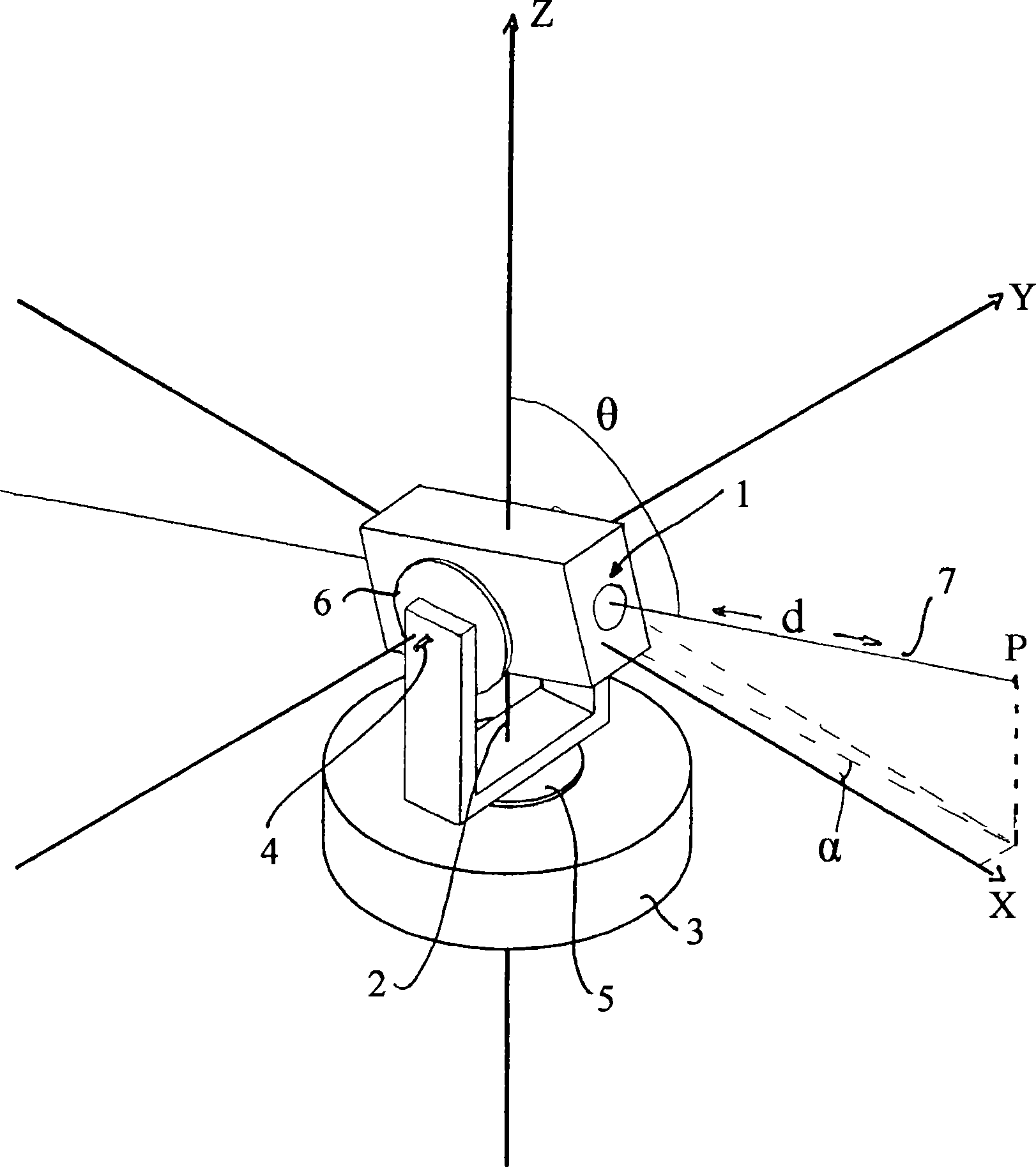
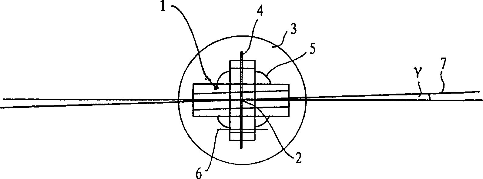
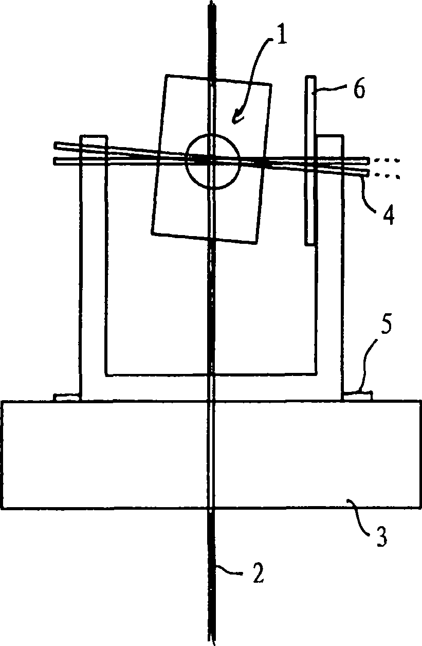
[0103] The television tachymeter 11 that can be calibrated by the first exemplary preferred embodiment of the method of the present invention is at Figures 4 to 6 is shown schematically in simplified form.

[0104] The alidade 12 is arranged on a base element 13 of a tripod 14 serving as a support for the television tachymeter 11 . The alidade 12 is rotatable about a vertical axis 15, which is oriented perpendicular to the ground if the television rangefinder 11 is properly oriented relative to the ground. The alidade 12 carries a telescope unit 16 including a housing 17 , a finder camera 18 with a wide field of view, and a telephoto camera 19 . The telescope unit 16 is rotatable about a tilt axis 20 which is perpendicular to the vertical axis 15 within a tilt axis tolerance. Thus, the tilt axis 14 rotates about the vertical axis 15 as one of the cameras 18 and 19 turns. The control panel 21 is detachably mounted on the alidade 12 . Alidade 12 can be picked up by handle 8...


PUM


Abstract

A method for calibrating a surveying instrument is disclosed the survey instrument comprising a base element (3) and a camera with an image sensor (10), the camera being rotatable about a vertical axis (2) fixed with respect to said base element and being rotatable about a tilting axis (4), the tilting axis being rotated about the vertical axis with rotation of the camera about the vertical axis, In the method, data associated with calibration points (P) and images (P1) of the calibration points on the image sensor captured in different faces are used, the data for each of said calibration points comprising distance data and the data for each of the images of each said calibration point comprising image position data and orientation data. Further, on the basis of the distance data for each of the calibration points and the image position and orientation data for each of the images of the calibration points the surveying instrument is calibrated simultaneously taking into account at least one optical property of camera and at least one of the relative orientation of the vertical axis and the tilting axis and the orientation of the camera relative to one of the base element, the vertical axis and the tilting axis.

Description

technical field [0001] The invention relates to a method of calibrating a detection instrument including a camera, a device for carrying out the method, and a detection instrument calibrated by using the method. Background technique [0002] Surveying typically involves the determination of the angles and positions of points, such as reflectors (trireflectors) or targets in the terrain, which can be measured by surveying instruments such as theodolites or tachymeters. [0003] Spatial positions may be defined with coordinates in an appropriate coordinate system. For example, the position of a point may be determined in terms of its Cartesian coordinates, where the Cartesian coordinates are defined relative to a Cartesian coordinate system having three mutually perpendicular axes. But for position measurement, spherical coordinates are more suitable. like figure 1 As shown, the position of a point can be determined by the distance d from the origin of the orthogonal coordi...

Claims


Application Information

Patent Timeline
IPC IPC(8): G01C15/00G01C25/00
CPCG01C25/00G01C15/00G01C1/04
Inventor M·弗格尔
Owner TRIMBLE JENA
Why Eureka
Try Eureka