

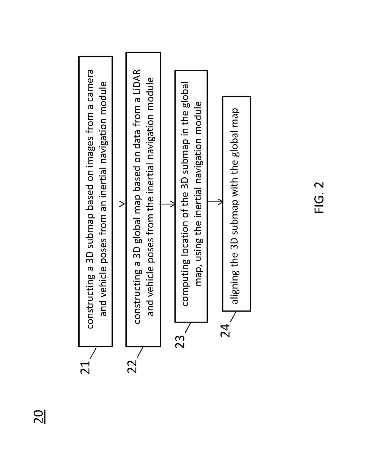
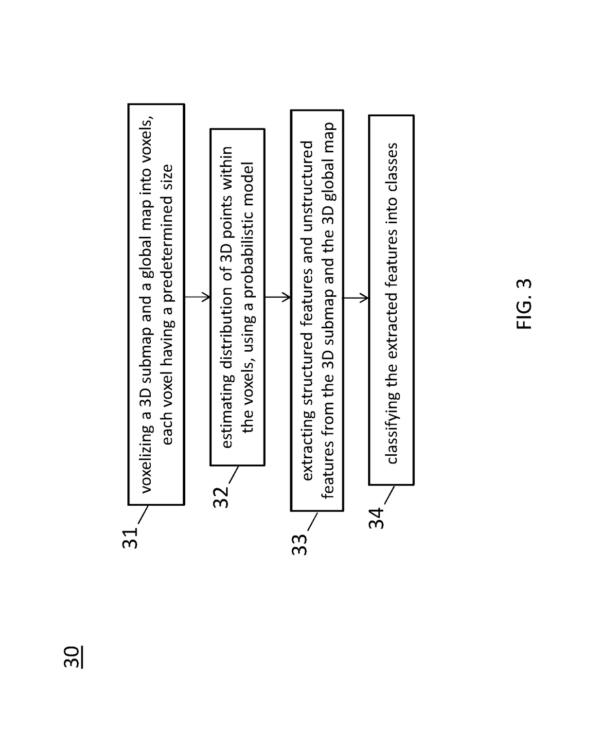
System and method for centimeter precision localization using camera-based submap and LiDAR-based global map
a technology of lidar-based global map and sub-map, applied in image enhancement, instruments, image data processing, etc., can solve the problems of poor accuracy, inability to provide gps satellite signal in urban environments, and inability to achieve accurate localization
- Summary
- Abstract
- Description
- Claims
- Application Information
AI Technical Summary
Benefits of technology
Problems solved by technology
Method used
Image


Examples
Embodiment Construction
[0037]The embodiment and its various embodiments can now be better understood by turning to the following detailed description of the embodiments, which are presented as illustrated examples of the embodiment defined in the claims. It is expressly understood that the embodiment as defined by the claims may be broader than the illustrated embodiments described below.
[0038]Any alterations and modifications in the described embodiments, and any further applications of principles described in this document are contemplated as would normally occur to one of ordinary skill in the art to which the disclosure relates. Specific examples of components and arrangements are described below to simplify the present disclosure. These are, of course, merely examples and are not intended to be limiting. For example, when an element is referred to as being “connected to” or “coupled to” another element, it may be directly connected to or coupled to the other element, or intervening elements may be pr...
PUM
 Abstract
Description
Claims
Application Information