
Method, apparatus and computer program product for mapping and modeling a three dimensional structure

a three-dimensional structure and modeling technology, applied in the field of mapping and modeling a three-dimensional structure, can solve the problems of lack of detail beyond roadways, lack of granularity in digital representations of precise navigation and route guidance, etc., and achieve the effect of simplifying the trajectory path

Active Publication Date: 2020-01-21
HERE GLOBAL BV
View PDF11 Cites 7 Cited by
  • Summary
  • Abstract
  • Description
  • Claims
  • Application Information

AI Technical Summary

Benefits of technology

[0005]According to some embodiments, causing the apparatus to determine a trajectory associated with each element of the LIDAR data may include causing the apparatus to: simplify a trajectory path according to a line regression including a plurality of simplified path points; determine path points to be turning points in response to an angle of the trajectory path at the respective path point satisfying a predefined measure; and segment the trajectory path according to the determined turning points. The sensor data indicative of a trajectory may include an inertial measurement unit sensor where inertial measurement unit sensor odometry may be applied to the LIDAR sensor data to remove a motion distortion effect from the LIDAR data. According to some embodiments, the apparatus may optionally be caused to: receive image data of the interior of the structure; align the image data of the interior of the structure with the LIDAR data defining structural surfaces within the structure; and identify structural elements of the interior of the structure in the three-dimensional point cloud based on the alignment of the image data with the LIDAR data.
[0010]Embodiments herein may provide a method including: receiving sensor data indicative of a trajectory; receiving sensor data defining structural surfaces within a structure; generating a three-dimensional point cloud from the sensor data defining structural surfaces within the structure; segmenting the three-dimensional point cloud into two or more segments based, at least in part, on the sensor data indicative of trajectory; generating a three-dimensional surface model of an interior of the structure based on the segmented three-dimensional point cloud; and providing the three-dimensional surface model of an interior of the structure to an advanced driver assistance system to facilitate autonomous vehicle parking.
[0012]Embodiments herein may provide an apparatus including: means for receiving sensor data indicative of a trajectory; means for receiving sensor data defining structural surfaces within a structure; means for generating a three-dimensional point cloud from the sensor data defining structural surfaces within the structure; means for segmenting the three-dimensional point cloud into two or more segments based, at least in part, on the sensor data indicative of trajectory; means for generating a three-dimensional surface model of an interior of the structure based on the segmented three-dimensional point cloud; and means for providing the three-dimensional surface model of an interior of the structure to an advanced driver assistance system to facilitate autonomous vehicle parking.

Problems solved by technology

While most location-based services rely on maps, such as digital representations of conventional paper maps, these digital representations may suffer from a lack of granularity with respect to precise navigation and route guidance.
Further, these digital representations of maps may rely upon widely available data with respect to roadways, but may lack detail beyond roadways.

Method used


Image

  • Method, apparatus and computer program product for mapping and modeling a three dimensional structure
  • Method, apparatus and computer program product for mapping and modeling a three dimensional structure
  • Method, apparatus and computer program product for mapping and modeling a three dimensional structure

Examples


Embodiment Construction

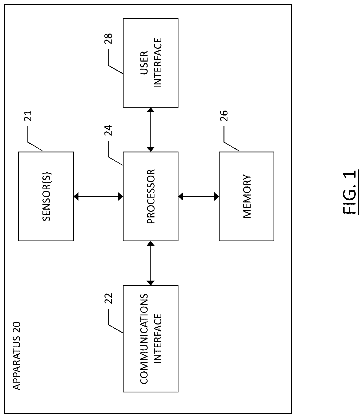
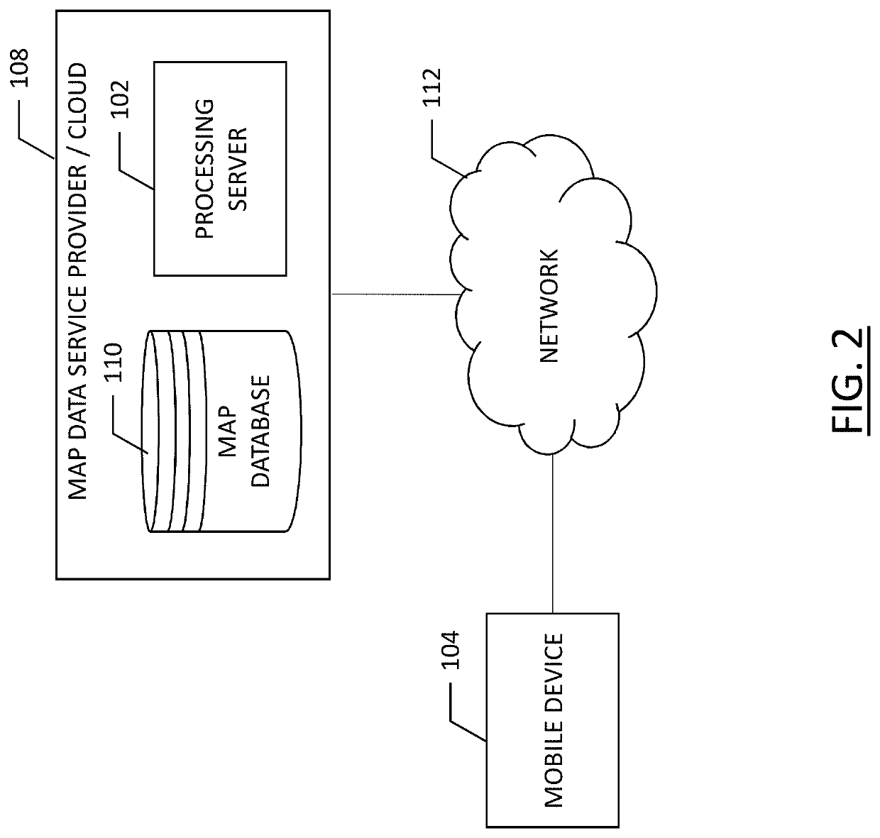
[0021]Some embodiments of the present invention will now be described more fully hereinafter with reference to the accompanying drawings, in which some, but not all, embodiments of the invention are shown. Indeed, various embodiments of the invention may be embodied in many different forms and should not be construed as limited to the embodiments set forth herein; rather, these embodiments are provided so that this disclosure will satisfy applicable legal requirements. Like reference numerals refer to like elements throughout. As used herein, the terms “data,”“content,”“information,” and similar terms may be used interchangeably to refer to data capable of being transmitted, received and / or stored in accordance with embodiments of the present invention. Thus, use of any such terms should not be taken to limit the spirit and scope of embodiments of the present invention.

[0022]As defined herein, a “computer-readable storage medium,” which refers to a physical storage medium (e.g., vol...


PUM


Abstract

Embodiments described herein may provide a method for generating a three-dimensional vector model of the interior of a structure. Methods may include: receiving sensor data indicative of a trajectory; receiving sensor data defining structural surfaces within a structure; generating a three-dimensional point cloud from the sensor data defining structural surfaces within the structure; segmenting the three-dimensional point cloud into two or more segments based, at least in part, on the sensor data indicative of trajectory; generating a three-dimensional surface model of an interior of the structure based on the segmented three-dimensional point cloud with semantic recognition and labelling; and providing the three-dimensional surface model of an interior of the structure to an advanced driver assistance system to facilitate autonomous vehicle parking.

Description

TECHNOLOGICAL FIELD[0001]An example embodiment of the present invention relates generally to mapping and modeling a three dimensional structure, and more particularly, to using LIDAR mapping data or equivalents thereof in combination with trajectory information to accurately model a multi-level parking garage which may be used for navigation purposes.BACKGROUND[0002]Service providers and device manufacturers (e.g., wireless, cellular, navigation, etc.) are continually challenged to deliver value and convenience to consumers by providing compelling and useful services. Location-based services have been developed to provide users with useful and relevant information regarding route planning and to facilitate route guidance along the way. While most location-based services rely on maps, such as digital representations of conventional paper maps, these digital representations may suffer from a lack of granularity with respect to precise navigation and route guidance. Further, these digi...

Claims


Application Information

Patent Timeline
Patent Type & Authority Patents(United States)
IPC IPC(8): G06K9/00G01S7/48G01S17/02G01C21/32G01S17/89G01S17/86
CPCG01S17/86G01S17/89G01C21/32G01S7/4808G06K9/00812G06V20/586G06V20/56G01C21/3848G01C21/383
Inventor LI, BINGVALDE, RICH
Owner HERE GLOBAL BV
Learn More