

Attitude determination system using null-steered array
a technology of arrays and positions, applied in direction finders, instruments, measurement devices, etc., can solve problems such as prone to errors in measurements, hindering the use of these devices, and prone to errors in geo-magnetic sensors
- Summary
- Abstract
- Description
- Claims
- Application Information
AI Technical Summary
Problems solved by technology
Method used
Image

Examples
Embodiment Construction
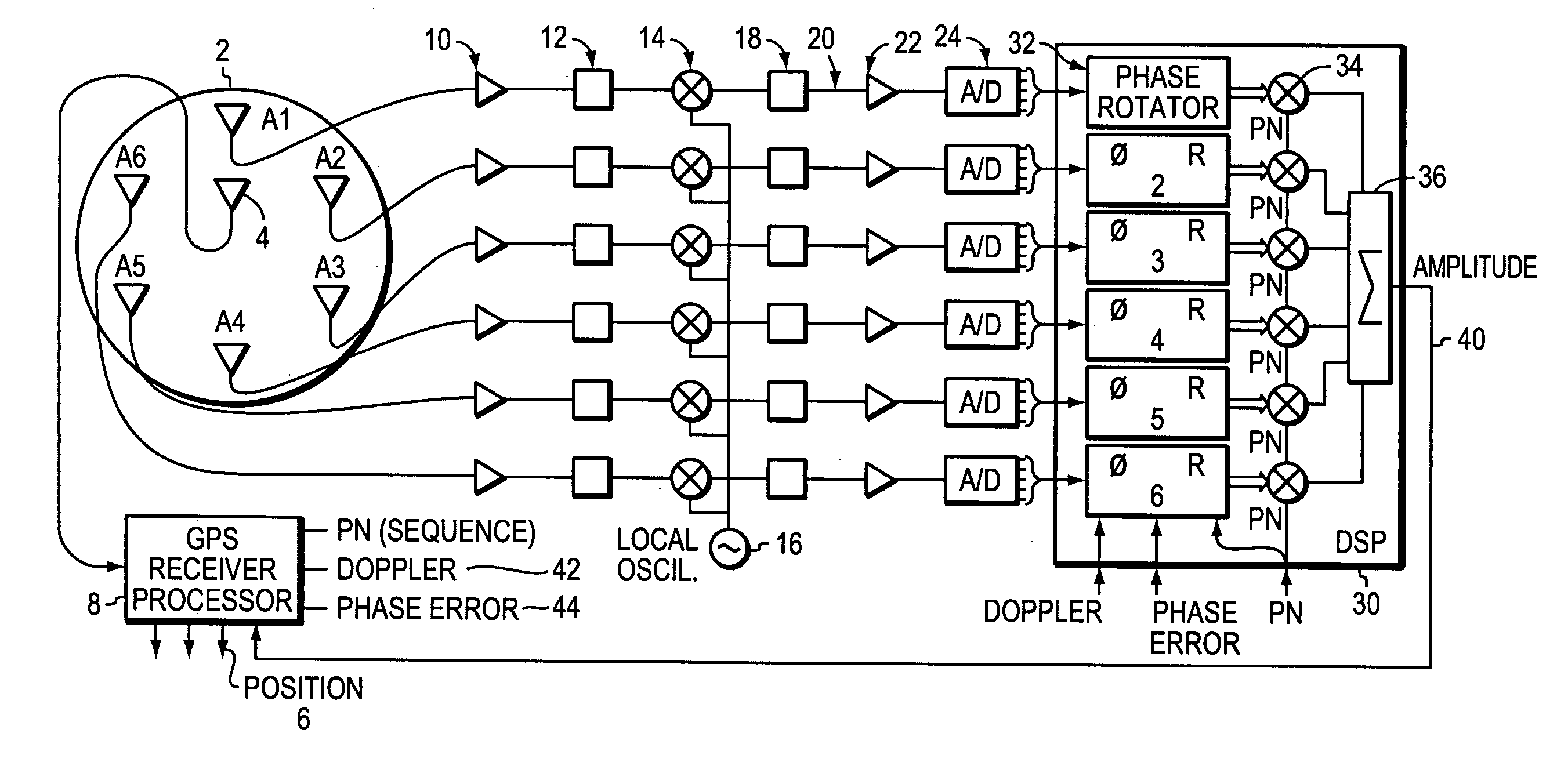
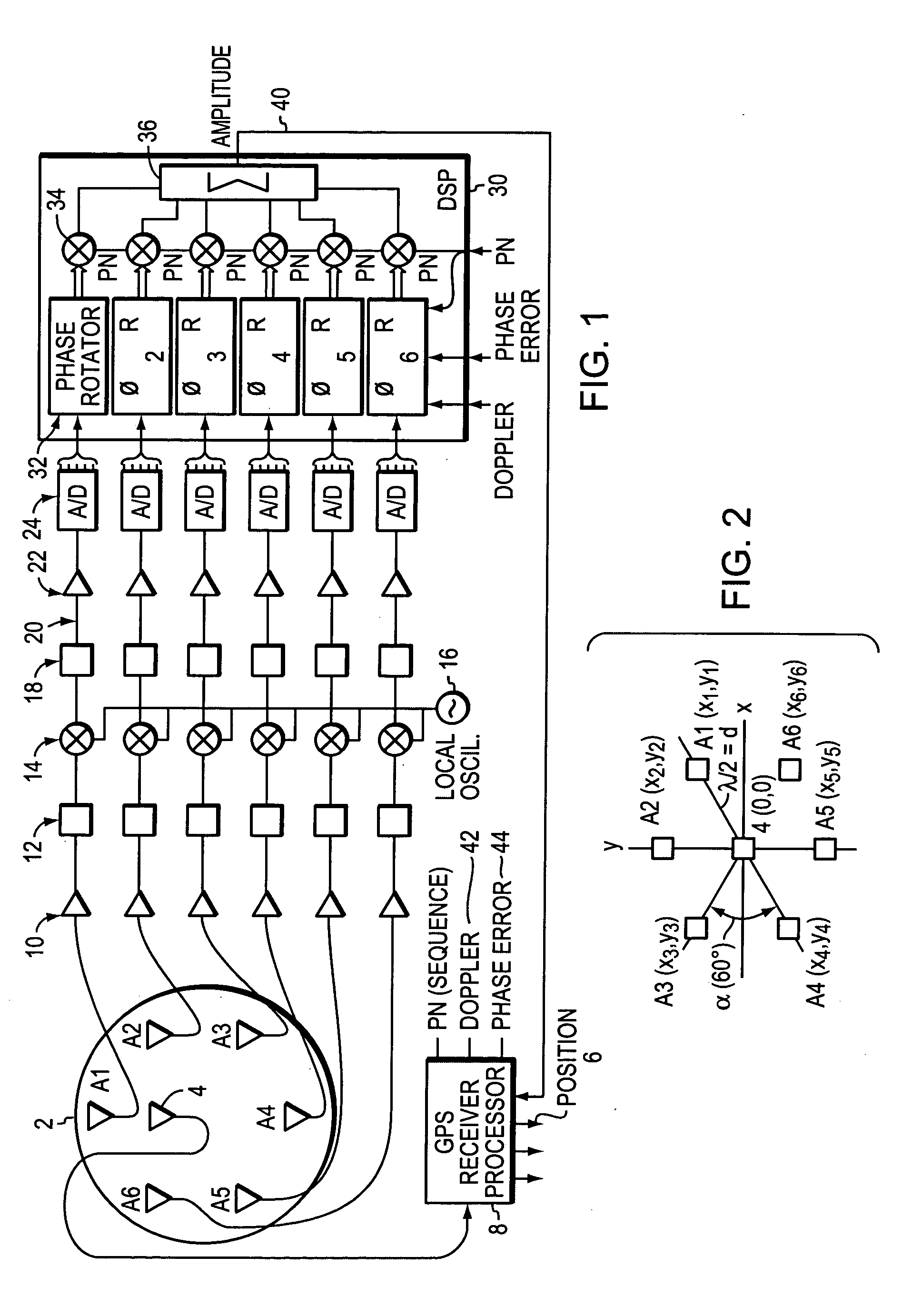
[0019]FIG. 1 is a block diagram schematic of a preferred electronic system and a seven antenna array 2 with a center antenna 4 that tracks all available GNSS satellites. GNSS systems are most familiar, but other satellite positioning systems may be used. A preferred antenna array is described in U.S. patent, mentioned above, U.S. Pat. No. 6,466,177 to Kunysz, which has been incorporated herein by reference. However, other arrays with fewer as antennas may be used to advantage as described below. In the seven antenna array, the center antenna tracks the array's position 6 on the Earth as commonly performed by the GNSS receiver 8.
[0020] Although this illustrative example discusses a satellite as a radiating source, other sources may be used to advantage within the present invention. Those other sources must have known locations, and may include television broadcasting towers, cell phone towers, or virtually any other tower based radiating source.
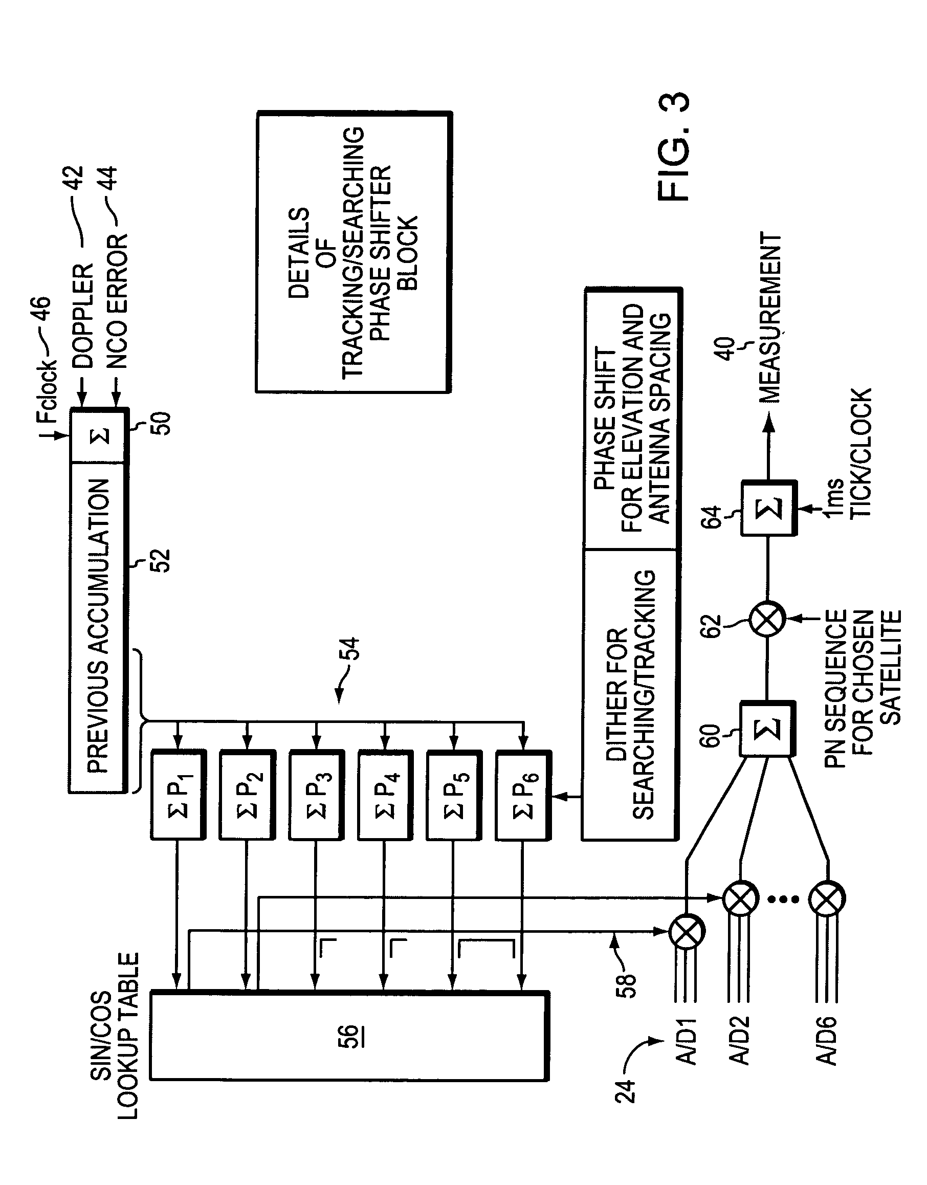
[0021] Still referring to FIG. 1, eac...
PUM
 Abstract
Description
Claims
Application Information