

System and method of optimizing database queries in two or more dimensions
a database and dimension technology, applied in the field of indexing database records, can solve the problems of difficult to efficiently search, slow when involving large data objects, and the possibility of posing many problems with three tiles
- Summary
- Abstract
- Description
- Claims
- Application Information
AI Technical Summary
Benefits of technology
Problems solved by technology
Method used
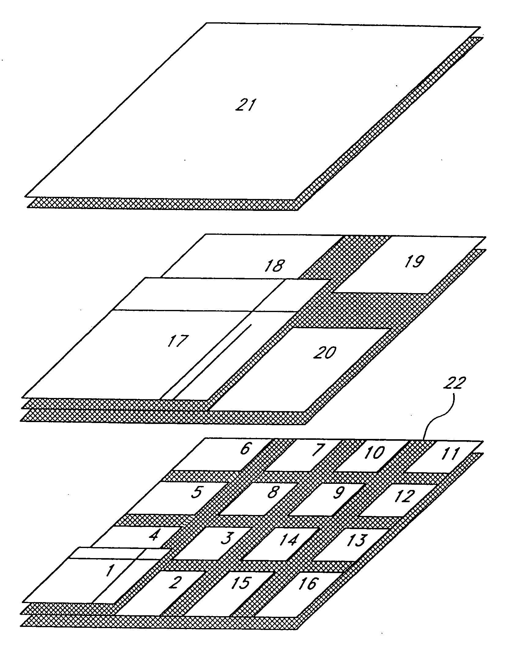
Image

Examples
example query 4
SQL to Find All Segments in a Window, Given a Key Range MinKey to MaxKey
[0128]
select StreetName, X1, Y1, X2, Y2from StreetSegmentswhere Shingle ∃ MinKeyand Shingle # MaxKeyand X1 ∃−10 and X1 # 35and X2 ∃−10 and X2 # 35and Y1 ∃ 15 and Y1 # 40and Y2 ∃ 15 and Y2 # 40
3. Empirical Analysis
[0129] The improved partitioning identified in the earlier comparison of FIGS. 12 and 15 can be validated by measuring how the present invention behaves when given a large quantity of real map data. DATA TABLE 3 shows the results of one such measurement. The data used to perform these measurements is an extract of street segments from a U.S. Census Bureau Topographically Integrated Geographic Encoding and Referencing (TIGER) database file of Los Angeles County, Calif. Census TIGER files comprise the defacto industry standard street map data source. Los Angeles County is a good representative choice because of its large size (426367 segments in this extract) and diverse coverage (dense urbanized core,...
PUM
 Abstract
Description
Claims
Application Information