Method for updating a geological reservoir model by means of dynamic data
a geological reservoir and dynamic data technology, applied in the field of method for updating a geological reservoir model, can solve the problems of incompatibility of realizations with dynamic data, inability to calculate objective functions, and difficulty in calculating spatial structure of realization y thus obtained, etc., and achieve the effect of local deformation
- Summary
- Abstract
- Description
- Claims
- Application Information
AI Technical Summary
Benefits of technology
Problems solved by technology
Method used
Image
Examples
second embodiment
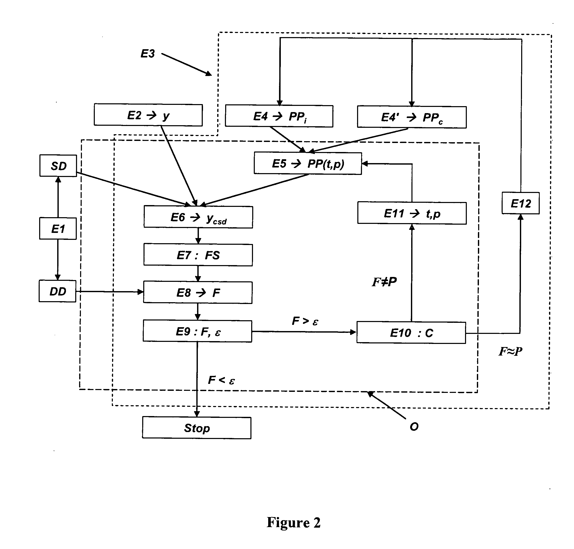
[0099] According to a second embodiment, the method according to the invention can be extended by integrating in the objective function a gradual deformation parameter (p) controlling the position of the gradual pilot points. The position of the gradual pilot points is modified by varying this parameter.
[0100] In this embodiment, not only the values of the two sets of initial gradual pilot points (PPi and PPc), but also their positions are considered. These positions correspond to uniform numbers that are converted to Gaussian numbers:
Y=G−1(x)
where G is the standard normal distribution function, x is the position vector of the pilot point and Y is its associate in the standard normal base. Two possible positions x1 and x2 of pilot points can be gradually combined according to the expression:
x(p)=G[G−1(x1)cos(p)+G−1(x2)sin(p)]
The quantity p is the deformation parameter. Variation of the deformation parameter modifies the position of the pilot point. This method was introduced i...
application example
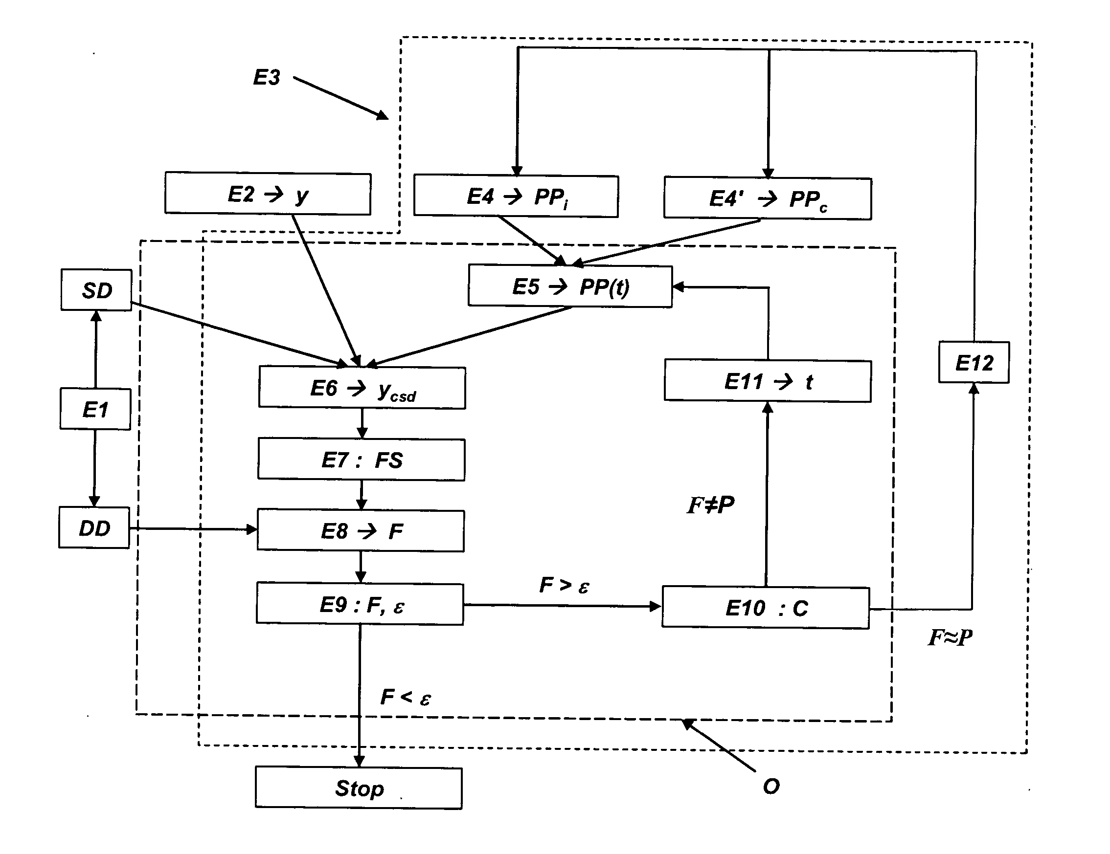
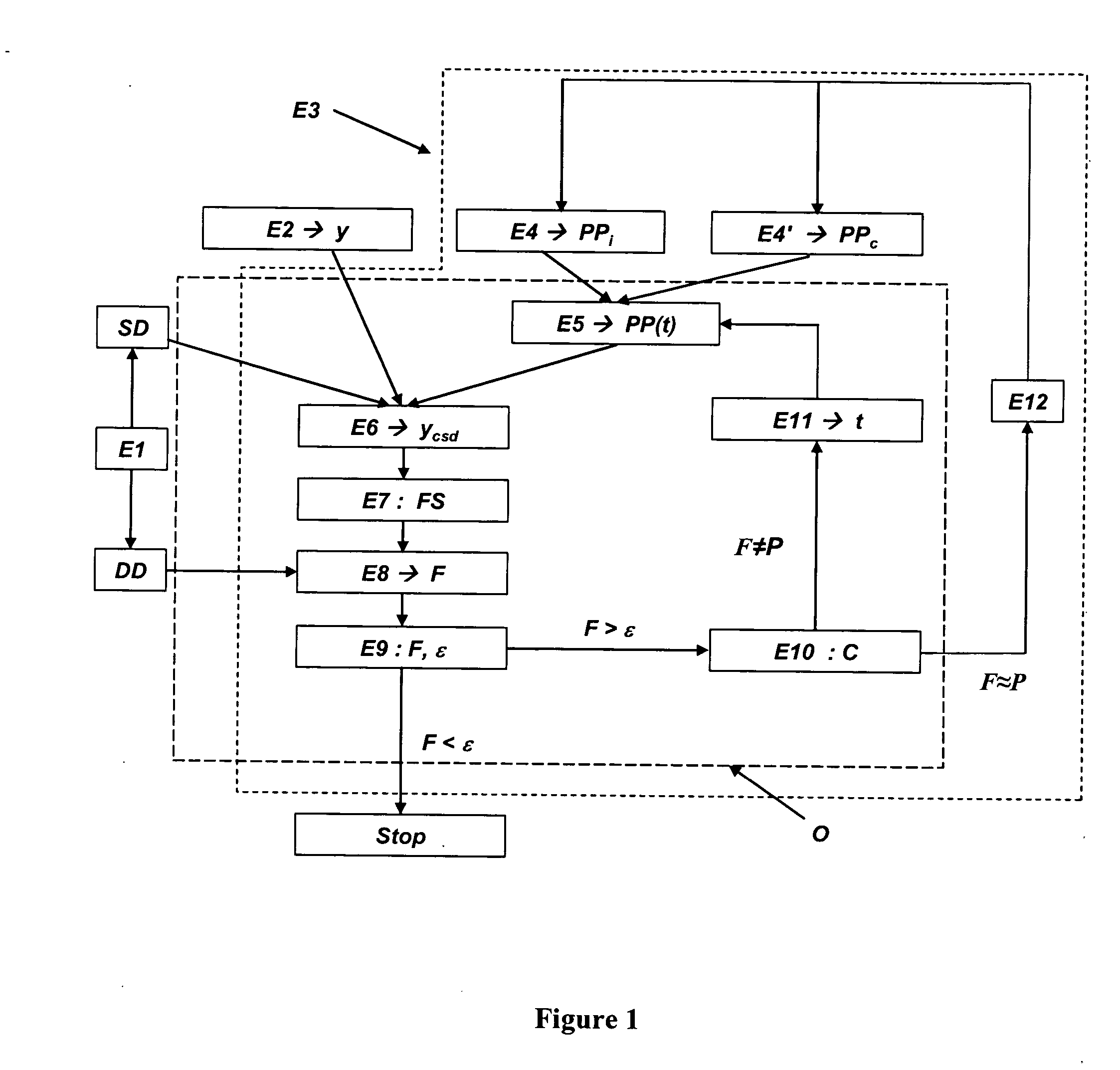
[0104] The following example illustrates the efficiency of the method developed. This example is limited to the deformation of the pilot point values (deformation parameter t, FIG. 1). FIG. 3 shows a synthetic permeability map (field) k discretized with a 30-cell grid in direction X and 20 cells in direction Z. The size of the cell is 1 m×1 m. The distribution is lognormal; the mean and the variance of In(k) are 3 and 1 respectively. The spatial variability of In(k) is apprehended by a spherical isotropic variogram of correlation length 10 m. For this reference synthetic map, a tracer injection experiment is numerically simulated: inert particles are injected on the left side of the map and produced on the right side. The dynamic data is obtained referred to as reference data, which are the distribution function (CDF) of the times (T) taken by the particles injected to flow through the medium, as illustrated in FIG. 4, where the time T is given in days. The reference permeability ma...
PUM
 Abstract
Description
Claims
Application Information
 - R&D
- Intellectual Property
- Life Sciences
- Materials
- Tech Scout
- Unparalleled Data Quality
- Higher Quality Content
- 60% Fewer Hallucinations
Browse by: Latest US Patents, China's latest patents, Technical Efficacy Thesaurus, Application Domain, Technology Topic, Popular Technical Reports.
© 2025 PatSnap. All rights reserved.Legal|Privacy policy|Modern Slavery Act Transparency Statement|Sitemap|About US| Contact US: help@patsnap.com


