System and method for determining positions of towed marine seismic streamers

a technology of marine seismic and position determination, applied in the field of geophysical prospecting, can solve the problems of complex solution of such tangling scenarios, exposing the seismic crew to hazardous hazards, and sometimes losing externally-mounted compasses, and achieve the effect of low cross-correlation

Active Publication Date: 2007-04-26
PGS GEOPHYSICAL AS
View PDF10 Cites 114 Cited by
  • Summary
  • Abstract
  • Description
  • Claims
  • Application Information

AI Technical Summary

Benefits of technology

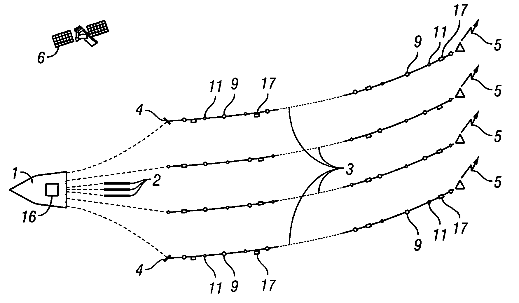
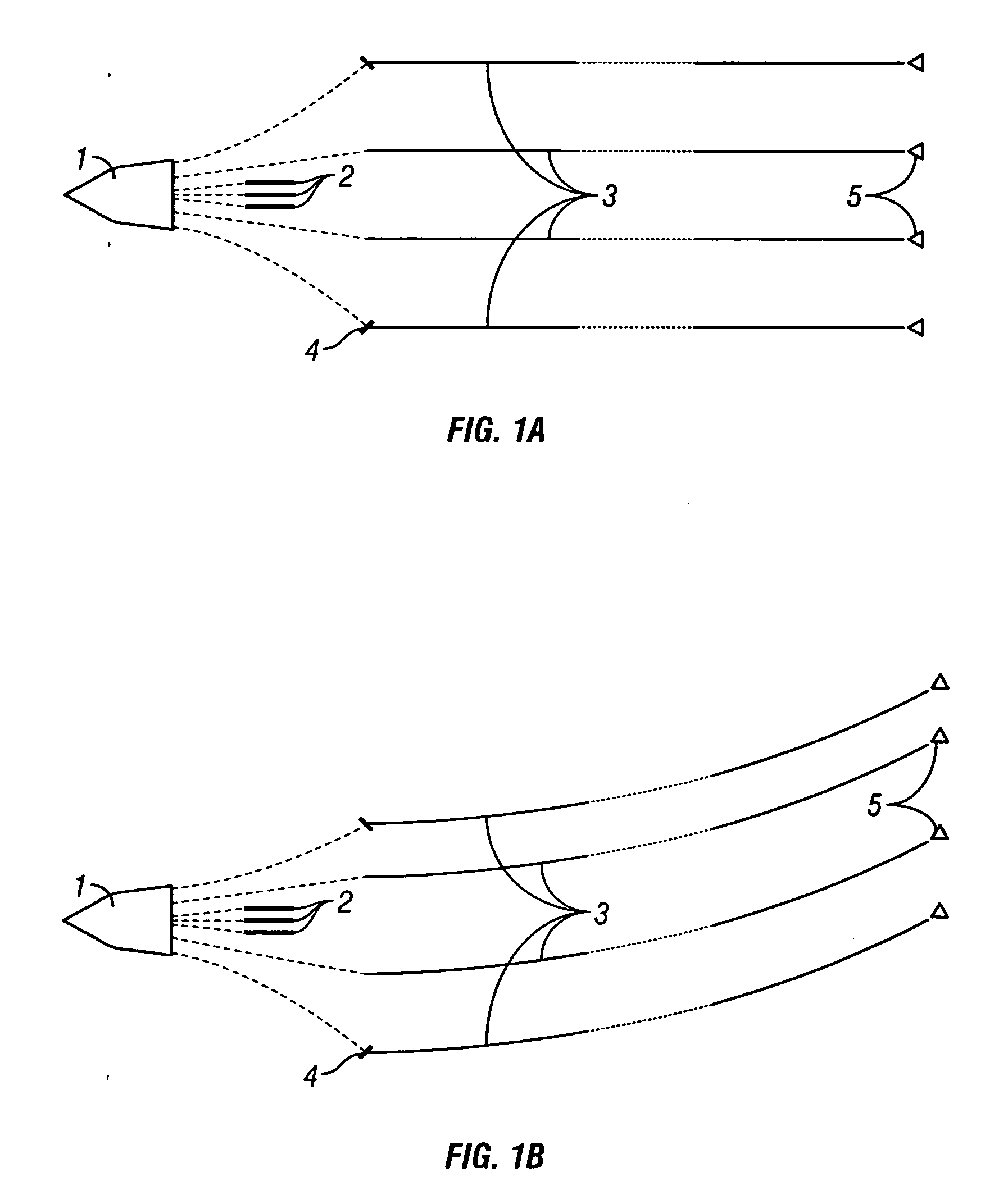
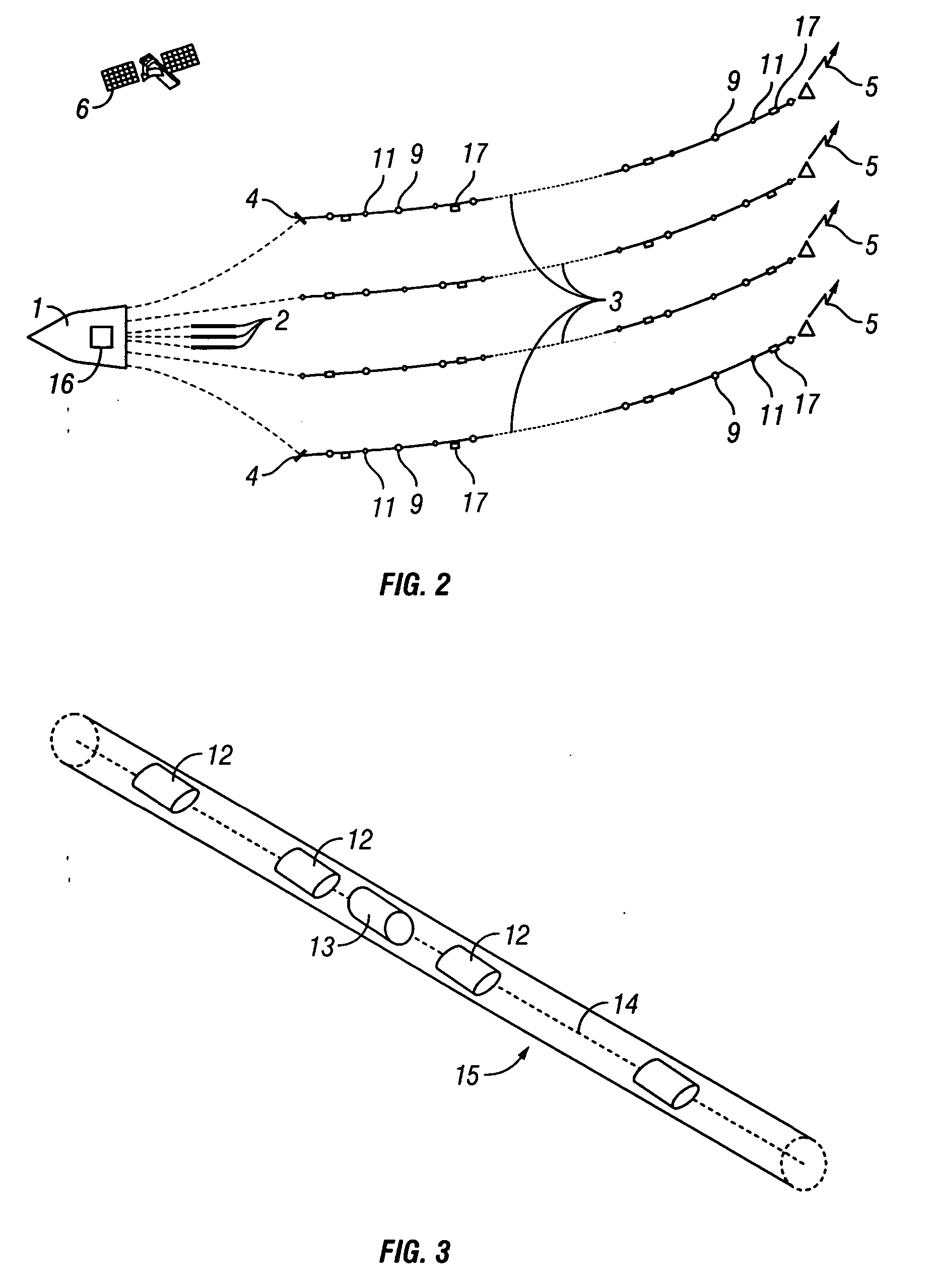
[0026] The invention is, in one embodiment, a system for determining positions of towed marine seismic streamers. The system comprises a plurality of acoustic transmitters, mounted inside the streamers, adapted to transmit broadband signals having low cross-correlation between the signals of different transmitters; a plurality of acoustic receivers, mounted inside the streamers, adapted to receive the signals from the transmitters; at least one processor adapted to cross-correlate the signals received at the receivers with copies of transmitter signals to determine identities of the transmitters of the received signals and to determine travel times of the received signals; and a main processor adapted to convert the travel times to distances between the identified transmitters and the receivers and to determine relative positions of the streamers from the distances.
[0027] The invention is, in another embodiment, a method for determining positions of towed marine seismic streamers, comprising: towing a plurality of transducers adapted to be acoustic transmitters inside the streamers, wherein the transmitters are adapted to transmit broadband signals having low cross-correlation between the signals of different transmitters; towing a plurality of transducers adapted to be acoustic receivers inside the streamers, wherein the receivers are adapted to receive the signals of the transmitters, cross-correlating the received signals with copies of transmitter signals to determine identities of transmitters of the received signals and travel times of the received signals, in at least one processor; converting the travel times to distances between the identified transmitters and the receivers; and determining the relative positions of the streamers from the distances.

Problems solved by technology

Resolving such tangling scenarios is complex and may expose the seismic crew to hazardous in-sea operations, in addition to being quite costly.
However, the externally-mounted compasses are sometimes lost due to streamer entanglement or other impact situations, and the compasses create flow noise on neighboring seismic sensors.
'153, the transmitters and receivers are only placed at the front, center and tail of the streamer spread, due to the high cost of the acoustic transceivers.
However, employing the seismic acquisition receivers to determiner streamer positions can cause problems when some of the seismic acquisition receivers are unavailable, due to mechanical or electrical failure in the streamers or elsewhere in the tow system.
Additionally, this method has the problems associated with externally mounted transceivers, as in Gikas et al.
However, employing the seismic acquisition receivers to determine streamer positions and attaching the transmitters and receivers externally to the streamer leads to the same problems discussed in Langeland et al.
However, locating the transmitters in additional insert sections between the streamer sections is expensive and labor intensive.
A problem particular to determining the positions of towed seismic streamers with transmitters and receivers is keeping track of which transmitter's signal is being detected by which receiver at any given time.
However, employing different frequencies to distinguish the transmitters generally increases the complexity and expense of both the transmitters and the receivers.
These higher frequency signals suffer from higher attenuation, thus degrading the resolution required for positioning long streamer arrays.
However, in Hatteland 3 775, the seismic receivers are employed both for determining streamer positions as well as conventional seismic acquisition, instead of employing separate systems of dedicated receivers, leading to the same problems discussed above in Norton, Jr. et al.
The previously described methods for determining the positions of streamers contain a number of problems.
The effect of magnetic storms and local anomalies can only partly be corrected for.
Due to the sparse sampling along the cable and lack of information about how the streamer behaves between the compass locations, the positioning accuracy is not precise.
This lack of precision is especially important when lateral steering devices used to control the cross-line position of the streamer cables are placed between the compass positions.
Because compass readings are influenced by wave motion caused by weather conditions, the compass readings are filtered over time, with the result that the values used in the computations of streamer positions have a significant time lag.
During streamer deployment and retrieval modes, attaching and removing the transceivers so that the streamers can be spooled directly on and off winches onboard the survey vessel requires considerable operational time, which is very expensive.
Externally-attaching the transceivers (or any other equipment, such as magnetic compasses) to the streamer cables increases tow drag on the streamer and increases the noise in the detected seismic signals.
The transceivers are also exposed to impact and thus transceivers are lost from time to time.
Because of the high frequencies used for the acoustic ranging, the performance may be degraded in hostile acoustic environments.
'302, is expensive and labor intensive.
Additionally, both data redundancy and quality may be limited because of the limitation on spacing of the transceivers.
'492, may increase the cost of both the transmitters and receivers.
This attenuation reduces the resolution at the longer distances employed in positioning long streamer arrays than in the shorter streamer arrays employed in detecting vessels, as in Holt '300.
'682, and Hatteland '775, leads to problems.
Receiver unavailability may occur during streamer failure, maintenance or system testing.
Finally, the inability to make inline distance measurements, as in Norton et al.
'682, leads to lack of precise knowledge of the distance between the transmitters and receivers when the streamer is under tow, which in turn, leads to lack of accurate knowledge of the amount of stretching of the streamer under tension.
This lack of knowledge degrades the streamer position-determining accuracy.

Method used


Image

  • System and method for determining positions of towed marine seismic streamers
  • System and method for determining positions of towed marine seismic streamers
  • System and method for determining positions of towed marine seismic streamers

Examples


Embodiment Construction

[0045] The invention is a system and method for determining the positions of data acquisition equipment, in particular the seismic sensors used in multiple streamer cables used in marine seismic surveys for imaging the subterranean formations. The system comprises a series of acoustic transmitters and receivers, dedicated to the task of determining streamer positions, distributed along the length of the streamers. The transmitters and receivers are incorporated along with corresponding power and control electronics into the streamer. In a preferred embodiment, the system for determining streamer positions of the invention is designed as a stand-alone system with separate power supply and communication telemetry links to the survey vessel.

[0046] Acoustic signals from the transmitters located within a section of a streamer cable are detected by a plurality of dedicated receivers located within other sections. The receivers can be located in sections both within the same streamer as t...


PUM


Abstract

A system comprises a plurality of acoustic transmitters, mounted inside the streamers, adapted to transmit broadband signals having low cross-correlation between the signals of different transmitters; a plurality of acoustic receivers, mounted inside the streamers, adapted to receive the signals from the transmitters; at least one processor adapted to cross-correlate the signals received at the receivers with copies of transmitter signals to determine identities of the transmitters of the received signals and to determine travel times of the received signals; and a main processor adapted to convert the travel times to distances between the identified transmitters and the receivers and to determine relative positions of the streamers from the distances.

Description

CROSS-REFERENCES TO RELATED APPLICATIONS [0001] Not Applicable FEDERALLY SPONSOR RESEARCH OR DEVELOPMENT [0002] Not Applicable SEQUENCE LISTING, TABLE, OR COMPUTER LISTING [0003] Not Applicable BACKGROUND OF THE INVENTION [0004] 1. Field of the Invention [0005] This invention relates generally to the field of geophysical prospecting. More particularly, the invention relates to the field of marine seismic data acquisition. [0006] 2. Description of the Related Art [0007] To perform a three-dimensional (3D) marine seismic survey, a plurality of marine seismic streamers are towed at a preset depth, typically between 4 and 25 meters, behind a surface survey vessel. Each seismic streamer, also referred to as a streamer cable, is typically several thousand meters long and contains a series of seismic sensors and associated analog-to-digital signal converter electronics distributed along the streamer length. The streamer cables comprise a series of individual segments, called streamer secti...

Claims


Application Information

Patent Timeline
Patent Type & Authority Applications(United States)
IPC IPC(8): G01V1/38
CPCG01V1/3835G01S15/46G01S2015/465B06B1/0633G01V1/3817H04R1/44B06B1/06
Inventor FALKENBERG, JONLUNDE, NILSGUNNARSSON, PER BIRGERKROLING, NILS GUNNAR OLOFLENNART TENGHAMN, STIG RUNE
Owner PGS GEOPHYSICAL AS
Why Eureka
Try Eureka