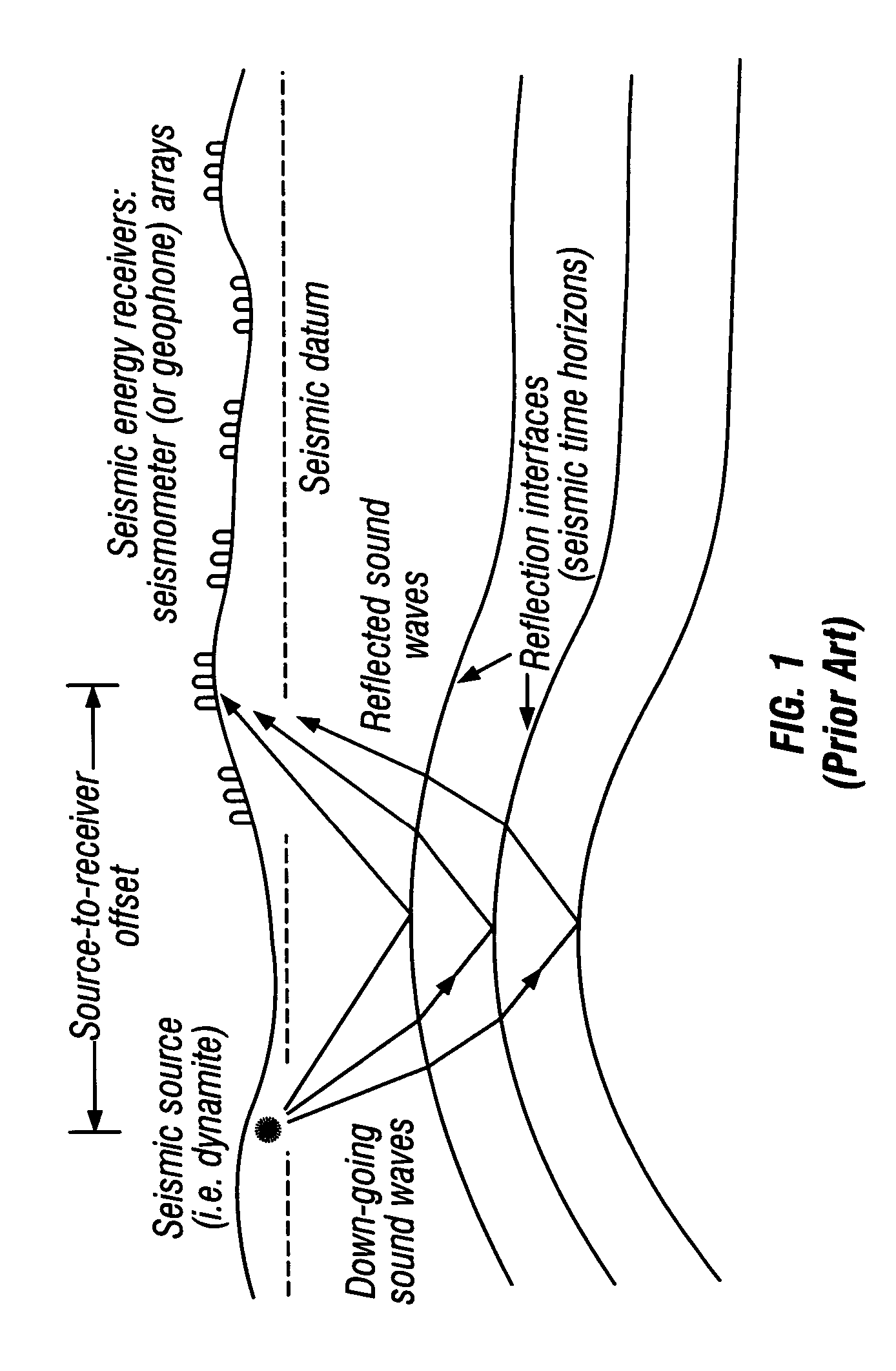
As those of ordinary skill in the pertinent arts will appreciate, both lateral and vertical variations in the velocity of sound
waves beneath the Earth's surface can result in the creation of an inaccurate structural interpretation of the subsurface when methods emphasizing only time-domain data are employed.
Consequently, accurate predictions of prospective drilling locations and estimated geological formation depths are difficult to achieve.
The method of Campbell has proven to be deficient, however, in that it is fundamentally only a calibration technique wherein an approximate horizon depth value is adjusted so as to be consistent with known depths of existing wells, rather than a method of deriving a geophysically-consistent
velocity function model between well locations using interval velocities from both well data and interpreted seismic horizons.
Another deficiency of the Campbell method is that
processing velocities are not in fact the true seismic velocities of the Earth, but estimates based on their effectiveness as parameters in the
processing of data, the goal being to derive the best possible data images or
signal-to-
noise characteristics of a seismic reflector set (see, for example, prior art FIG. 1).
Therefore, even after calibration at well locations, there is a great chance of significant computational error and uncertainty as to the actual geological conditions present between wells.
In addition, irregular lateral deviations of processing velocities, which are common, can result in large computational errors in associated depth values.
In situations where existing well data is located far away, or where data is derived from wells located on the other side of a fault or are for some other reason unsuitable as a basis for data extrapolation, the method of Campbell is simply inadequate for establishing the relatively precise drilling depth estimates sought by modern geophysicists and drilling investors.
Even though the function is approximately linear, however, the data points do not lie exactly on the extracted line and therefore exact well ties will not result without additional calibration.
More importantly, in instances where the
interval velocity is not a linear function with respect to depth, which is the case for the second layer in their article, Keho and Samsu conclude this method is inadequate for estimating accurate drilling depth values.
This method, however, also has pitfalls as velocity logs are not always readily available, and it also requires considerable effort by the
interpreter to derive the functions, map the parameters, and hopefully estimate the reliability of the values.
Such an assumption, however, is often incorrect.
For example, lithological changes that have occurred slowly over a great deal of geologic time, lateral and / or vertical changes in the composition of the sedimentary layer, and an inadequate number of horizons used to define
layers with different velocity functions can all invalidate the
linear model assumption.
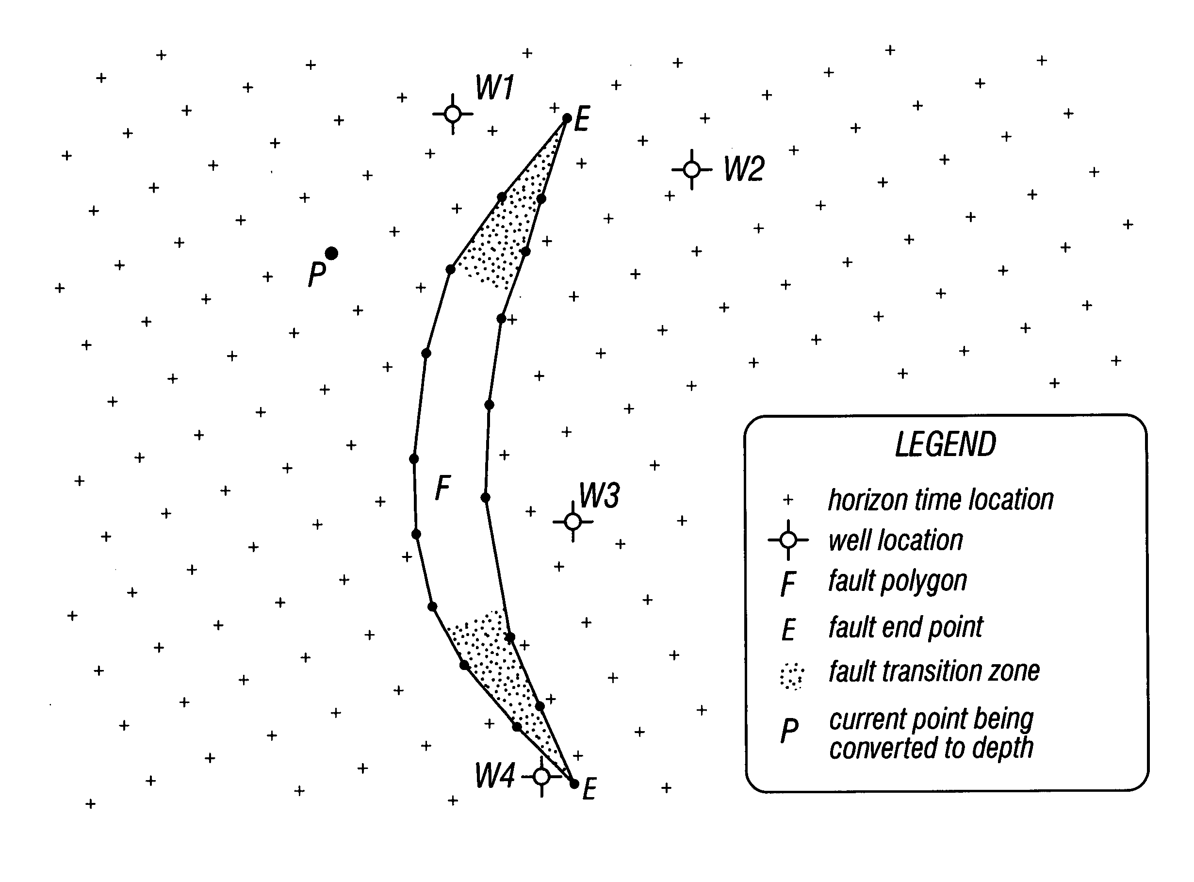
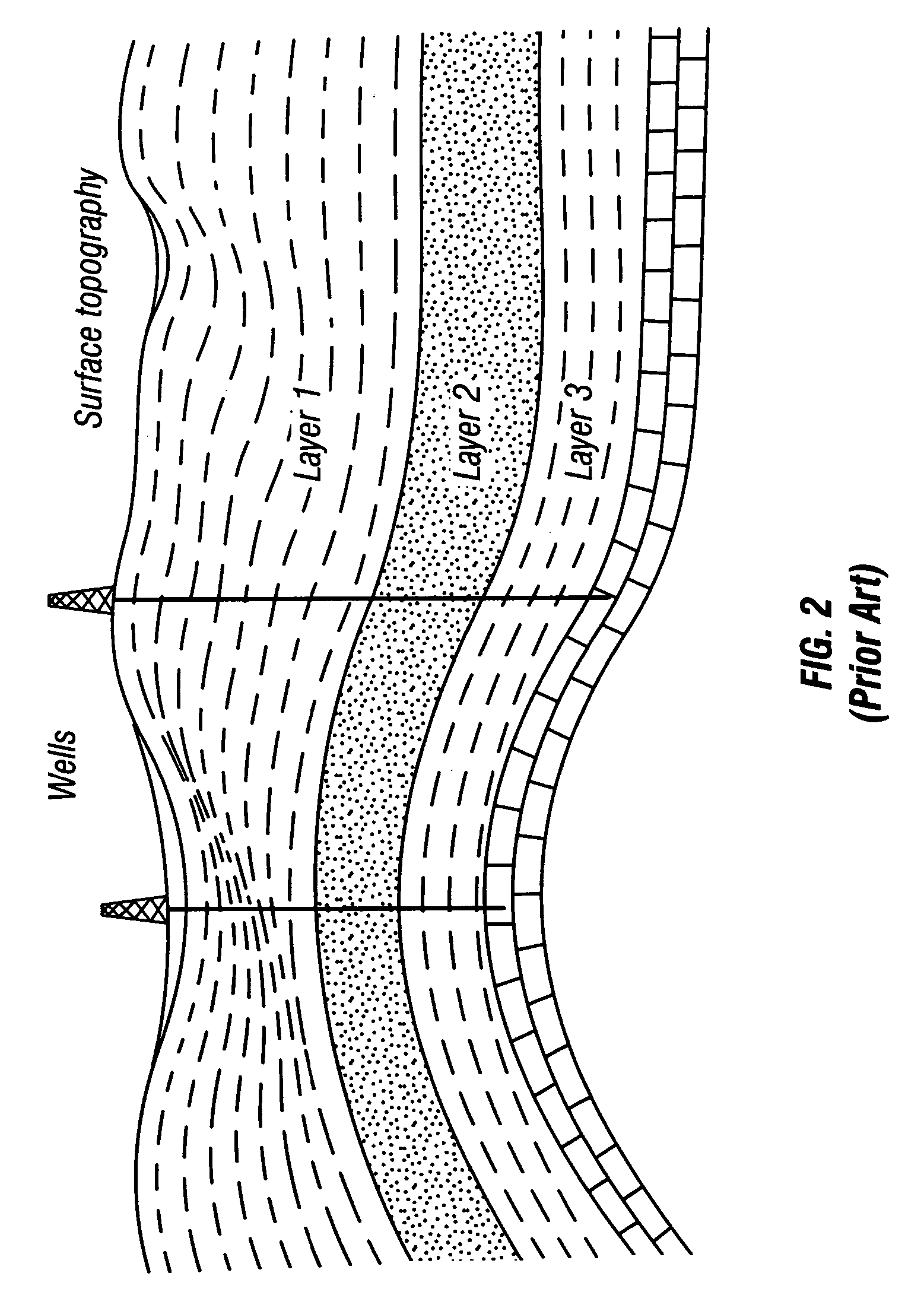
Moreover, in the case of geological mapping, exact well ties and determinations regarding the precise location and extent of faults are particularly problematic when gridded data is used.
In addition, faults can cause abrupt changes to geological formation structure, and bin intervals must be small enough to adequately sample such changes.
As a result, precise computations around fault planes are necessarily compromised, especially when several finely spaced horizon time picks are averaged into one value for a grid bin disposed next to a
fault plane.
When applied to depth conversions, estimates using only gridding processes to determine the location of geological formations will incorporate error factors that are simply unacceptable to modern geophysicists and drilling investors.
In certain applications, three-dimensional sampling is also employed, which can create such a massive data volume that an extremely large amount of random-access memory is required, even though the problems associated with faulting and non-exact well ties are not significantly reduced.
In short, even if a geophysically consistent solution of the velocity model between well locations could be determined, conventional gridding processes simply do not provide adequate precision as to allow an accurate conversion of horizon
time data into depth values.

