
Method and System for Detecting Changes in Geographic Information

a technology of geographic information and change detection, applied in the field of geographic database information, can solve the problems of high method cost, constant change of real-world features stored as information in the digital map, and low direct value of attributes such as street names and addresses

Inactive Publication Date: 2009-04-16
TELE ATLAS NORTH AMERICA
View PDF24 Cites 49 Cited by
  • Summary
  • Abstract
  • Description
  • Claims
  • Application Information

AI Technical Summary

Benefits of technology

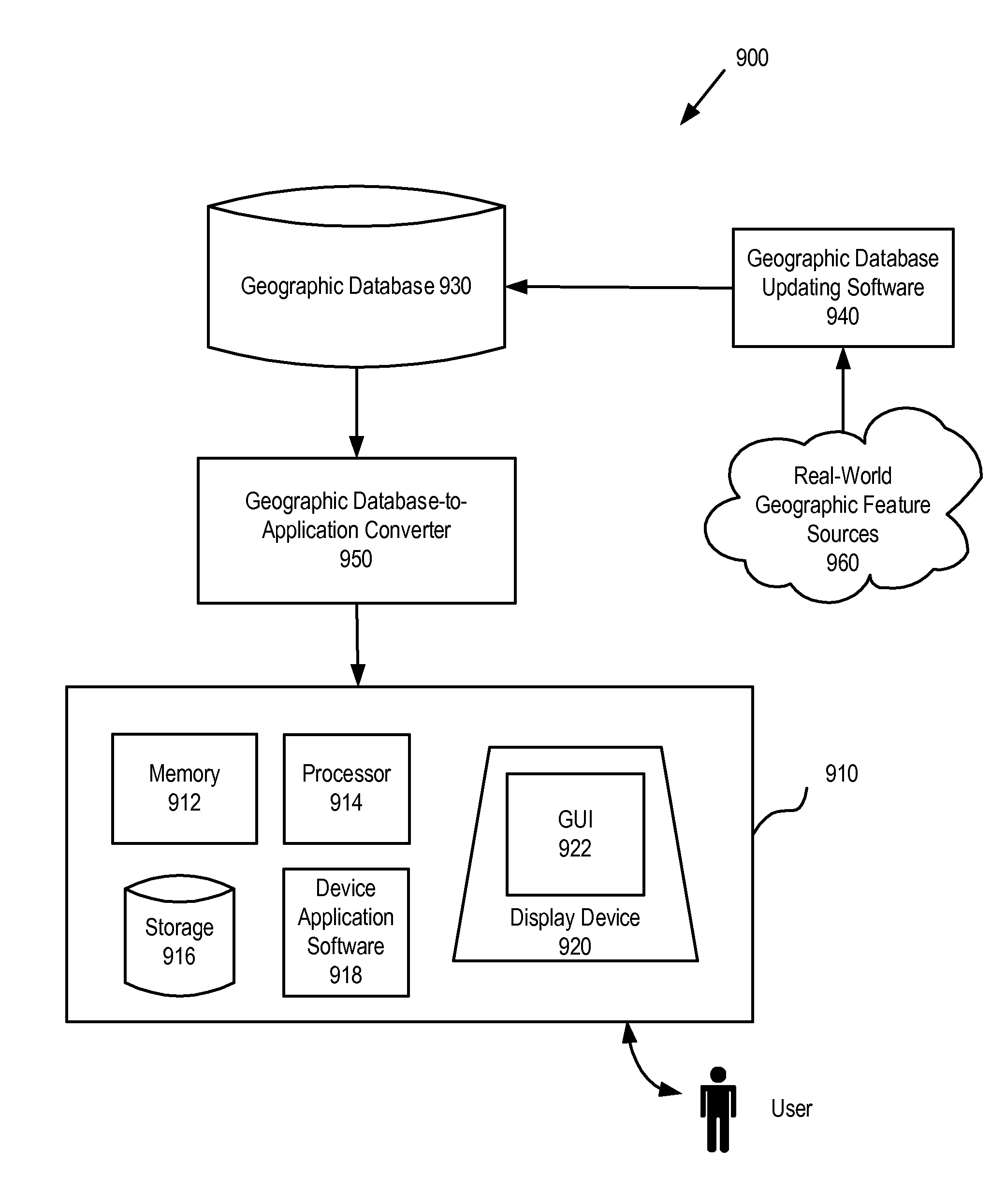
[0148]Embodiments of the present invention can include computer-based methods and systems which can be implemented using a conventional general purpose or a specialized digital computer(s) or microprocessor(s), programmed according to the teachings of the present disclosure. Appropriate software coding can readily be prepared by programmers based on the teachings of the present disclosure.

Problems solved by technology

One problem is that the real-world features that are stored as information in the digital map are constantly in change.
These methods can give good information regarding the existence and geometry of new or changed roads, but they have little direct value regarding attributes such as street names and addresses.
Additionally, these methods are expensive, and their coverage is spotty and irregular.
Although the USPS reports are effective in showing new streets, these USPS reports do not show the addition or subtraction of a one way driving restriction on a street or prohibited turn, for example.
Both types of reports lack speed and efficiency.
Further, neither one of these techniques provides detection of changes in vehicle routing and navigation attribution.

Method used


Image

  • Method and System for Detecting Changes in Geographic Information
  • Method and System for Detecting Changes in Geographic Information
  • Method and System for Detecting Changes in Geographic Information

Examples


Embodiment Construction

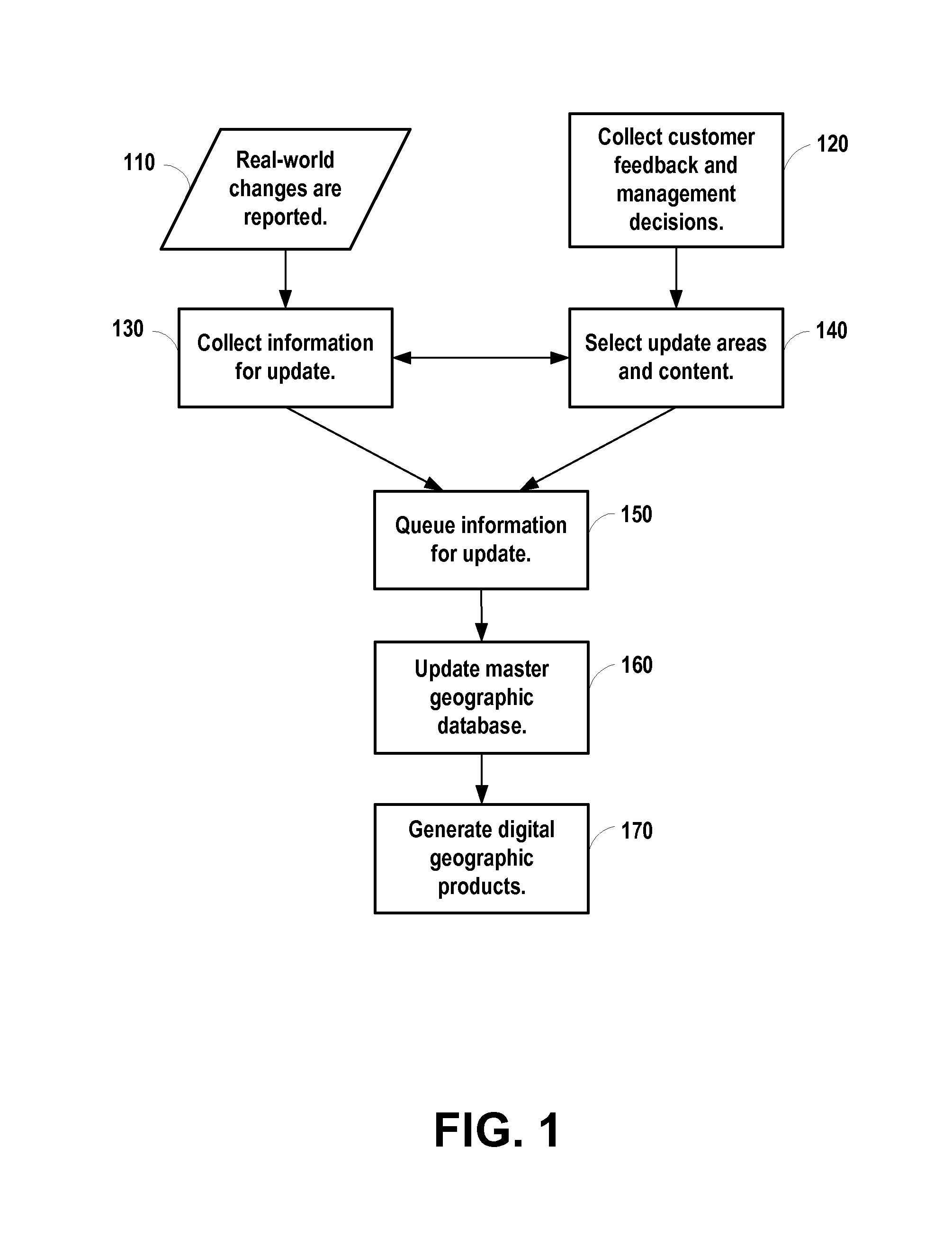
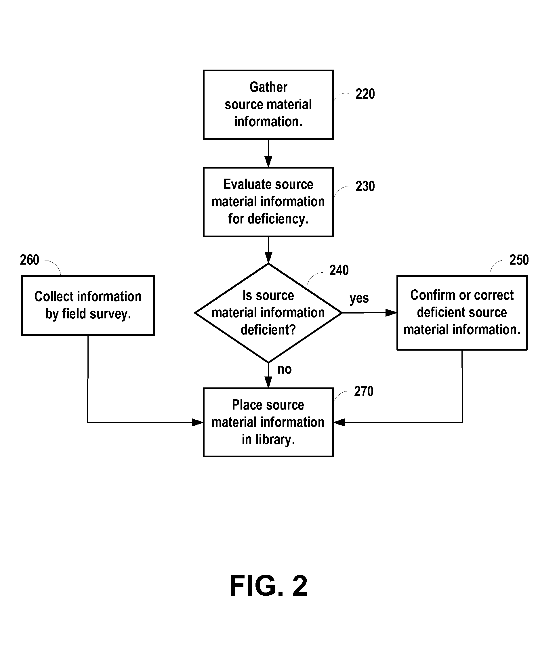
[0022]A method of detecting changes in real-world geographic data close to the time it occurs is provided. Generally, many local government and commercial activities benefit by knowing about such changes. For example, Emergency Services need to know of new street routing. All forms of private and public delivery operations need to know of changes in names and addresses. Sometimes local communities and commercial enterprises post information about such changes at various places on the World Wide Web. A geographic database producer uses query strings that include keywords to search the Web for indications of a change that has been accomplished, is in process, or is proposed. The resulting Web pages are collected, filtered for applicability to the geographic database producer's products, and formed into leads that describe the changes. The leads so collected are then compared with each other and with a library of previously collected leads for references to the same real-world change. ...


PUM


Abstract

Data related to changes in real-world geography are collected promptly for incorporating into a geographic database. Query strings are created using keywords targeted to detect data related to changes in real-world geography. Automatic Web search technology is utilized to search the World Wide Web for instances that match the created query strings. References to Web pages, references to Web pages accompanied by brief abstracts, Web pages, and hard copies of documents by mail are automatically collected that potentially refer to changes in real-world geography.

Description

CLAIM OF PRIORITY[0001]This application claims priority to U.S. Provisional Patent Application 60 / 979,700 filed Oct. 12, 2007, entitled “METHOD AND SYSTEM FOR DETECTING CHANGES IN GEOGRAPHIC INFORMATION,” which is hereby incorporated by reference.BACKGROUND OF THE INVENTION[0002]1. Field of the Invention[0003]The present invention relates to geographic database information and, more particularly, to the collection and storage of geographic database information.[0004]2. Description of the Related Art[0005]Digital maps are used in many consumer products to enable end-users to locate places on the digital maps and assist end-users in finding directions to a place. Places include street addresses, buildings located at street addresses such as businesses and landmarks, and facilities such as shopping malls and business parks. These consumer products are devices and systems in the form of in-vehicle navigation systems that enable drivers to navigate over streets and roads, hand-held devic...

Claims


Application Information

Patent Timeline
Patent Type & Authority Applications(United States)
IPC IPC(8): G06F7/06G06F17/30
CPCG06F17/30241G01C21/32G06F16/29
Inventor GILLIGAN, THOMAS WILLIAMMCDEVITT, PATRICK ALLANANGWIN, GEORGE T.
Owner TELE ATLAS NORTH AMERICA
Learn More