System and method for generating a terrain model for autonomous navigation in vegetation

a technology of vegetation and terrain model, applied in the direction of vehicle position/course/altitude control, process and machine control, instruments, etc., can solve the problems of unfavorable autonomous navigation, difficult obstacle detection, and inability to train classifiers individually to detect all possible types of obstacles, etc., to achieve stable and robust navigation

Active Publication Date: 2010-01-28
CARNEGIE MELLON UNIV
View PDF8 Cites 8 Cited by
  • Summary
  • Abstract
  • Description
  • Claims
  • Application Information

AI Technical Summary

Benefits of technology

[0010]Our approach is a generative, probabilistic approach to modeling terrain. The model exploits the 3D spatial structure inherent in outdoor domains and an array of noisy but abundant sensor data to simultaneously estimate ground height, vegetation height and classify obstacles and other areas of interest, even in dense non-penetrable vegetation. Joint inference of ground height, class height and class identity over the whole model results in more accurate estimation of each quantity. For example, inferring the vegetation height permits an improved estimate of the height of the underlying ground. Similarly, knowing the ground height helps disambiguate solid obstacles from the ground surface.
[0013]The spatial constraints embodied in the terrain model are combined with information from multiple sensors on the vehicle. The sensor models are automatically learned from training data collected by driving over representative terrain. Our use of MRFs to encode horizontal spatial correlations precludes an analytical solution to the inference problem. However, by exploiting an organization of our data into vertical HSMM columns, our approach allows us to model 3D structure in a reasonably efficient inference scheme. Gibbs sampling over the MRF structures lets us perform exact inference in the HSMM models using an efficient dynamic programming algorithm. This substantially reduces computation time over a full 3D MRF model, and although our approach is computationally demanding, the system can run in real-time.

Problems solved by technology

The challenge lies in expressing this type of structure in a way that can be made useful in autonomous navigation tasks.
Obstacle detection is particularly challenging because of the wide variety of objects that might be considered obstacles.
There may be little in common between these things that we wish to classify as obstacles, and it is impractical to train classifiers to individually detect all possible types of obstacles.
As a result, the model considers surprising and otherwise unexplainable measurements as those most likely to be associated with an obstacle.

Method used


Image

  • System and method for generating a terrain model for autonomous navigation in vegetation
  • System and method for generating a terrain model for autonomous navigation in vegetation
  • System and method for generating a terrain model for autonomous navigation in vegetation

Examples


Embodiment Construction

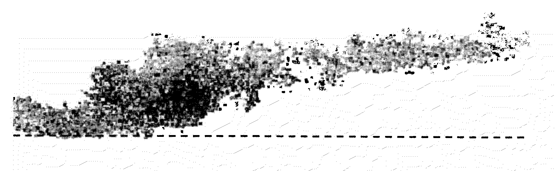
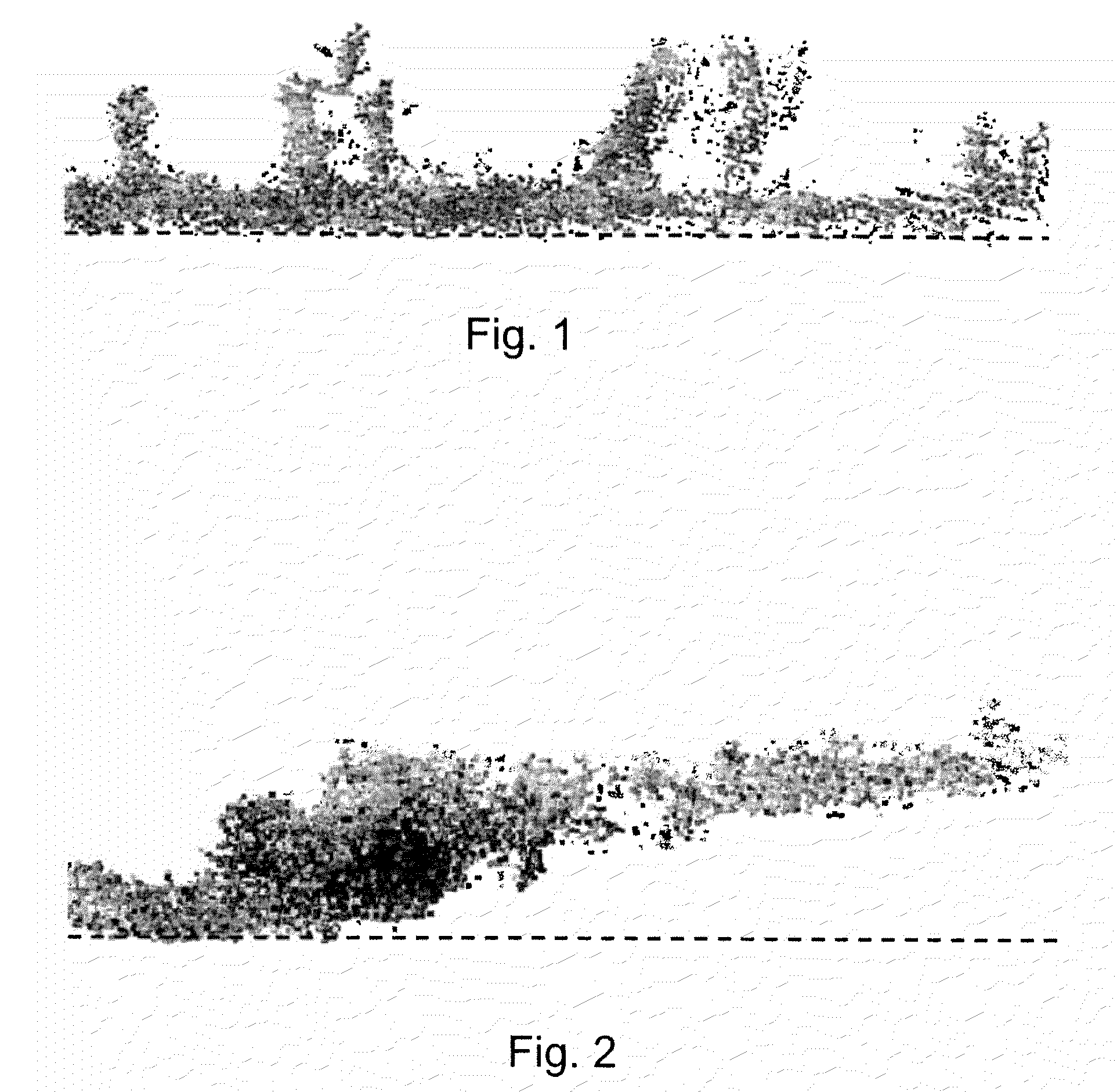
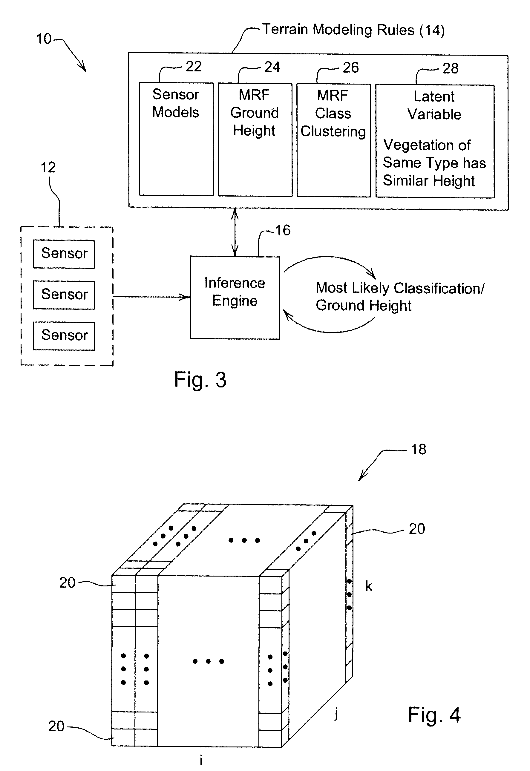
[0028]FIG. 3 illustrates a system 10 constructed according to the teachings of the present disclosure. The system 10 is constructed of an array of sensors 12, terrain modeling rules 14, and an inference engine 16 responsive to both the sensor array 12 and the terrain modeling rules 14. In attempting to classify the terrain in any given volume 18, see FIG. 4, the volume 18 is divided into a plurality of small cubes 20 called voxels. Each voxel 20 is assigned an initial class (ground, vegetation, obstacle, or open space) by the inference engine 16 based on information provided by the sensor array 12 operating in conjunction with sensor models 22, which are part of the terrain modeling rules 14. Note that the sensor models 22 have been trained (as is discussed below) to recognize classes. For example, the sensor array 12 may be comprised of a video camera, an infrared sensor, and a laser range finder. The data produced by these sensors is processed by the inference engine 16 in conjunc...


PUM


Abstract

The disclosed terrain model is a generative, probabilistic approach to modeling terrain that exploits the 3D spatial structure inherent in outdoor domains and an array of noisy but abundant sensor data to simultaneously estimate ground height, vegetation height and classify obstacles and other areas of interest, even in dense non-penetrable vegetation. Joint inference of ground height, class height and class identity over the whole model results in more accurate estimation of each quantity. Vertical spatial constraints are imposed on voxels within a column via a hidden semi-Markov model. Horizontal spatial constraints are enforced on neighboring columns of voxels via two interacting Markov random fields and a latent variable. Because of the rules governing abstracts, this abstract should not be used to construe the claims.

Description

CROSS-REFERENCE TO RELATED APPLICATIONS[0001]The present application is a divisional of copending U.S. application Ser. No. 11 / 446,089 filed Jun. 2, 2006 and entitled System and Method for Generating a Terrain Model for Autonomous Navigation in Vegetation, the entirety of which is hereby incorporated by reference for all purposesBACKGROUND[0002]The present invention is directed generally to the field of autonomous or computer-aided navigation, and more particularly to systems and methods for classifying sensor data and inferring ground height for use in generating terrain models that may be used for autonomous or computer-aided navigation.[0003]Outdoor environments such as those encountered in agriculture, mining, and the exploration of hazardous environments often have no structured features, such as road markers, straight walls, a flat ground plane, etc. For that reason, outdoor environments are viewed as being unstructured. The unstructured nature of those environments has often ...

Claims


Application Information

Patent Timeline
Patent Type & Authority Applications(United States)
IPC IPC(8): G06K9/00
CPCG05D1/024G05D1/0242G05D1/0251G05D1/0274G05D2201/0201G06T17/05G05D2201/021G06K9/00201G06K9/00664G06K9/00697G06K9/4638G05D2201/0207G06V20/64G06V20/10G06V20/38G06V10/457G06V20/188
Inventor WELLINGTON, CARL K.COURVILLE, AARON C.STENTZ, ANTHONY J.
Owner CARNEGIE MELLON UNIV
Why Eureka
Try Eureka