Continuous Tracking Counter for Enabling Cycle-slip Free Messages in a Network of Global Navigation System Satellite Receivers

a technology of global navigation system and satellite receiver, applied in the field of data communication, to achieve the effect of reducing the size of cmrx messages and smooth bandwidth utilization over tim

a technology of global navigation system and satellite receiver, applied in the field of data communication, to achieve the effect of reducing the size of cmrx messages and smooth bandwidth utilization over tim

US20100085253A1Active Publication Date: 2010-04-08TRIMBLE NAVIGATION LTD

Image

  • Continuous Tracking Counter for Enabling Cycle-slip Free Messages in a Network of Global Navigation System Satellite Receivers
  • Continuous Tracking Counter for Enabling Cycle-slip Free Messages in a Network of Global Navigation System Satellite Receivers
  • Continuous Tracking Counter for Enabling Cycle-slip Free Messages in a Network of Global Navigation System Satellite Receivers

Examples


Embodiment Construction

Introduction

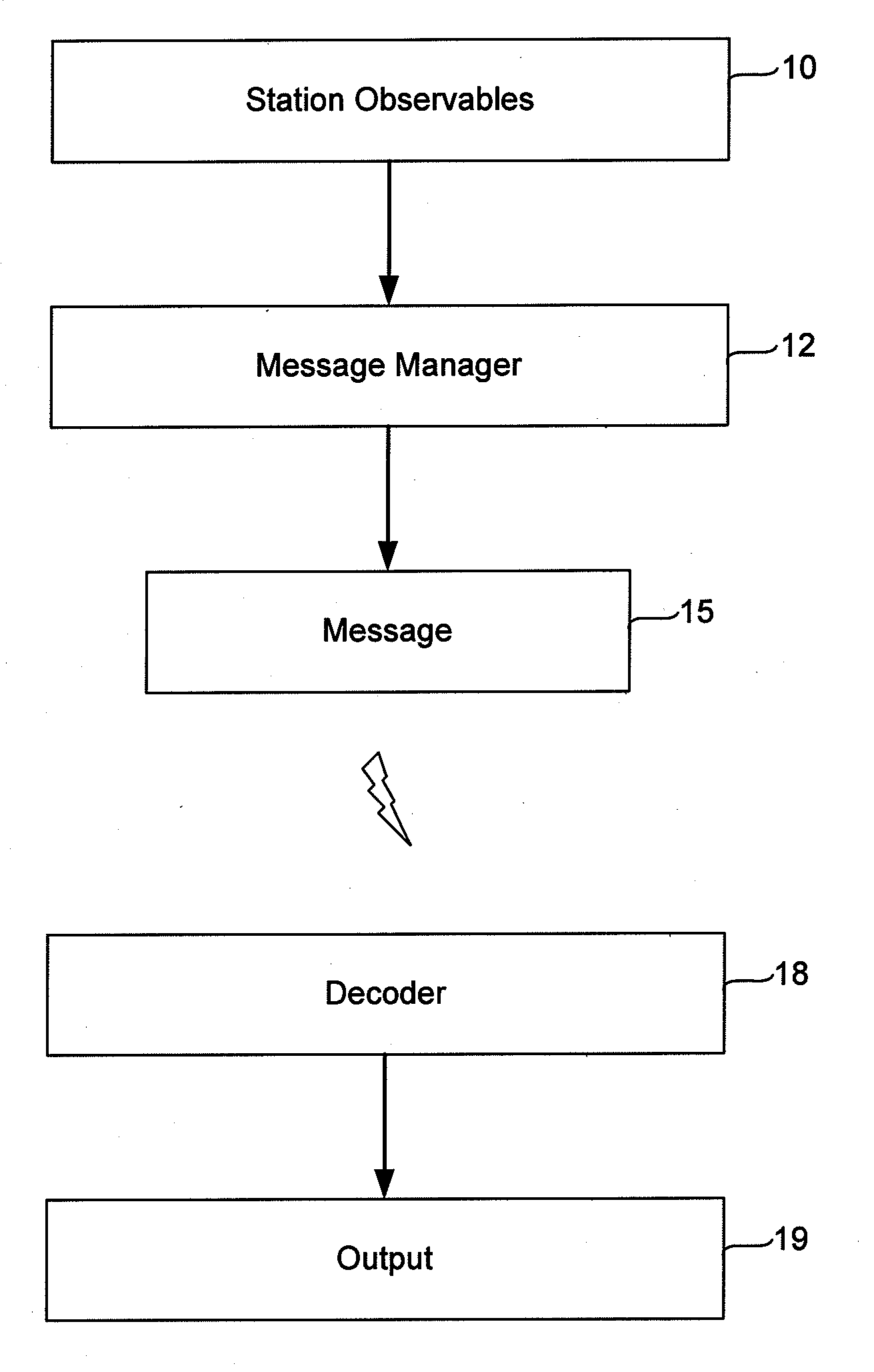
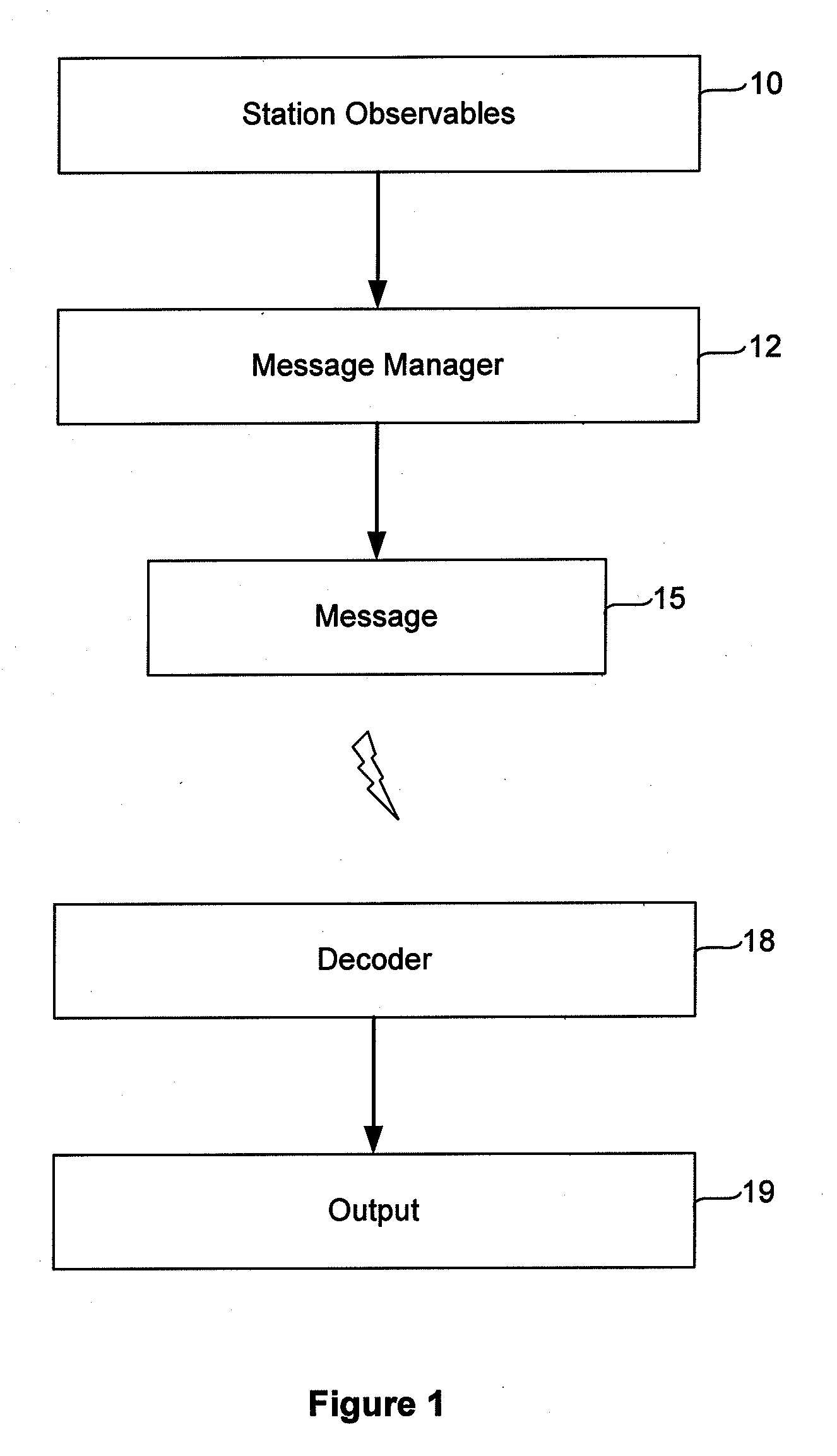
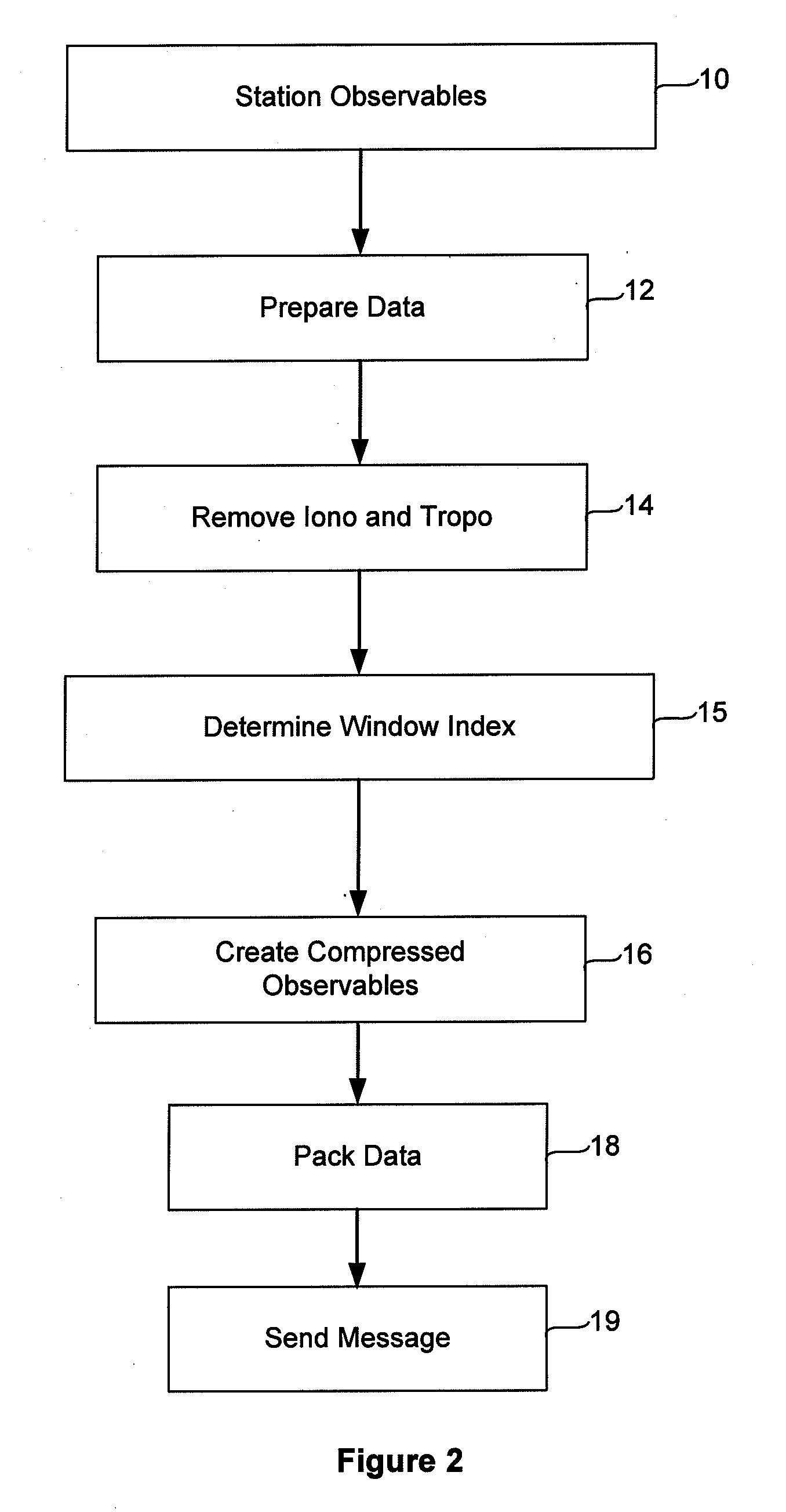
[0046]This invention relates to global navigation satellite systems, and in particular to the transmission of information among global navigation satellite system processing apparatus such as receivers, virtual reference stations, data processing centers, and rovers. The recipients of positioning information from satellites may wish to communicate that information to other stations to provide information about the relative positions of the stations. FIG. 1 is a flow diagram illustrating typical operation of a system implementing our invention. As depicted, GPS data received at a reference or other station, herein termed “observables” are collected. The data typically includes both code phase and carrier phase information.

[0047]A GPS receiver determines the travel time of a signal from a satellite by comparing the “pseudo random code” the receiver generates with code transmitted in the signal from the satellite. The receiver compares its own generated code with the code f...


PUM


Abstract

A method of communicating satellite tracking information among a network of global navigation satellite system receivers is described. The method includes determining at a first GNSS receiver which satellites in a constellation of satellites have been continuously tracked over a preceding selected time period, and for each such satellite determining its elevation with respect to the zenith. Only the elevation value for the lowest satellite in the set of satellites for which all satellites of higher elevation values have been continuously tracked over the selected time period is then transmitted to the second GNSS receiver. That receiver can then reconstruct the set of satellites which have been continuously tracked.

Description

BACKGROUND OF THE INVENTION[0001]This invention relates to the communication of data among global navigation satellite system (“GNSS”) receivers, virtual reference stations, data processing centers, rovers, and other apparatus, and in particular to techniques for transmitting that data in a format which conserves use of bandwidth available for the transmission of the data. Herein we describe the invention in terms of use with the US global positioning satellite system (“GPS”), but we use the terms GNSS and GPS interchangeably to refer to any global navigation satellite system, whether based on satellites provided by the United States, or by other countries, e.g. GLONASS (Russia), Galileo (European Union), GAGAN (India) etc. As will be apparent, the technology described herein can be applied to use with any GNSS system, including GPS.[0002]A technique known as real time kinematic (RTK) positioning is now commonly used to determine the position of a roving GNSS receiver relative to a ...

Claims


Application Information

Patent Timeline
08 Apr 2010
Publication
US20100085253A1
IPC
H04B7/185
CPC
G01S19/04; G01S19/07; H03M7/30; G01S19/43; G01S19/41; G01S19/073
Inventors
FERGUSON, KENDALL; ALLISON, MICHAEL TIMO