Unmanned boat automatic survey system and unmanned boat automatic survey method

an automatic survey and unmanned boat technology, applied in the direction of steering initiation, distance measurement, instruments, etc., can solve the problem of not being able to automatically generate survey routes and make surveys

Inactive Publication Date: 2010-05-27
CODEN
View PDF46 Cites 32 Cited by
  • Summary
  • Abstract
  • Description
  • Claims
  • Application Information

AI Technical Summary

Benefits of technology

[0017]These and other features of the invention will be...

Problems solved by technology

However, they were not capable of automatically generating survey routes ...

Method used


Image

  • Unmanned boat automatic survey system and unmanned boat automatic survey method
  • Unmanned boat automatic survey system and unmanned boat automatic survey method
  • Unmanned boat automatic survey system and unmanned boat automatic survey method

Examples


first embodiment

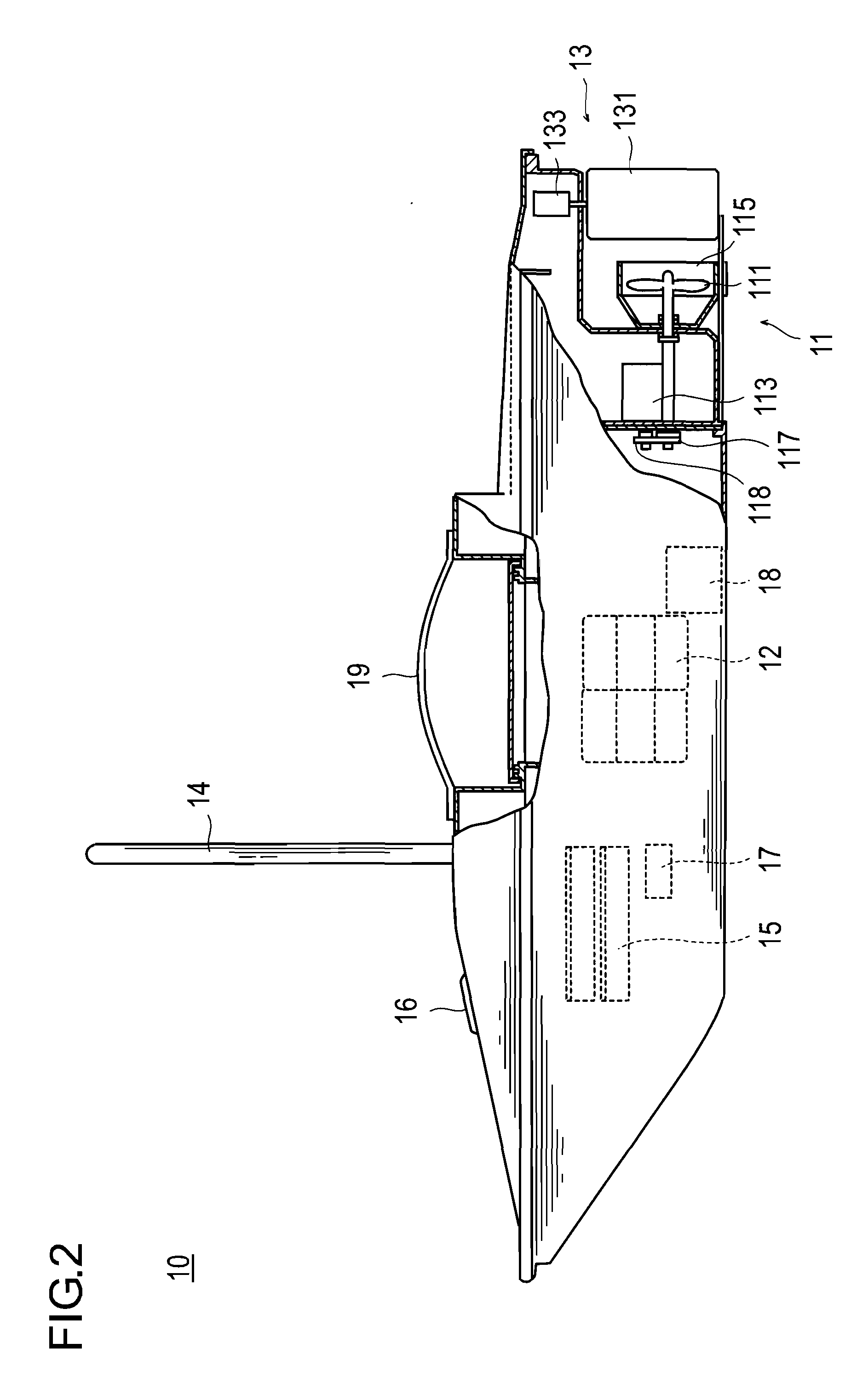
[0036]The unmanned boat automatic survey system and the unmanned boat automatic survey method to be described as the first embodiment accomplish underwater and water bottom surveys automatically by generating a plurality of survey routes at a fixed interval using an entered reference survey line as a reference, and causing an unmanned boat for automatic survey to navigate automatically along said plurality of survey routes. Since the interval between the adjacent survey routes can be freely designated, a more detailed survey of the water bottom, for example, can be accomplished easily, if so desired, by setting the interval between the routes narrower and causing an unmanned boat to a reciprocating navigation at a narrow interval.

[0037]First, let us describe the constitution of the unmanned boat automatic survey system in the first embodiment.

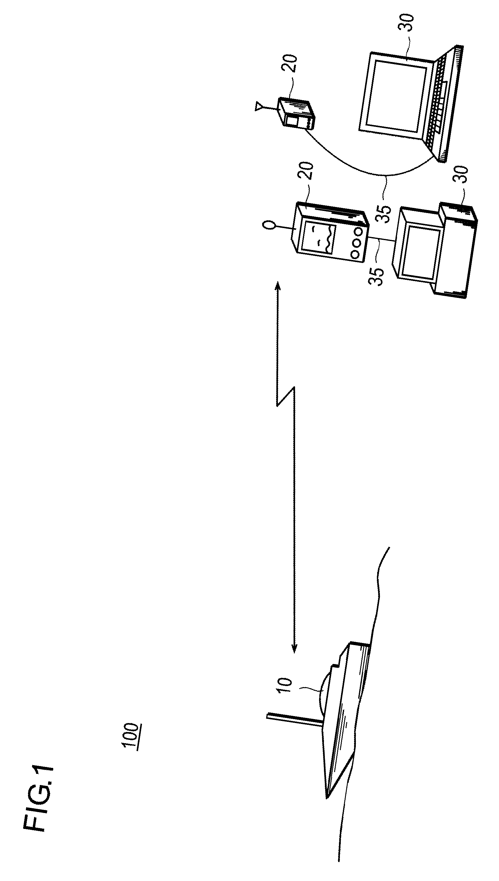
[0038]FIG. 1 is a schematic diagram of an unmanned boat automatic survey system according to the present invention.

[0039]As can be seen in the...

second embodiment

[0095]The unmanned boat automatic survey system and the unmanned boat automatic survey method to be described as the second embodiment accomplish underwater and water bottom surveys automatically by generating a plurality of survey routes as straight line segments extending at a fixed interval perpendicular to a survey line that forms an entered reference survey line as a reference, and causing the unmanned boat 10 for automatic survey to navigate automatically along said plurality of survey routes. Since the interval between the adjacent survey routes can be freely designated, a more detailed survey of the water bottom, for example, can be accomplished easily, if so desired, by setting the interval between the survey routes narrower and causing the unmanned boat 10 to navigate at a narrower interval.

[0096]The difference between the first and the second embodiments is only the method of generating survey routes to be generated by the survey route generating unit 26 provided on the w...

third embodiment

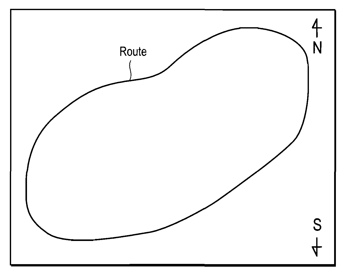
[0114]The unmanned boat automatic survey system and the unmanned boat automatic survey method to be described as the third embodiment are to cause the unmanned boat 10 to navigate first along a loop-like route surrounding a place to be surveyed, store the loop-like route based on the position data of the GPS acquired during the navigation, generate a plurality of survey routes specified in a direction and intervals specified inside the loop-like route, and cause the unmanned boat 10 to navigate automatically said plurality of survey routes to conduct automatically underwater and water bottom surveys. Since the interval between the adjacent survey routes can be freely designated, a more detailed survey of the water bottom, for example, can be accomplished easily, if so desired, by designating the interval between the routes narrower and causing the unmanned boat 10 to navigate at a narrower interval.

[0115]The difference between the third embodiment and the first or second embodiment ...


PUM


Abstract

The present invention is about an unmanned boat automatic survey device and an unmanned boat automatic surveying method that automatically generate survey routes and automatically survey underwater and water bottom conditions under the survey routes.
Under the present invention, a reference survey line is entered for generating a survey route (S1), and a plurality of survey routes are generated by translating the reference survey line at a fixed distance (S2). It then determines the distances of the generated survey routes and instructs a traversing order of the determined survey routes (S3), and causes the unmanned boat to navigate automatically according to the instructed traversing order. It surveys at least underwater or water bottom condition during the navigation (S5), and display and store the surveyed underwater or water bottom condition (S6).

Description

CROSS REFERENCE TO RELATED APPLICATIONS[0001]The present application is related to, and claims priority from, Japanese patent application no. 2008-303105 filed Nov. 27, 2008, the entire contents of which is hereby incorporated by reference in its entirety.BACKGROUND OF THE INVENTION[0002]1. Field of the Invention[0003]The invention relates to an unmanned boat automatic survey system and an unmanned boat automatic survey method, in particular to an unmanned boat automatic survey system and an unmanned boat automatic survey method capable of automatically surveying underwater and water bottom conditions by causing an unmanned boat to navigate over a range.[0004]2. Description of the Related Art[0005]In order to survey underwater and water bottom conditions of sea, lakes, ponds and rivers, a remote controlled unmanned boat can be used. Such an unmanned boat is typically equipped with a sonar system that radiates ultrasonic waves toward water bottom, catches ultrasonic waves bounced off...

Claims


Application Information

Patent Timeline
IPC IPC(8): G05D1/00G01C21/00G01S15/00B63H25/04G01S19/14
CPCG05D1/0206G08G3/00G05D1/00G01S5/14B63C11/48
Inventor KODA, YOSHIHARUKODA, KOJIRO
Owner CODEN
Why Eureka
Try Eureka