System and method for applying code corrections for GNSS positioning

a technology of positioning code and code correction, applied in the field of positioning using a global navigation satellite system, can solve the problems of incomplete accuracy of determining differences between carrier waves and receivers, poor approximation of distance to satellites, and inability to distinguish carrier waves from other receivers

Active Publication Date: 2010-06-24
HEMISPHERE GNSS
View PDF2 Cites 79 Cited by
  • Summary
  • Abstract
  • Description
  • Claims
  • Application Information

AI Technical Summary

Problems solved by technology

However, the code portion of the transmitted signal generally has wavelengths in the tens of meters to hundreds of meters in length, so this approximation of the distance to the satellite, by itself yields relatively poor position accuracy.
However, the carrier portion of the signal consists of a repeated waveform and one carrier wave cannot be distinguished from another by the receiver.
However, even using the carrier portion of the signal to determine differences is not completely accurate because the signals being transmitted between the satellites and the receiver are subjected to numerous errors, such as satellite orbit, satellite clock error, atmosphere delay, environmental affections and the like.

Method used


Image

  • System and method for applying code corrections for GNSS positioning
  • System and method for applying code corrections for GNSS positioning
  • System and method for applying code corrections for GNSS positioning

Examples


Embodiment Construction

[0031]The invention relates to a system and method for using code corrections in carrier phase based single point GNSS positioning. When describing the present invention, all terms not defined herein have their common art-recognized meanings. To the extent that the following description is of a specific embodiment or a particular use of the invention, it is intended to be illustrative only, and not limiting of the claimed invention. The following description is intended to cover all alternatives, modifications and equivalents that are included in the spirit and scope of the invention, as defined in the appended claims.

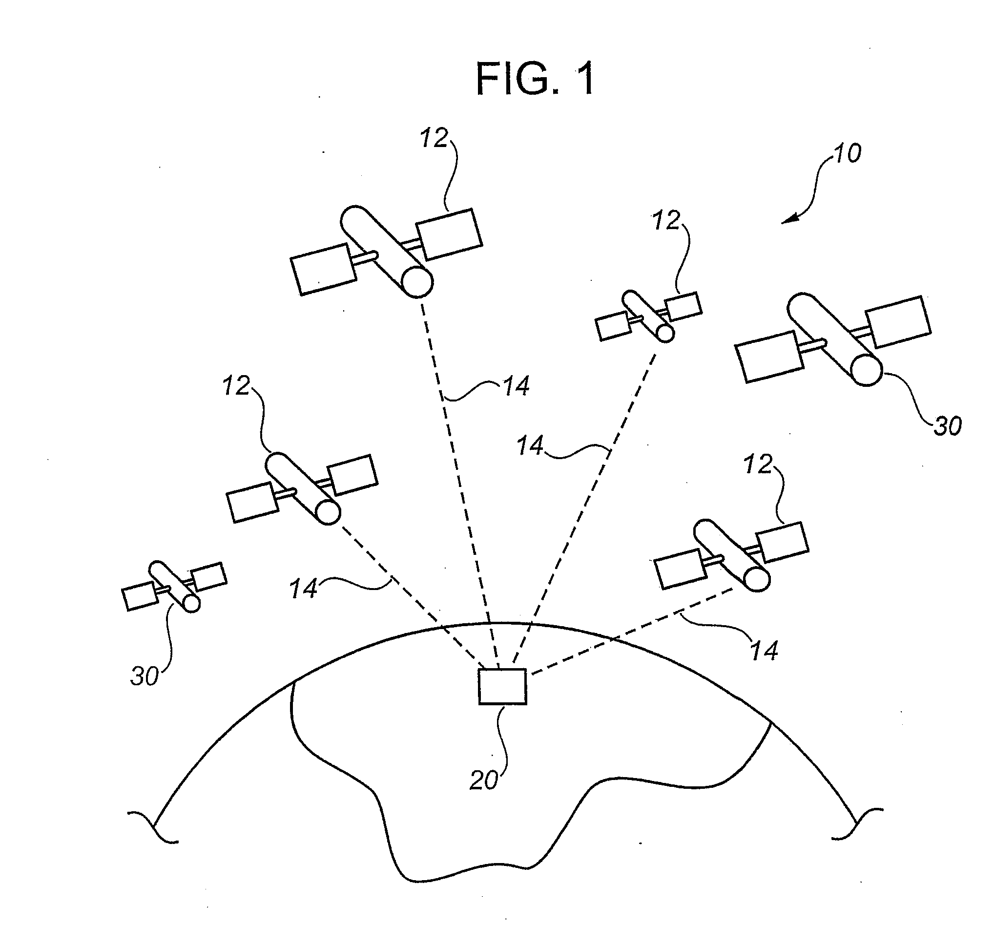
[0032]FIG. 1 illustrates a representative view of Global Navigation Satellite system (GNSS) 10. In one embodiment, the GNSS 10 comprises the Global Positioning System (GPS). The GNSS 10 includes a plurality of satellites 12 orbiting the earth with each satellite 12 transmitting signals 14 that include a data stream providing information regarding the satellite 12 trans...


PUM


Abstract

A method and system for approximating a position using a Global Navigational Satellite System (GNSS) having a plurality of GNSS satellites and an augmentation system, the method including the steps of obtaining an initial code pseudorange measurement and an initial carrier phase measurement from a signal transmitted by a GNSS satellite in the GNSS system, receiving a code correction from the augmentation system, using the code correction to correct the initial code pseudorange measurement and the initial carrier phase measurement to mitigate for errors in the signal, to result in a corrected code pseudorange measurement and a corrected carrier phase measurement, and using a code dominated measurement in a filter which outputs apposition and ambiguity estimate.

Description

FIELD OF THE INVENTION[0001]The present invention relates to positioning using a Global Navigation Satellite System and more particularly to correcting errors in received signals from satellites in a Global Navigation Satellite System to more accurately determine a position.BACKGROUND[0002]Global Navigation Satellite Systems (GNSS) is the commonly accepted term for all weather navigation and positioning systems using line of sight radio from orbiting satellites. The Global Positioning System (GPS), which is funded and controlled by the U.S. Department of Defence, is likely the most well known type of GNSS, however, GLONASS which is founded and controlled by Russia, as well as, Europe's GALILEO and China's Beidou, which are currently under development, are also examples of GNSS.[0003]The concept of GNSS positioning is based on the simultaneously ranging to a minimum of four GNSS satellites from a receiver. With known satellite coordinates, the four dimensional coordinates of the rece...

Claims


Application Information

Patent Timeline
Patent Type & Authority Applications(United States)
IPC IPC(8): G01S1/00
CPCG01S19/43G01S19/41
Inventor ZHANG, YUFENGGAO, YANGLEE, SUEN
Owner HEMISPHERE GNSS
Why Eureka
Try Eureka