Context-sensitive route generation system

Inactive Publication Date: 2010-08-12
YAHOO INC
View PDF14 Cites 97 Cited by
  • Summary
  • Abstract
  • Description
  • Claims
  • Application Information

AI Technical Summary

Benefits of technology

[0004]Embodiments of the present invention describe systems and methods for automatically generating route(s) based on users' trip intent and conditions. A user enters his/her trip intent and conditions. A context-sensitive route generation system generates one or more routes based on information surrounding the user's trip intent, such as destination, time, means of transportation, purpose and identity(ies) of traveler(s), and conditions, such as user's limitations, needs, and preferences, for the user. Once the user chooses a route to follow, context-sensitive route generation system (CRGS) keeps track of user's m

Problems solved by technology

The current GPS navigation systems or mobile devices with navigation function are designed to

Method used


Image

  • Context-sensitive route generation system
  • Context-sensitive route generation system
  • Context-sensitive route generation system

Examples


Embodiment Construction

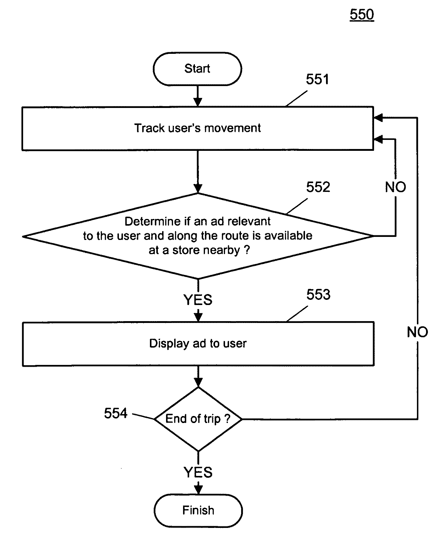
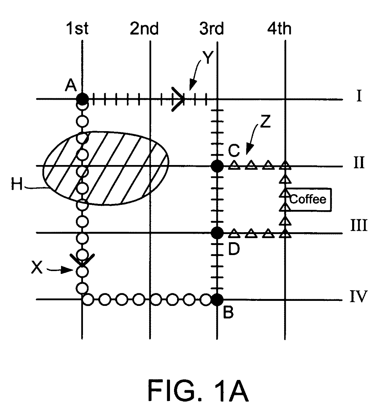
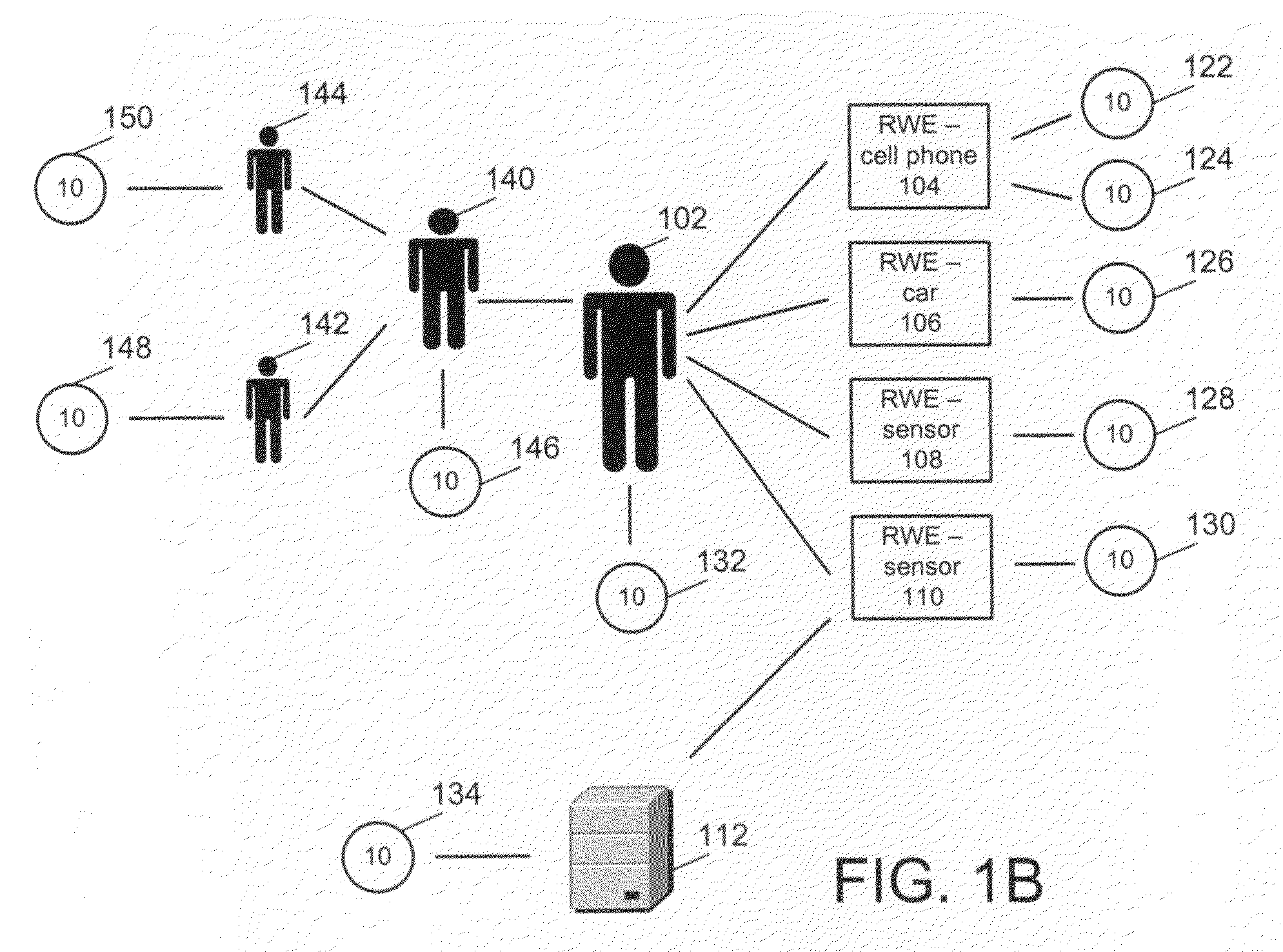
[0024]As described above, modern GPS navigation systems utilize the mapping information of roads and freeways and the locating capability of GPS to generate travel routes for users. In addition, modern GPS navigation systems also monitor the movement of users. Users often type in the addresses or names of the destinations, such as names of restaurants, to allow the GPS navigation system to identify routes that are shortest or quickest to users. Typically, navigation systems only present a list of routes when traveling distances are relatively long and there are multiple highways and / or freeways between the starting points and destinations. After a user, such as a driver, selects a route and starts to drive, the navigation system displays the movement of the car on the map of the navigation system in real time. Navigation systems can also be used by users walking around cities or taking hikes. For example, if a user wants to visit a neighborhood in the city that the user is not famil...


PUM


Abstract

Embodiments of the present invention describe systems and methods for automatically generating route(s) based on users' trip intent and conditions. A user enters his/her trip intent and conditions. A context-sensitive route generation system generates one or more routes based on information surrounding the user's trip intent, such as destination, time, means of transportation, purpose and identity(ies) of traveler(s), and conditions, such as user's limitations, needs, and preferences, for the user. Once the user chooses a route to follow, context-sensitive route generation system (CRGS) keeps track of user's movement and can modify the user's route when a need arises. The CRGS searches one or more networks and the system database(s) for profile and real-time (or instant) information for route generation, and continues to mine networks for information related to the trip to ensure the best route is recommended to the user. In one embodiment, profile and real-time information relevant to the trip is used in generating and modifying the route. In addition to generation, monitoring and updating route(s) for the user, the CRGS also can present advertisements of interest to the user for business and services along user's route.

Description

CROSS REFERENCE To RELATED APPLICATIONS[0001]This application is related to U.S. patent application Ser. No. 12 / 352,753, filed on Jan. 13, 2009, entitled “Optimization of Map Views Based on Real-Time Data.”BACKGROUND OF THE INVENTION[0002]Global positioning system (GPS) navigation is widely used to assist users in reaching a desired destination. A navigation system that utilizes GPS can simply be called a GPS, or a GPS navigation system. Modern GPS navigation systems utilize the mapping information of roads and freeways and the locating capability of GPS to generate travel (or trip) routes for users, and also to monitor the movement of users. Users utilizing GPS navigation systems can be in vehicles, such as airplanes, boats, ships, cars, and bikes, etc., or on foot. Users often type in the addresses or names of the destinations to allow the GPS navigation system to identify routes that are shortest, or quickest to users. Once users start moving, the system track users' movement and...

Claims


Application Information

Patent Timeline
IPC IPC(8): G01C21/36G06Q30/00
CPCG01C21/3484G01C21/3617G06Q30/0261G06Q30/02G06Q10/047
Inventor ATHSANI, ATHELLINACHURCHILL, ELIZABETH F.
Owner YAHOO INC
Why Eureka
Try Eureka