
Map data update apparatus

a technology for updating apparatuses and maps, applied in the direction of 2d-image generation, navigation instruments, instruments, etc., can solve the problems the appearance of the map may worsen, and the event of an area update, so as to reduce the possibility of worsening the appearance of the map

Inactive Publication Date: 2010-09-09
DENSO CORP
View PDF1 Cites 12 Cited by
  • Summary
  • Abstract
  • Description
  • Claims
  • Application Information

AI Technical Summary

Benefits of technology

The present invention provides a map update apparatus and method that reduces the possibility of worsening the appearance of a map by updating an area in map data. The apparatus includes an image display device and a storage medium that stores map data that is classified into several unit areas, which include a first unit area and a second unit area adjoining the first unit area. The method includes updating the second unit area and determining if a position separation occurs between a first border node and a second border node on the unit areas border. The method also includes generating a new planimetric feature to fill in a recess area resulting from the area update. The technical effect of the invention is to improve the appearance of the map by reducing the likelihood of distortion or displacement of map features due to the area update.

Problems solved by technology

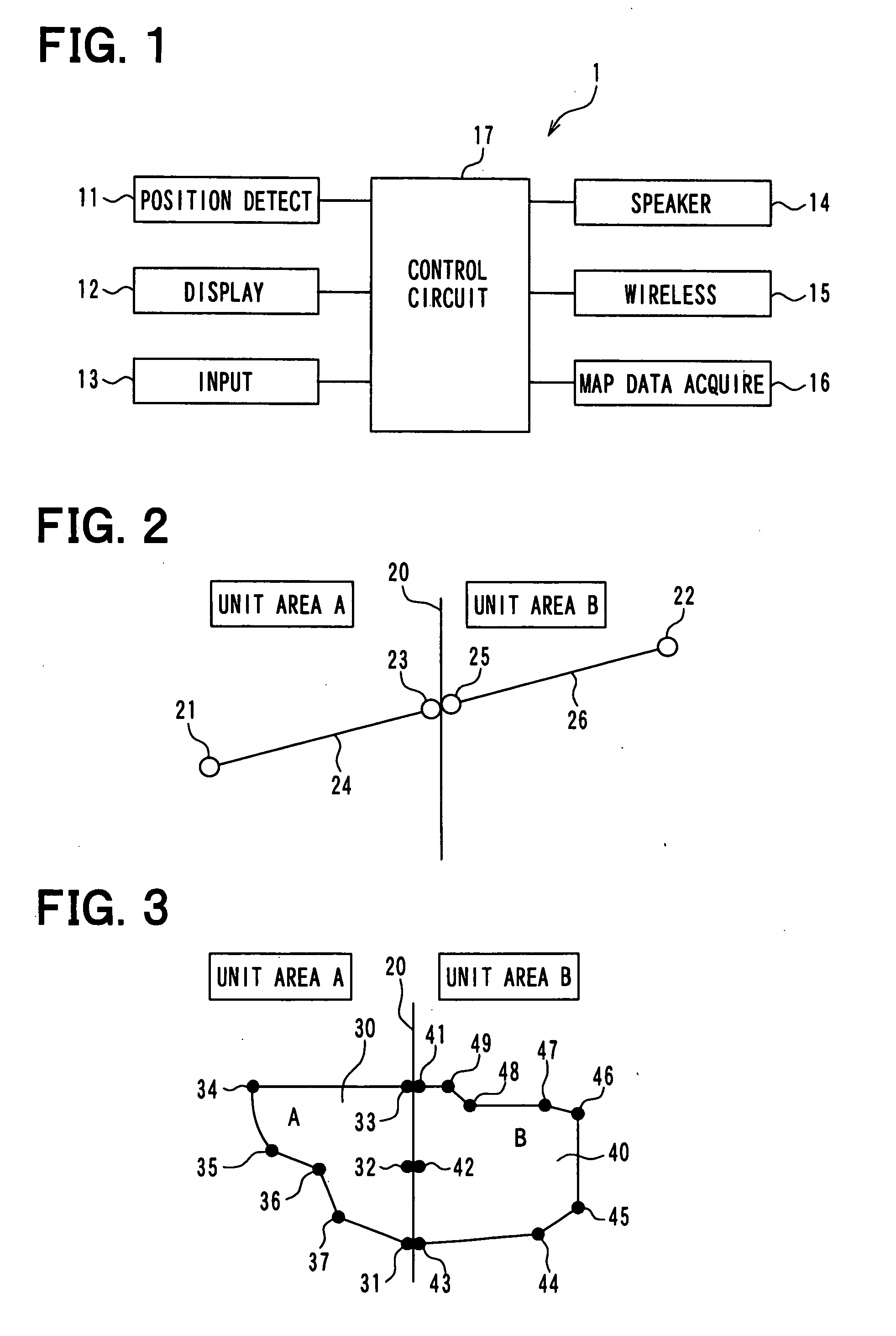
In this regard, however, when the first border node belonging to one unit area and the second border node belonging to the other unit area are provided as a single node existing on the single position of the border of the adjoining unit areas, the following disadvantage may occur in the case of an area update.
That is, the appearance of the map may worsen.
However, when the planimetric feature which occupies the geographical area range over the unit areas border is thus divided into two border planimetric features, the following disadvantage may occur in the case of the area update.
As a result, the configuration appearing when the occupied area range of the original planimetric feature is displayed on the map may different from the actual one, thereby possibly causing distortion.
That is, the appearance of the map may worsen.

Method used


Image

  • Map data update apparatus
  • Map data update apparatus
  • Map data update apparatus

Examples


first embodiment

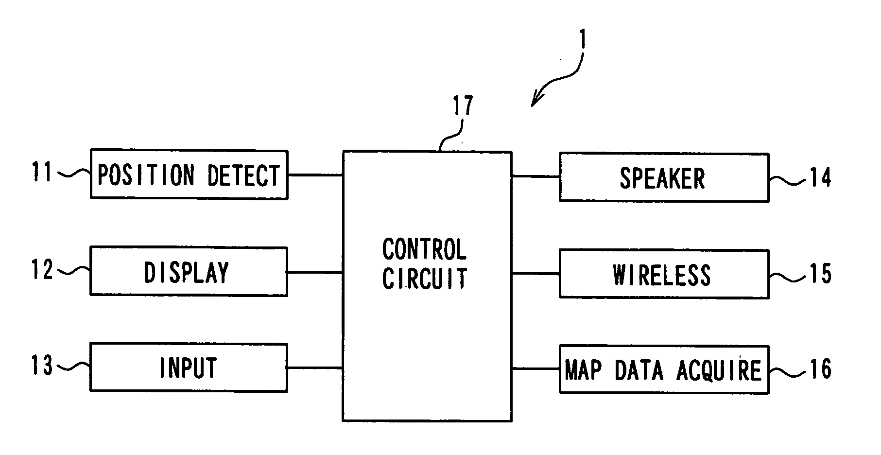
[0033]The following describes a first embodiment of the present invention. FIG. 1 illustrates a navigation apparatus 1, which functions as an example of a map update apparatus, for a vehicle according to the first embodiment. The navigation apparatus 1 is mounted in a subject vehicle and includes a position detection device 11, an image display device 12, an input device 13, a speaker 14, a wireless communications device 15, a map data acquisition device 16, and a control circuit 17.

[0034]The position detection device 11 includes known sensors or the like such as an acceleration sensor, a geomagnetic sensor, a gyroscope sensor, a speed sensor, and a GPS (Global Positioning System) receiver. The sensors or the like individually output information for designating a present position, travel direction, and speed of the vehicle to the control circuit 17.

[0035]The image display device 12 displays images based on video signals outputted from the control circuit 17. For instance, a display ...

second embodiment

[0106]Next, a second embodiment of the present invention is explained while focusing on the different points from the first embodiment. The present second embodiment is different from the first embodiment in respect of a map data update program for the map data updates which the control circuit 17 executes. FIG. 8 illustrates a map data update program 200 executed for the map update process by the vehicular navigation apparatus 1 according to the second embodiment.

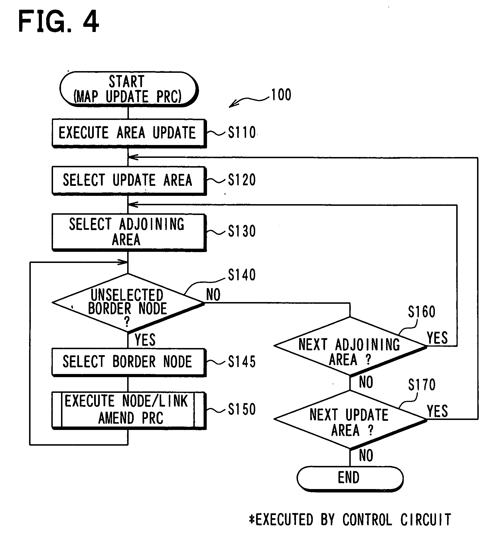
[0107]In the program 200, the processing contents of S210, S220, S230, S260, and S270 are the same as those of S110, S120, S130, S160, and S170 of the program 100 indicated in FIG. 4, respectively.

[0108]At S220, a update unit area is selected. At S230, an adjoining unit area is selected as being adjoining the update unit area selected at S220. At S240, it is determined whether a border planimetric feature, which has not been selected previously at S240, is located on the unit areas border between the update unit area selec...


PUM


Abstract

In a vehicular navigation apparatus, when map data of a unit area is updated, it is determined whether a border node contained in an adjoining unit area which adjoins the updated unit area is separated from an opponent border node contained in the updated unit area. The positions of the border node and the opponent border node are moved to target points so as to accord with each other, thereby reducing a possibility to worsen an appearance of a map as a result of the update of the unit area of the map data.

Description

CROSS REFERENCE TO RELATED APPLICATION[0001]The present application is based on and incorporates herein by reference Japanese Patent Application No. 2009-51824 filed on Mar. 5, 2009.FIELD OF THE INVENTION[0002]The present invention relates to a map data update apparatus.BACKGROUND OF THE INVENTION[0003][Patent document 1] JP 2002-54934 A[0004]There is known a technology to update map data in a map display apparatus which displays a map using map data (for example, refer to Patent document 1).[0005]Methods of update of map data may include, for instance, a method of updating the whole map data stored in the map display apparatus, a method of updating only a difference of a new version of the map from the previous version of the map, and a method of updating an area covering a specific geographical area range in the map data.[0006]In order to realize the update of the area, the map data may be divided into several unit areas as update units. In addition, the method of dividing the map...

Claims


Application Information

Patent Timeline
Patent Type & Authority Applications(United States)
IPC IPC(8): G06T11/20
CPCG01C21/32G01C21/3811G01C21/3867
Inventor NOMURA, TOSHIO
Owner DENSO CORP
Learn More