Method of spreading out and displaying closely located points of interest on a personal navigation device

a personal navigation and location technology, applied in surveying and navigation, navigation instruments, instruments, etc., can solve the problems of not being able to narrow down the categories of users, difficult to clearly show multiple points of interest, and changing the area displayed on the map

Active Publication Date: 2011-03-03
MITAC INT CORP
View PDF20 Cites 34 Cited by
  • Summary
  • Abstract
  • Description
  • Claims
  • Application Information

AI Technical Summary

Benefits of technology

[0016]It is an advantage that the present invention provides a clear way to display multiple points of interest, even when the points of interest are located in very close proximity to each other. Icons representing the points of interest will automatically spread out so that the points of interest located near the touched position can easily be seen.

Problems solved by technology

It is difficult to clearly show multiple points of interest that are in very close proximity to each other on the display of a personal navigation device.
One problem with the traditional approach to displaying points of interest is that if several points of interest occur at the same location or nearby locations, only one type of point of interest icon is drawn, which will be the icon representing the point of interest having the highest priority level.
Another related problem is if a point of interest has been selected as a target destination for a user's trip, it is still not shown on the map if this type of point of interest was not enabled or not given high enough priority.
In addition, it is not often possible for users to narrow down categories to a finer granularity of point of interest types, such as selecting curry houses within the restaurant category, or selecting specific chains such as Starbucks™ within the coffee shop category.
Other problems come when the areas displayed on the map change when a user continues driving.
Having icons constantly appear and disappear can be distracting to users.
However, most of the time, users are not interested in many of these points of interest.
However, if the point of interest that they are interested in is not shown as one of the displayed types of points of interest, they do not have this option.
This may cause confusion as to why they are not able to find the specific point of interest on the map when they know that the point of interest is actually there.
Another problem comes when the user touches a map at a specific location containing multiple points of interest.
In this case, the personal navigation device cannot tell which point of interest the user is interested in, and cannot show them the correct location details.

Method used


Image

  • Method of spreading out and displaying closely located points of interest on a personal navigation device
  • Method of spreading out and displaying closely located points of interest on a personal navigation device
  • Method of spreading out and displaying closely located points of interest on a personal navigation device

Examples


Embodiment Construction

[0031]The present invention aims to provide information about points of interest to a user in an unobtrusive manner. To accomplish this, by default very few point of interest icons will be shown on the map of the personal navigation device. Those points of interest that are shown should be of genuine interest, such as landmarks, tourist attractions, etc.

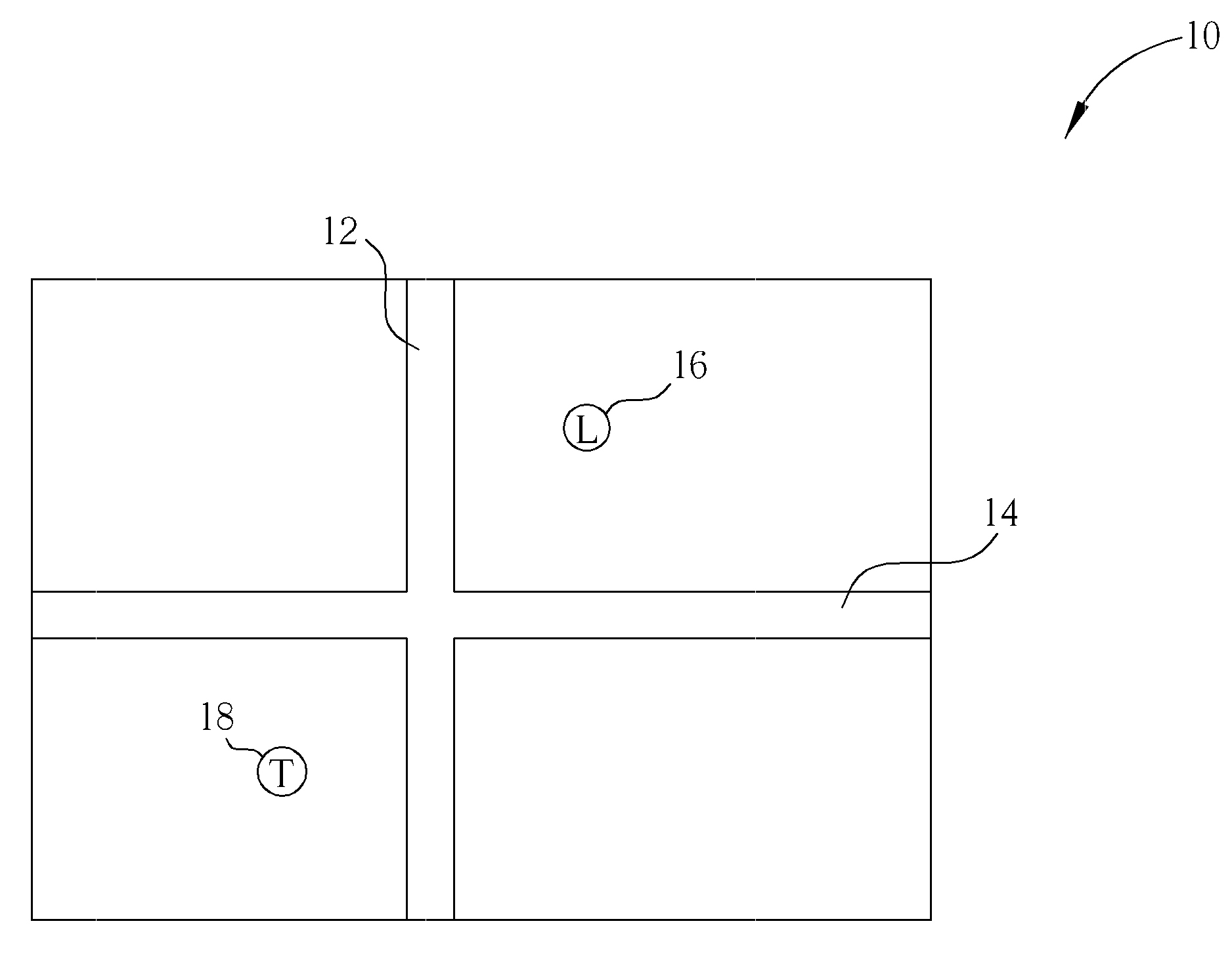
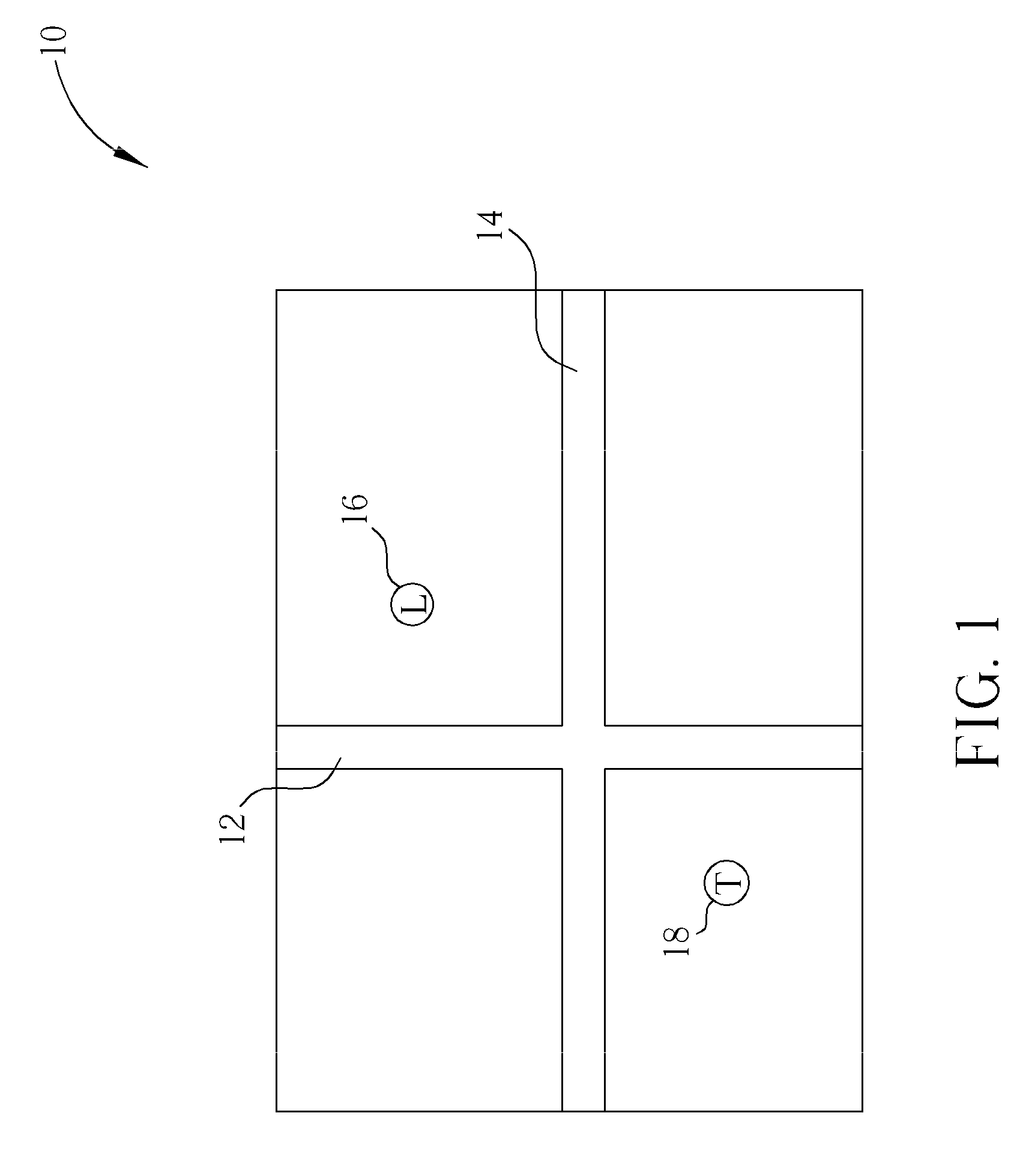
[0032]Please refer to FIG. 1. FIG. 1 illustrates a map 10 showing roads 12 and 14 and points of interest 16 and 18. Point of interest 16 corresponds to a landmark, whereas point of interest 18 corresponds to a tourist attraction. If the user wishes to find out more information about either of the points of interest 16 and 18, the user can touch or select one of them to see additional information. If there are many points of interested clustered together, it may be that an icon for one point of interest will block icons corresponding to other nearby points of interest. The present invention provides a way to see the hidden icons by le...


PUM


Abstract

A method of displaying points of interest in a personal navigation device includes displaying a map on a display of the personal navigation device, receiving touch input at a touched position of the display, displaying points of interest located near the touched position, wherein the points of interest are represented by icons, each icon being connected to its location on the map with a line extending out from the touched position, and spreading out the icons around the touched position to separate the icons from each other, the spread out icons being displayed in a pattern around the touched position, wherein a length of the line connecting each icon to its location on the map is not directly proportional to a distance from the corresponding point of interest to the touched position.

Description

BACKGROUND OF THE INVENTION[0001]1. Field of the Invention[0002]The invention relates to a method of displaying multiple points of interest on a personal navigation device, and more particularly, to a method for spreading out closely located points of interest to create a flower shape surrounding a selected position.[0003]2. Description of the Prior Art[0004]Global Positioning System (GPS) based navigation devices are well known and are widely employed as in-car navigation devices. Common functions of a navigation device include providing a map database for generating navigation instructions that are then shown on a display of the navigation device. These navigation devices are often mounted on or in the dashboard of a vehicle using a suction mount or other mounting means.[0005]The term “navigation device” refers to a device that enables a user to navigate to a pre-defined destination. The device may have an internal system for receiving location data, such as a GPS receiver, or may...

Claims


Application Information

Patent Timeline
Patent Type & Authority Applications(United States)
IPC IPC(8): G06F3/048G06F3/041
CPCG01C21/3664G06F3/0488G01C21/3682
Inventor MACFARLANE, RODNEYSTANTON, RICHARDRANFORD, PAUL
Owner MITAC INT CORP
Why Eureka
Try Eureka