System for identifying sustainable geographical areas by remote sensing techniques and method thereof
a technology of sustainable geographical areas and remote sensing, applied in the field of system for identifying sustainable geographical areas by remote sensing techniques and methods thereof, can solve problems such as difficult in-situ check-in
- Summary
- Abstract
- Description
- Claims
- Application Information
AI Technical Summary
Benefits of technology
Problems solved by technology
Method used
Image
Examples
Embodiment Construction
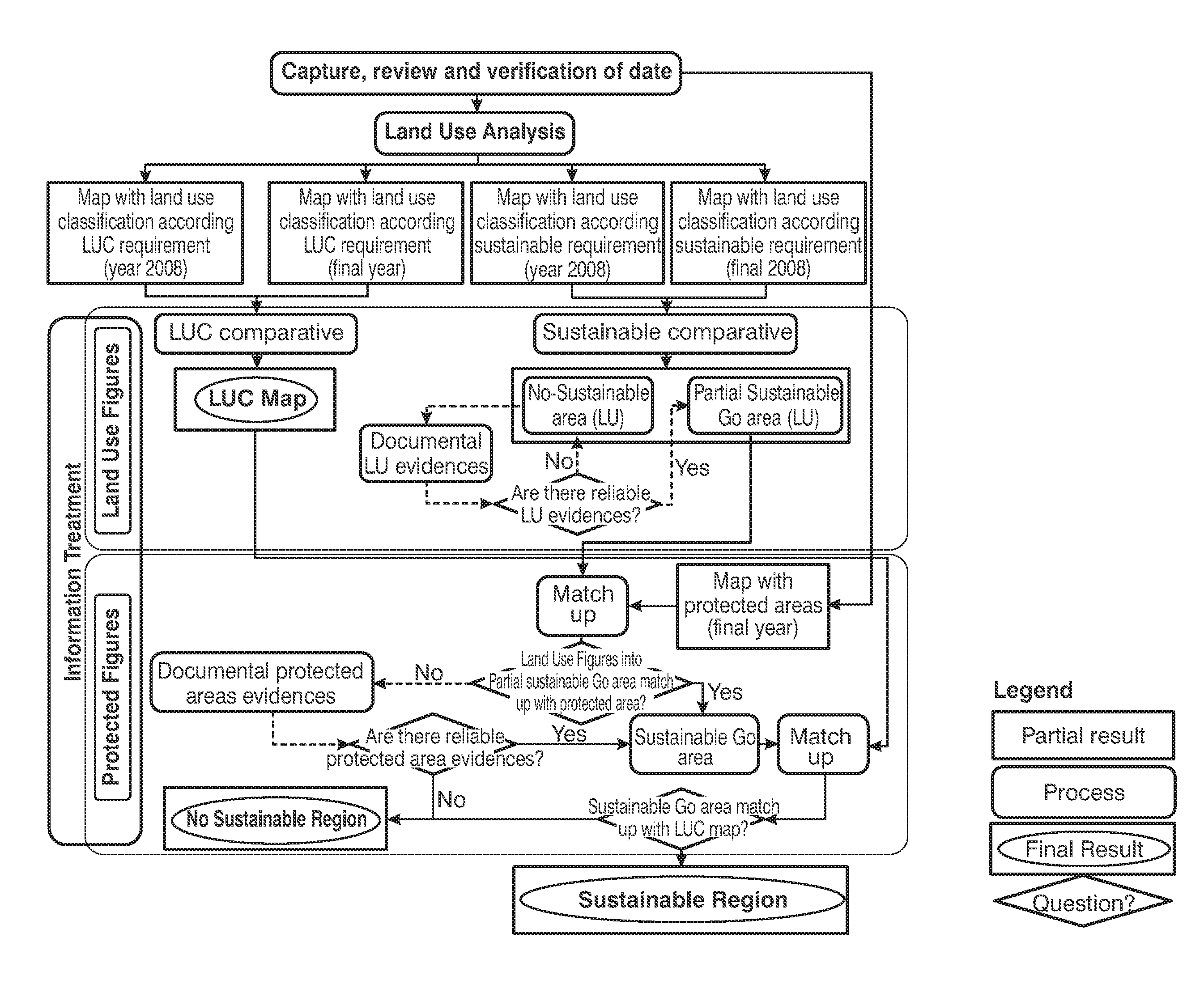
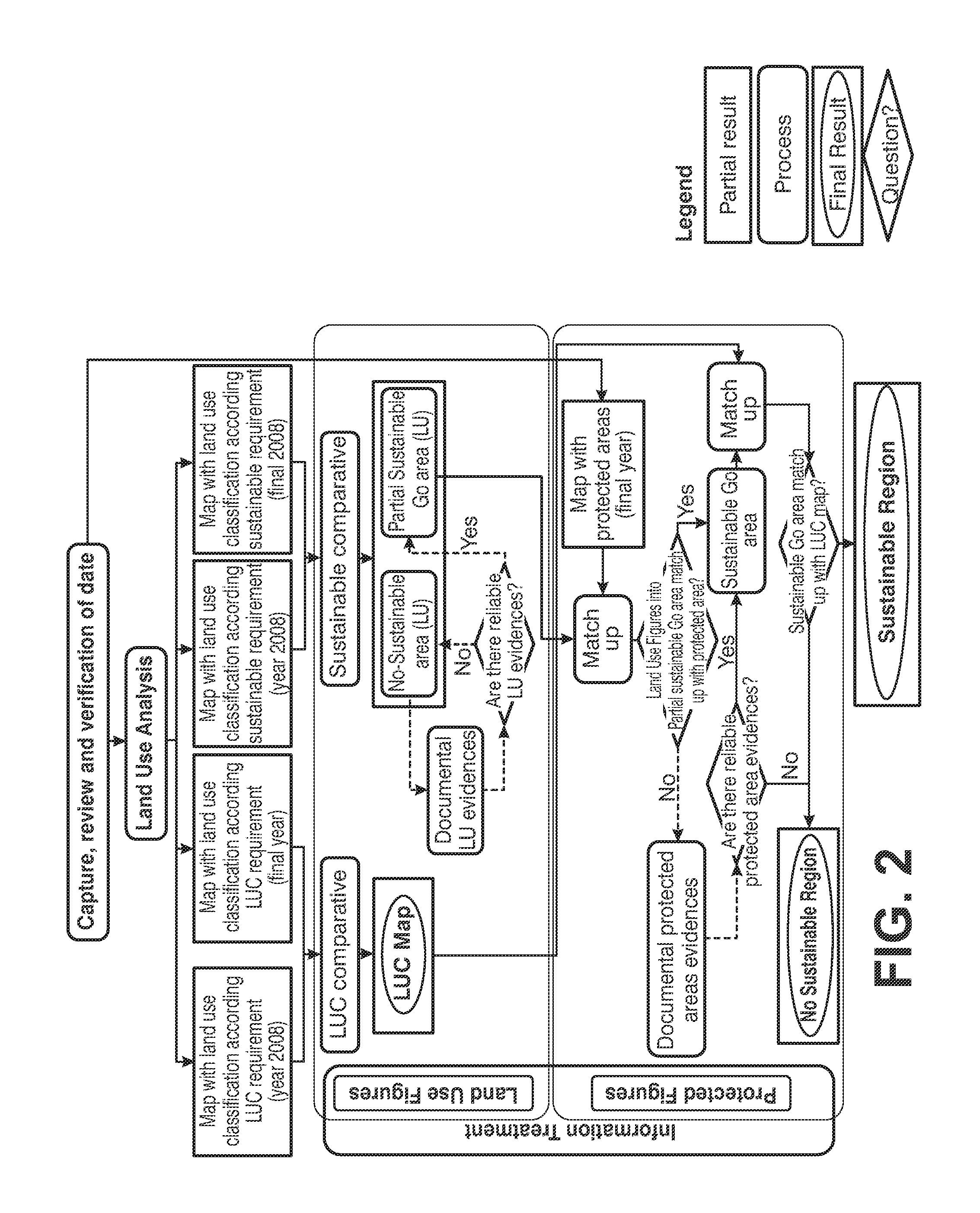
[0029]The present invention resolves the aforementioned drawbacks by providing a system and a method for identifying sustainable geographical areas for the production of raw materials intended for bioproduct production by remote sensing techniques. More specifically, the system and method object of the invention are particularly applicable for identifying those areas that comply with previously defined sustainability requirements. Said sustainability requirements state that raw material intended for bioproduct production shall not be made from lands with a high biodiversity, high carbon stock or peatlands, and bearing in mind additionally the land use requirement cited above.
[0030]Next, some definitions corresponding to some terms which will be used below are provided:
[0031]Go area: is a region that complies with established sustainability requirements for biodiversity, carbon stock and peatland.
[0032]Partial Go area: is a region that complies with the established sustainability req...
PUM
 Abstract
Description
Claims
Application Information
 - R&D
- Intellectual Property
- Life Sciences
- Materials
- Tech Scout
- Unparalleled Data Quality
- Higher Quality Content
- 60% Fewer Hallucinations
Browse by: Latest US Patents, China's latest patents, Technical Efficacy Thesaurus, Application Domain, Technology Topic, Popular Technical Reports.
© 2025 PatSnap. All rights reserved.Legal|Privacy policy|Modern Slavery Act Transparency Statement|Sitemap|About US| Contact US: help@patsnap.com


