Method and system for refining accuracy of location positioning

a technology of location positioning and accuracy, applied in the field of method and system for determining the location of the mobile device, can solve the problems of poor performance of the location tracking system, easy interruption of the reception of satellite signals, time-consuming, etc., and achieve the effect of improving accuracy and reliability, and fast location determination of the mobile devi

Active Publication Date: 2013-03-28
GLOPOS FZC
View PDF8 Cites 40 Cited by
  • Summary
  • Abstract
  • Description
  • Claims
  • Application Information

AI Technical Summary

Benefits of technology

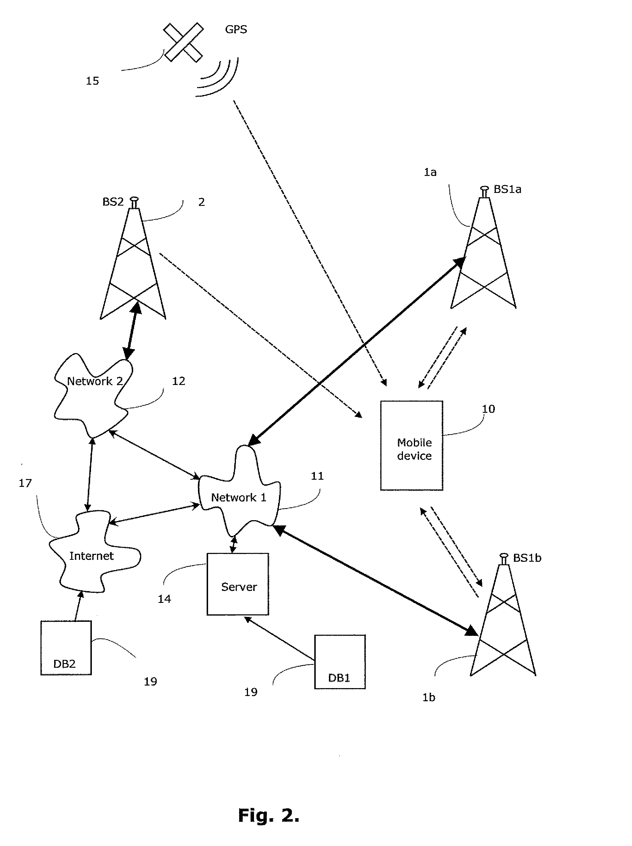
[0046]Still another potential benefit of the embodied invention is that it provides fast location determination of the mobile device. Since the further calculation of the covered area estimation, base station location estimation and estimation of the type of the location area is based on environment data including cell data received from the mobile device or on environment data including cell data received from the mobile device and external databases, there is no need to spent time for slow and unreliable satellite-based positioning data reception again once it has been done in the beginning of the process.
[0047]Still another potential benefit of the embodied invention is that it provides more accurate location determination of the mobile device, since it can exploit in addition to cell based data received from the base stations also external environment data from data bases and it can also deduce additional environment data from all the data that the mobile is configured to collect from nearby base stations.
[0048]Still another potential benefit of the embodied invention is that it provides a flexible location determination of the mobile device, since it can exploit cell data received from base stations from multiple network operators and/or

Problems solved by technology

However, the reception of signals from the satellites easily suffer from interruptions caused by landscape obstructions such as geographic features, buildings, trees, etc.
Because location tracking devices are often operated in environments, such as cities and urban areas, wherein GPS signal reception will be intermittent, this can result in poor perf

Method used


Image

  • Method and system for refining accuracy of location positioning
  • Method and system for refining accuracy of location positioning
  • Method and system for refining accuracy of location positioning

Examples


Embodiment Construction

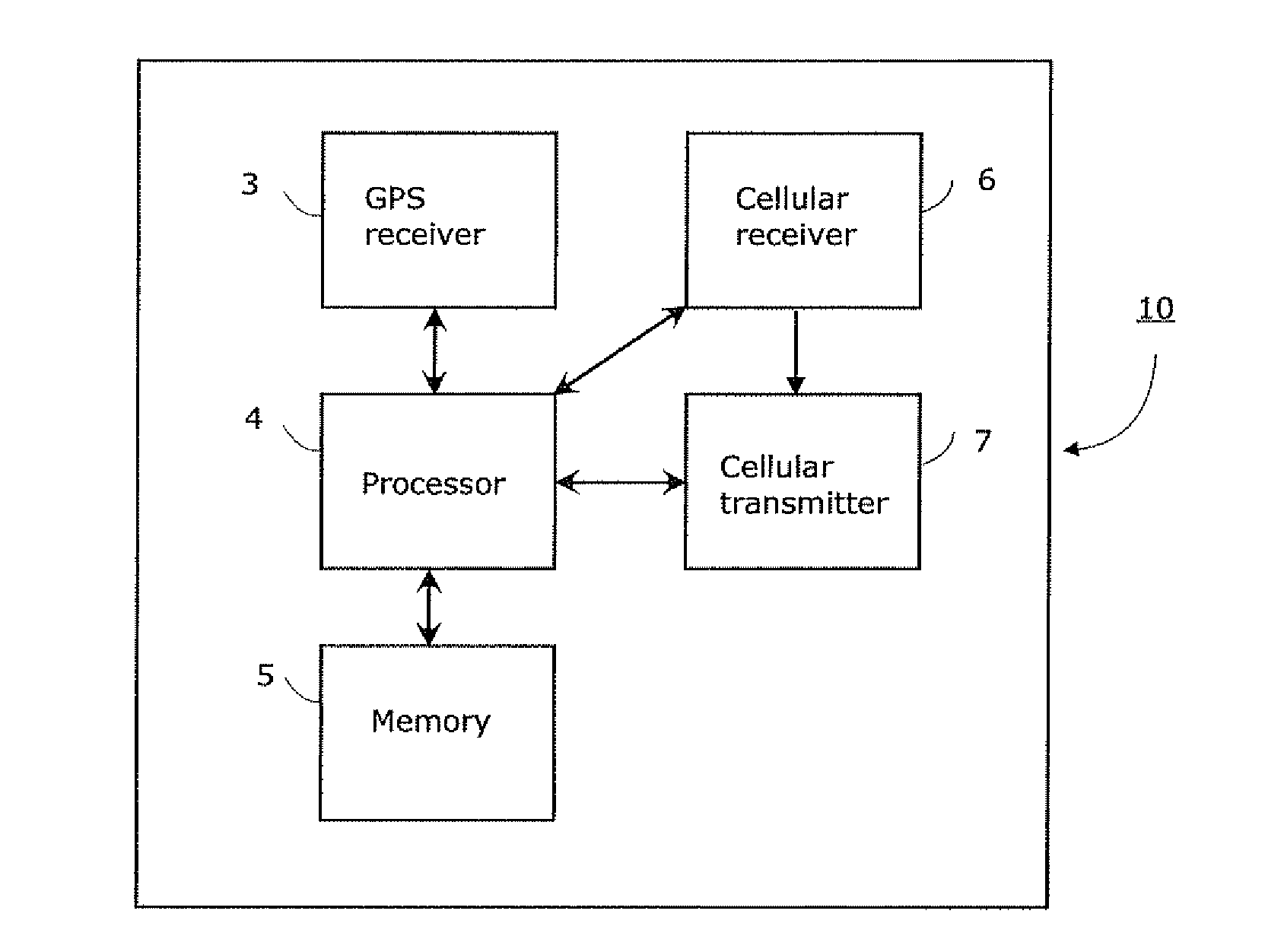
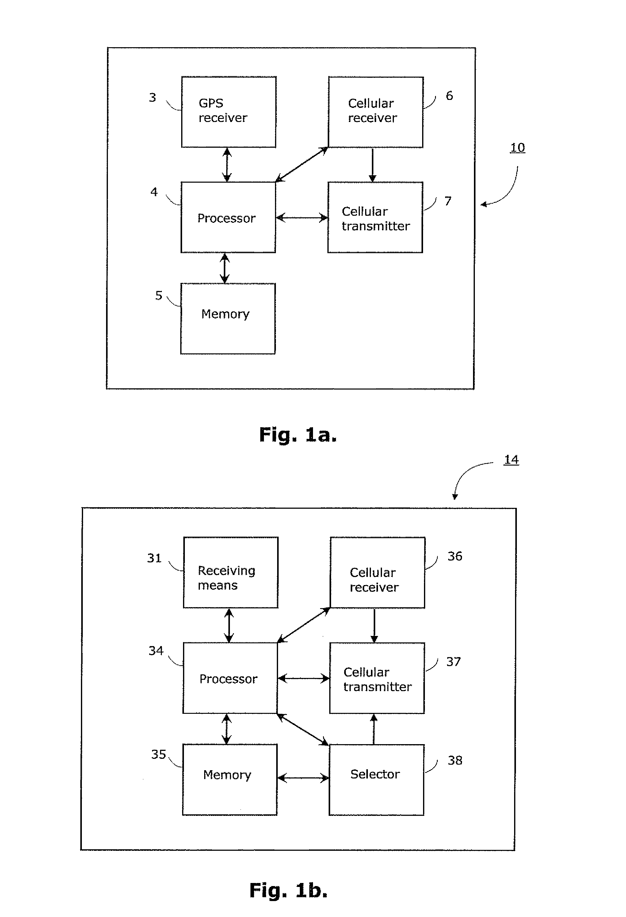
[0062]FIG. 1a shows a block diagram of a mobile device 10 according to an embodiment of the invention. The mobile device 10 may be e.g. a location tracking device or any other such device capable of indicating its present location upon request and / or continuously. The location of the mobile device 10 is monitored when it is moving or in stationary state. The mobile device 10 comprises first receiving means 3 for receiving positioning signals, e.g. satellite-based global positioning system (GPS) signals, and second receiving means 6 for receiving cellular communication network signals, e.g. GSM, GPRS, 3G, CDMA signals. Exemplary as shown in FIG. 1a, the first receiving means may comprise at least one GPS receiver 3 and associated antenna (not shown), and at least one cellular receiver 6 with associated antenna (not shown). The cellular receiver 6 may comprise one or more receiving means for different cellular communication networks and it is capable of receiving signals from cellular...


PUM


Abstract

To accurately determine the location of mobile device a multi-phase procedure incorporating mapping and location determination phases is suggested, wherein covered area estimation comprises (i) estimation of base station location, (ii) estimation of transmission range, (iii) estimation of signal map and/or (iv) estimation of area type. The actual location of the mobile device (10) is determined from the covered area estimation based on relative comparison between the actual environment data and estimations (i)-(iv) and weight numbers resulted from the comparison. During the both phases a database is stored in server (14) and updated whenever new environment data is received. The vertical position, or ‘elevation’, of mobile device is further estimated based on vertical level information associated with the covered area estimations during the mapping phase.

Description

CROSS-REFERENCE TO RELATED APPLICATIONS[0001]This application is a continuation-in-part of U.S. patent application Ser. No. 12 / 618,063, filed Nov. 13, 2009, which claims foreign priority of PCT International Application No. PCT / F12008 / 050656, filed Nov. 13, 2008, both entitled “METHOD AND SYSTEM FOR REFINING ACCURACY OF LOCATION POSITIONING”, the specifications of both of which are hereby incorporated by reference.TECHNICAL FIELD OF THE INVENTION[0002]This invention relates generally to a method and system for determining the location of the mobile device comprising mobile positioning technology. More particularly the invention relates to a method and system for accurately determining the location of the mobile device in which the location positioning is refined by environment data received through wireless cellular communication network and optionally from external databases.BACKGROUND OF THE INVENTION[0003]Location tracking devices and other such mobile terminals typically compris...

Claims


Application Information

Patent Timeline
IPC IPC(8): H04W4/02
CPCH04W4/025G01S19/14G01S2205/008G01S5/0045G01S5/0252G01S5/0018
Inventor HEIKKILAE, TIMOJAKORINNE, ANSSIKUISMA, TIMOPAANANEN, JYRKIHIETANEN, ARNO
Owner GLOPOS FZC
Why Eureka
Try Eureka