
Gps-denied geolocation

a geolocation and GPS technology, applied in the field of geolocation, can solve the problems of time-consuming manual methods and inability to obtain gps information, and achieve the effect of determining quickly and accurately

Active Publication Date: 2020-11-19
APPLIED RES ASSOCS INC
View PDF0 Cites 0 Cited by
  • Summary
  • Abstract
  • Description
  • Claims
  • Application Information

AI Technical Summary

Benefits of technology

This patent describes a new method for navigation that does not rely on landmarks. Instead, the operator can measure points on the horizon, which are then compared to pre-known surface terrain data to determine the operator's position. The method filters out any points that have too much variation in their inclination, range, or azimuth, and finds the best point based on its minimal weighted residual sum over a set of points. This allows for accurate navigation even in areas where the surface terrain data is not very precise.

Problems solved by technology

However, in some circumstances, such as an urban canyon environment, GPS may be unavailable.
Environments where GPS satellites are obscured, however, are the very environments where the predetermined points of known location useable for triangulation are also obscured.
Existing methods for GPS-denied navigation rely on time-consuming manual methods such as resection.

Method used


Image

  • Gps-denied geolocation
  • Gps-denied geolocation
  • Gps-denied geolocation

Examples


Embodiment Construction

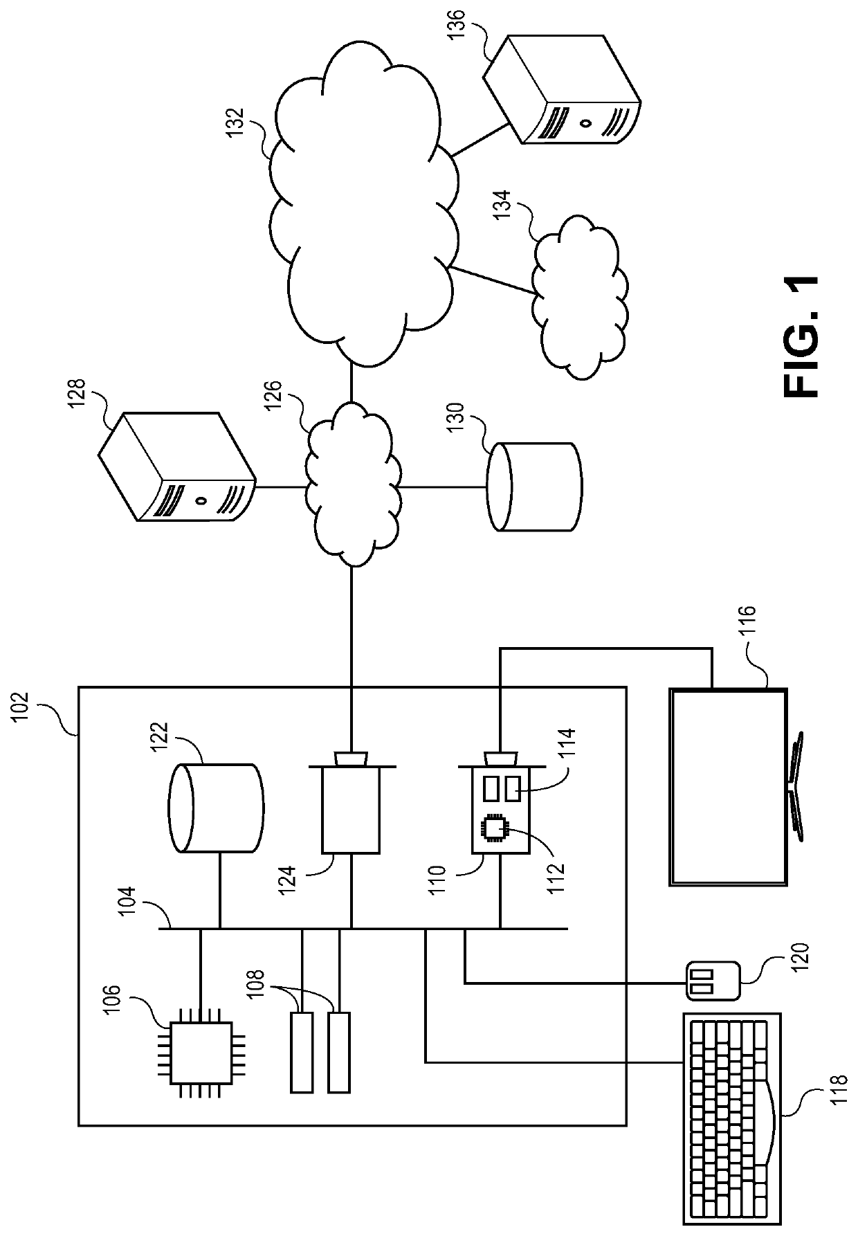
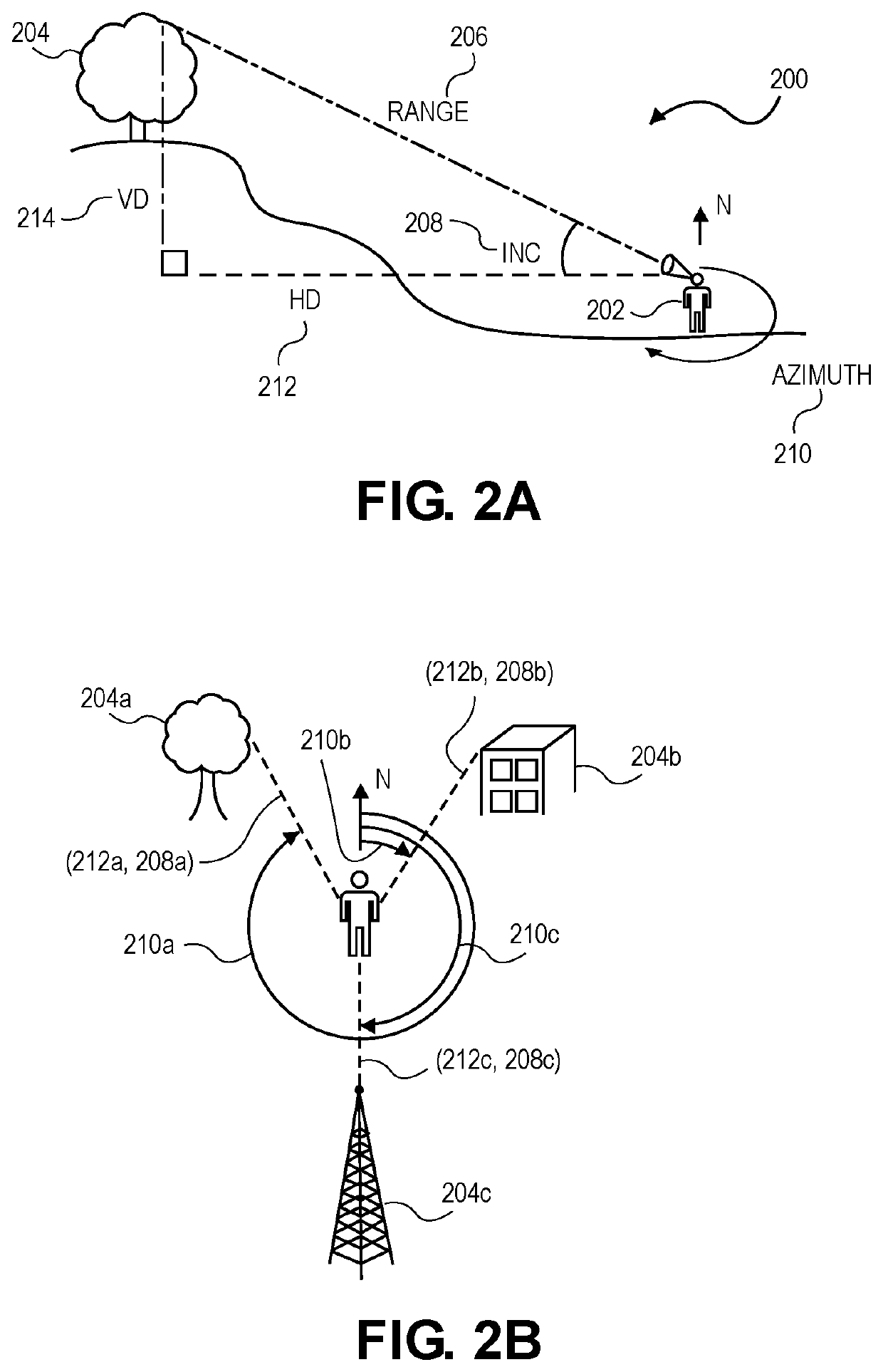
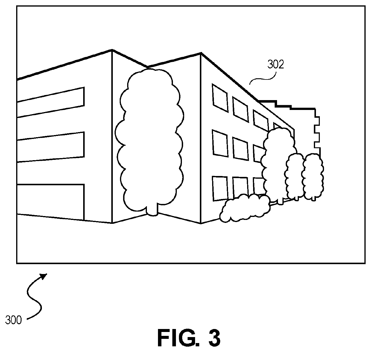
[0018]At a high level, embodiments of the invention perform geolocation in environments where GPS may be degraded or unavailable. In particular, embodiments of the invention can determine the operator's precise location based on measured distances and angles to unknown points. Unlike previous geolocation techniques based on triangulation or trilateration, no landmarks are required. Instead, an operator can determine a precise location using only the azimuth, inclination and distance (or, in some embodiments, any two of these three measurements) to a set of arbitrarily selected points on the visible horizon or sub-horizon. In this way, an operator can quickly and conveniently determine their location in GPS-denied environments without requiring time-consuming resection techniques.

[0019]The subject matter of embodiments of the invention is described in detail below to meet statutory requirements; however, the description itself is not intended to limit the scope of claims. Rather, the...


PUM


Abstract

Systems and techniques for navigation in a GPS-denied environment that do not rely on locations of known points. Instead, the operator can measure distance and / or inclination as well as azimuth to arbitrary points on the visual horizon (or sub-horizon) from their location. These observations can then be compared to precomputed distances and inclinations for corresponding azimuths to the visual horizon of a grid of points based on known surface terrain data. The closest grid point to the observer's location obtained in this way can be refined using a model of the surrounding environment, allowing for the operators position to be quickly and accurately determined.

Description

BACKGROUND1. Field[0001]Embodiments of the invention generally relate to geolocation, and more particularly to techniques for determining the position of an operator in GPS-denied environments without relying on predetermined points of known location.2. Related Art[0002]Traditionally, determining an unknown location relies upon measuring angles (triangulation) or distances (trilateration) to predetermined points of known location (i.e., landmarks). As used herein, the term landmark will refer to a known location on some type of map and also measurable from the operator's position, where the operator is a person or a device whose position needs to be located on the map. For example, celestial navigation relies upon measuring the angles to known stars whose positions are recoded in ephemerides, thus serving as landmarks for geolocation. Similarly, global positioning system navigation relies on determining the distances to a number of satellites that continually broadcast their positio...

Claims


Application Information

Patent Timeline
Patent Type & Authority Applications(United States)
IPC IPC(8): G01C21/00G01C9/00G01C3/00
CPCG01C3/00G01C9/00G01C21/005G01C15/002
Inventor WARNAAR, DIRK B.JOHNSON, DAVID H.
Owner APPLIED RES ASSOCS INC
Features
  • Generate Ideas
  • Intellectual Property
  • Life Sciences
  • Materials
  • Tech Scout
  • Unparalleled Data Quality
  • Higher Quality Content
  • 60% Fewer Hallucinations
Learn More