
Visual localization using a three-dimensional model and image segmentation

a three-dimensional model and image segmentation technology, applied in the field of localization, can solve the problems of insufficient accuracy, difference of almost half a block, and insufficient localization accuracy

Active Publication Date: 2021-10-21
HERE GLOBAL BV
View PDF2 Cites 4 Cited by
  • Summary
  • Abstract
  • Description
  • Claims
  • Application Information

AI Technical Summary

Benefits of technology

The patent text describes a method for accurately determining the location and pose of a mobile device by analyzing images captured by a camera on the mobile device. The method involves creating a set of artificial images and comparing them to the captured images to identify the most accurate match. The method can be used in various applications such as in autonomous vehicles or mobile devices. The technical effect of the patent is to provide a reliable and efficient way to determine the position and pose of a mobile device in real-time.

Problems solved by technology

However, in complicated urban environments, reflection or obstruction of GPS signals by tall buildings and other structures can further increase this error, such that a determined location may be off by as much as 30 meters (also known as multipath error).
In an autonomous driving example occurring in a large city, this accuracy is not sufficient to properly localize an autonomous vehicle so that it can make safe route planning decisions, given that the width of many lanes is only 3 to 4 meters.
City blocks typically extend around 80 meters, thus this error in GPS localization could mean the difference of almost half of a block.
Local device sensors, such as inertial measurement units (IMUs) can increase the accuracy of localization by taking into account movement, but these sensors tend to drift and still do not provide sufficient accuracy for localization.
Navigation in indoor environments is even more unreliable due to the even greater obstruction of GPS signals.
Furthermore, navigation relies on GPS signals for positioning, hence the positioning system name, but typically count on local device sensors for orientation (pose), which again may drift or simply be inaccurate.
As such, an obvious barrier to ubiquitous implementation of visual-based localization methods is scalability, especially on a global scale, as an incredibly large database would be required to store data on a large number of geo-tagged visual features.
Even following implementation of a large visual features database, most if not all localization methods can only be implemented on the server side as a network-centric architecture, due to client devices exhibiting constraints in data storage capacity and / or computational power.

Method used


Image

  • Visual localization using a three-dimensional model and image segmentation
  • Visual localization using a three-dimensional model and image segmentation
  • Visual localization using a three-dimensional model and image segmentation

Examples


Embodiment Construction

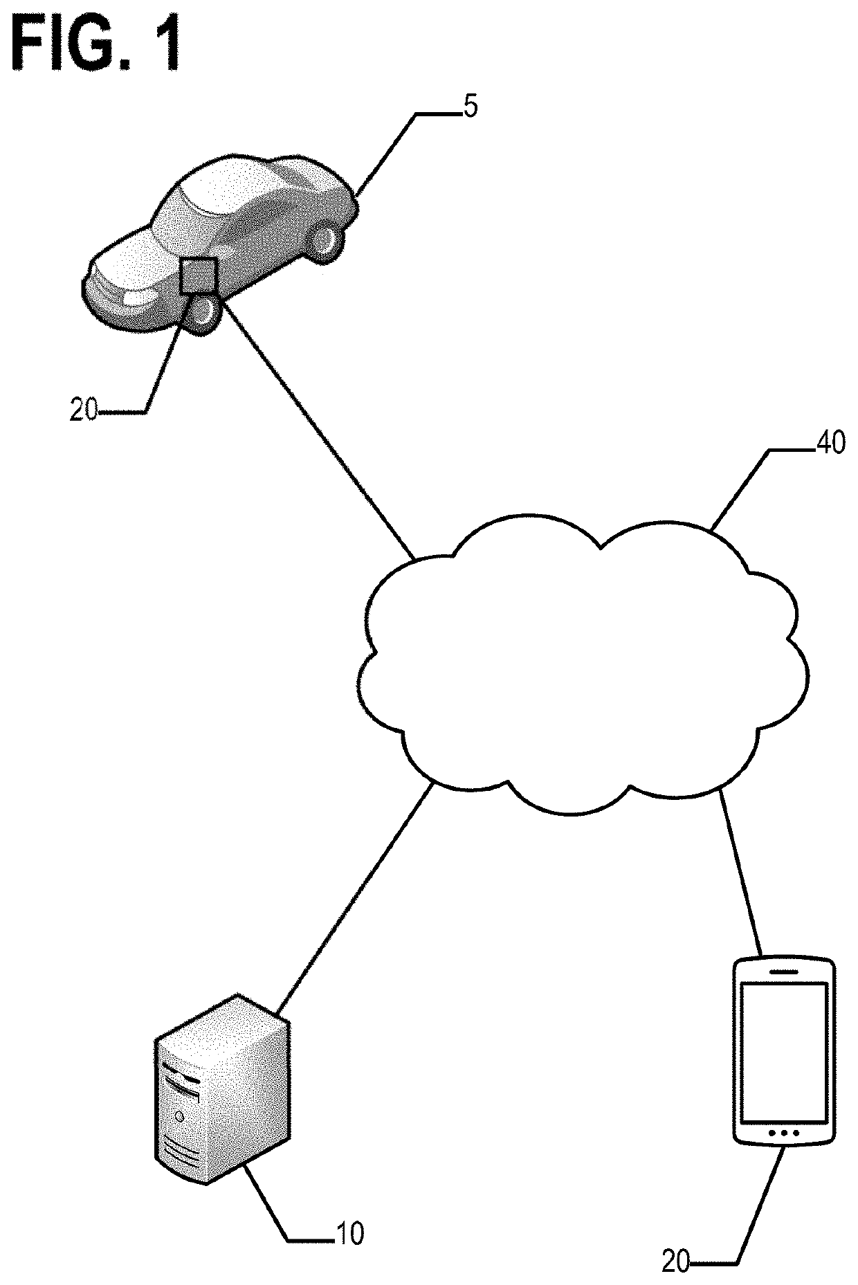
[0027]Some embodiments will now be described more fully hereinafter with reference to the accompanying drawings, in which some, but not all, embodiments of the disclosure are shown. Indeed, various embodiments of the disclosure may be embodied in many different forms and should not be construed as limited to the embodiments set forth herein; rather, these embodiments are provided so that this disclosure will satisfy applicable legal requirements. Like reference numerals refer to like elements throughout. As used herein, the terms “data,”“content,”“information,” and similar terms may be used interchangeably to refer to data capable of being transmitted, received and / or stored in accordance with embodiments of the present disclosure. Thus, use of any such terms should not be taken to limit the spirit and scope of embodiments of the present disclosure.

I. General Overview

[0028]Methods, apparatus and computer program products are provided in accordance with an example embodiment in order...


PUM


Abstract

An apparatus receives a first image captured by an image capture device of a mobile apparatus. The first image corresponds to surroundings of the mobile apparatus. Each artificial image of a first plurality of artificial images respectively is a two-dimensional projection of a three-dimensional model from a perspective of an image position and image pose. The apparatus determines one or more first image attributes respectively for one or more sections of the first image; identifies at least one artificial image of the first plurality of artificial images that has one or more artificial image attributes that substantially match the one or more first image attributes for corresponding sections of the at least one artificial image and the first image; and determines a location and / or pose of the mobile apparatus based at least in part on the image position and / or the image pose associated with the at least one artificial image.

Description

TECHNOLOGICAL FIELD[0001]An example embodiment relates generally to localization. In particular, an example embodiment generally relates to visual localization using a three-dimensional model and image segmentation.BACKGROUND[0002]Autonomous driving, for example, requires high accuracy, real-time localization of vehicles. Pedestrian navigation, especially in dense urban environments, also relies upon receiving precise real-time location data. Currently, most navigation has been accomplished using a global positioning system (GPS), which provides a real-time location with a 95% confidence interval of 7.8 meters, according to the US government. However, in complicated urban environments, reflection or obstruction of GPS signals by tall buildings and other structures can further increase this error, such that a determined location may be off by as much as 30 meters (also known as multipath error). In an autonomous driving example occurring in a large city, this accuracy is not sufficie...

Claims


Application Information

Patent Timeline
Patent Type & Authority Applications(United States)
IPC IPC(8): G06T7/70H04W4/021G01C21/28G06T17/05G06F17/16G06V10/44G06V10/56G06V10/764
CPCG06T7/70H04W4/021G06F17/16G06T17/05G01C21/28G01C21/1656G06T7/74G06T2207/30252G06V20/588G06V10/44G06V10/56G06V10/82G06V10/764
Inventor IVANOV, PAVEL
Owner HERE GLOBAL BV
Learn More