Surveying instrument and method for acquiring image data by using the surveying instrument

a technology of surveying instrument and image data, which is applied in the field of surveying instruments, can solve the problems of difficult to associate the surveying data with the images thus taken, troublesome to perform the surveying operation on the target object and to take images, etc., and achieve the effect of efficient utilization

Inactive Publication Date: 2005-02-22
KK TOPCON
View PDF4 Cites 65 Cited by
  • Summary
  • Abstract
  • Description
  • Claims
  • Application Information

AI Technical Summary

Benefits of technology

It is an object of the present invention to overcome the disadvantages of the prior art and to provide a surveying instrument and a method for acquiring image data by using the surveying instrument, by which it is possible to easily carry out a series of surveying operation a

Problems solved by technology

In this respect, there is disadvantages such that it is troublesome to perform surveying operation on the target object and to t

Method used


Image

  • Surveying instrument and method for acquiring image data by using the surveying instrument
  • Surveying instrument and method for acquiring image data by using the surveying instrument
  • Surveying instrument and method for acquiring image data by using the surveying instrument

Examples


second embodiment

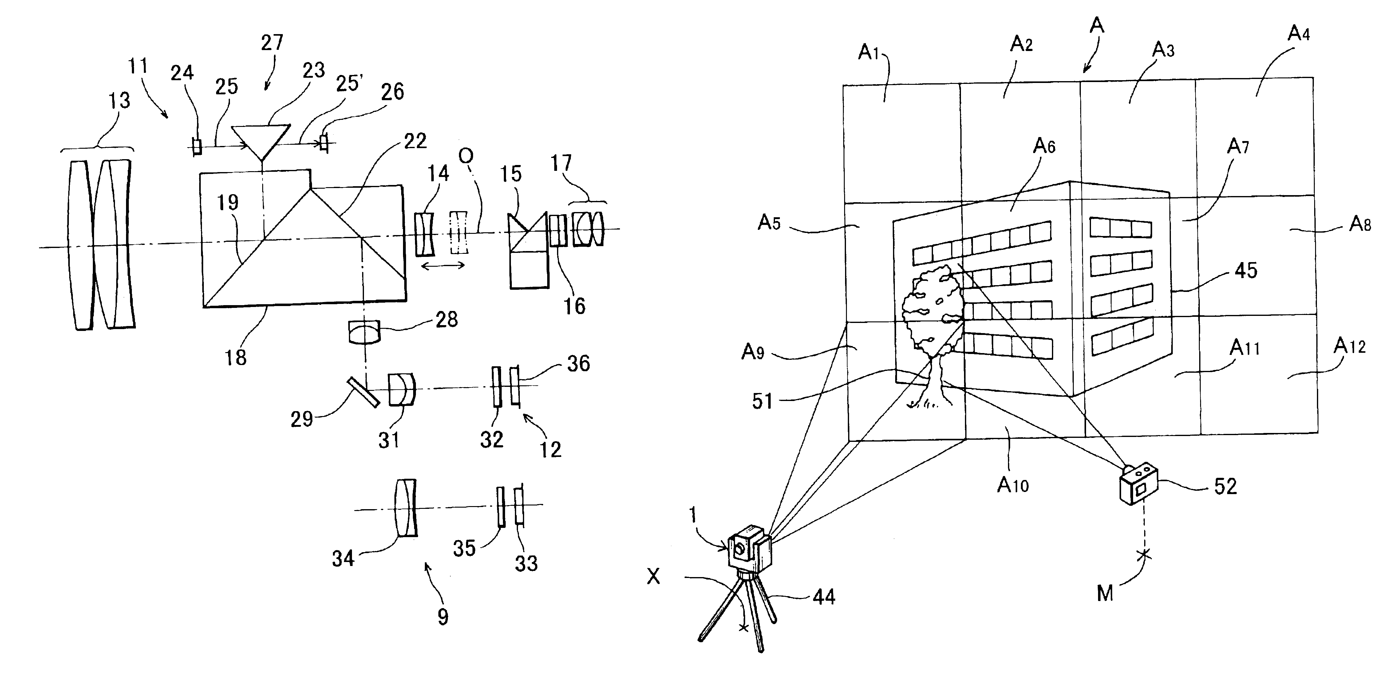
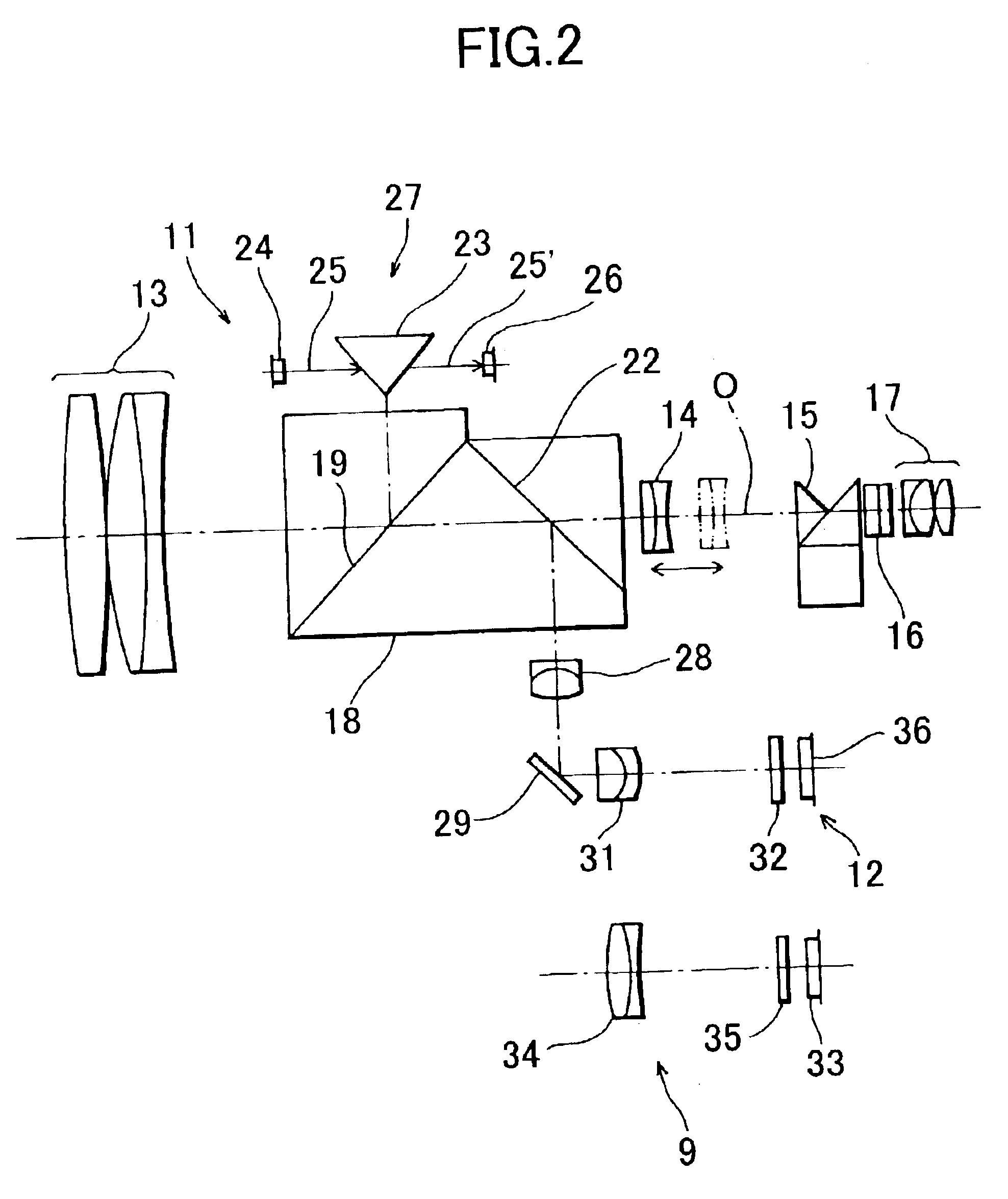
FIG. 7 represents the invention.

In the second embodiment, a GPS 53 is provided. Based on a signal from a satellite, an absolute position of the main unit 1 can be measured. Further, the horizontal driving unit 54 for rotating the frame unit 4 in a horizontal direction and the vertical driving unit 55 for rotating the telescope unit 5 in a vertical direction are provided. This makes it possible to more easily acquire the image data.

In the first embodiment as described above, the data of the known point is inputted from the operation unit 7. In the second embodiment, positional data can be acquired by measuring with the GPS 53. Thus, there is no need to input the data. After installing the main unit 1 at any position as desired, the operation to acquire the image data can be immediately started.

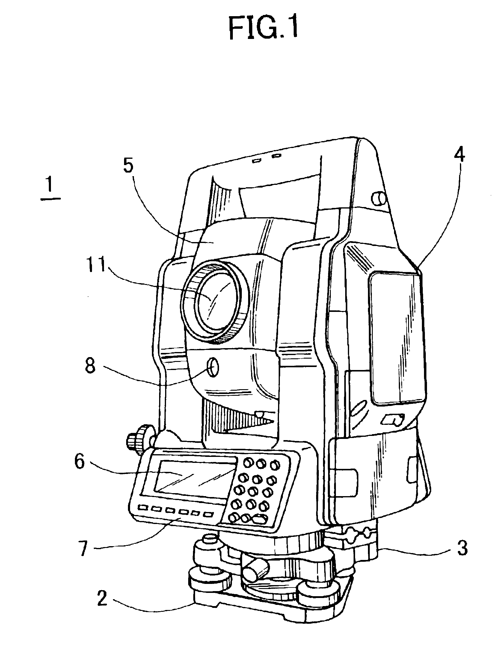
The present invention provides a surveying instrument, which comprises a distance measuring unit for measuring a distance to a collimating point, an angle measuring unit for measuring a vertica...


PUM


Abstract

A surveying instrument, comprising a distance measuring unit for measuring a distance to a collimating point, an angle measuring unit for measuring a vertical angle and a horizontal angle of the collimating point, an image pick-up means for acquiring an image in a collimating direction, a driving unit for directing the image pick-up means in a direction of a predetermined object to be measured as selected based on an entire image data acquired by the image pick-up means, and a control arithmetic unit for recording by associating an image of an object to be measured with survey data to the object, wherein the image is picked-up in the direction directed by the driving unit and the survey data is measured by the distance measuring unit and the angle measuring unit.

Description

BACKGROUND OF THE INVENTIONThe present invention relates to a surveying instrument, particularly to a survey instrument capable of recording an image data of a target object and a distance data of the target object by associating these data with each other, and the invention also relates to a method for acquiring an image data by using the surveying instrument.In recent years, for the purpose of acquiring map information, it has been necessary to acquire, not only surveying data of a target point, but also an image of the target point. Thus, it is now practiced to acquire the surveying data and to take and record the image of the target point.However, in the conventional method, a target object is determined, and general surveying operation is performed on the target object. In addition to the general surveying operation, the image of the target object is taken by means such as an electronic camera. In this respect, there is disadvantages such that it is troublesome to perform surve...

Claims


Application Information

Patent Timeline
IPC IPC(8): G01C1/00G01C1/02G01S19/14G01C15/00
CPCG01C1/02G01C15/002G01C1/04
Inventor OHTOMO, FUMIOOTANI, HITOSHIOMORI, MAKOTO
Owner KK TOPCON
Why Eureka
Try Eureka