Method and apparatus for calculating altitude based on barometric and GPS measurements

a barometric and gps technology, applied in the direction of speed/acceleration/shock measurement devices, instruments, surveying and navigation, etc., can solve the problem of less accurate vertical or horizontal measurements performed by a gps system with respect to altitude or horizontal measurements, more difficult to measure the vertical or altitude component of a users location, and less accurate barometric altimeter measurements than gps derived altimeter measurements

Inactive Publication Date: 2005-11-29
GARMIN
View PDF1 Cites 54 Cited by
  • Summary
  • Abstract
  • Description
  • Claims
  • Application Information

AI Technical Summary

Benefits of technology

[0013]In accordance with at least one embodiment of the present convention, a navigation device is provided having a barometric altimeter for obtaining barometric elevation readings based on barometric pressure measurements. A processor is provided for obtaining GPS elevation readings based on GPS measurements. The processor calculates differences between the barometric elevation readings and the GPS e

Problems solved by technology

In the past, the vertical measurements performed by a GPS system have been found to be less accurate than desired with respect to altitude or horizontal measurements.
In this geometry, with all of the visible satellites above the horizon, it is more difficult to measure the vertical or altitude component of a users location since no satellites are visible below the user.
However, over longer periods of time, pressure variations may be of such magnitude that the barometric altimeter measurement becomes less accurate than GPS derived altimeter measurements.
The altitude derived from an uncalibrated barometric altimeter is typically in error by several tens of meters due to normal atmospheric pressure fluctuations, weather fronts and other sources.
However, the errors attributed to normal atmospheric pressure fluctuations exhibit bias like characteristics that vary slowly with time.
Slow variations in such bias errors cause the barometric altimeter to be less accurat

Method used


Image

  • Method and apparatus for calculating altitude based on barometric and GPS measurements
  • Method and apparatus for calculating altitude based on barometric and GPS measurements
  • Method and apparatus for calculating altitude based on barometric and GPS measurements

Examples


Embodiment Construction

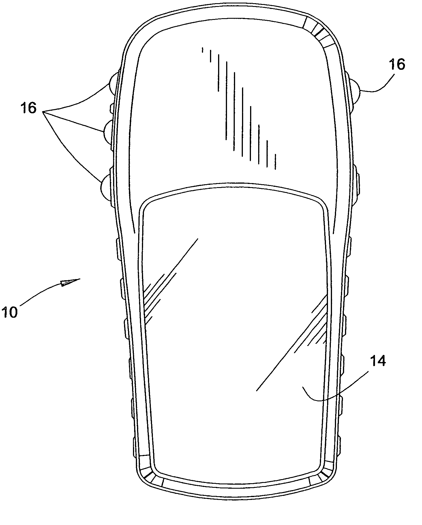
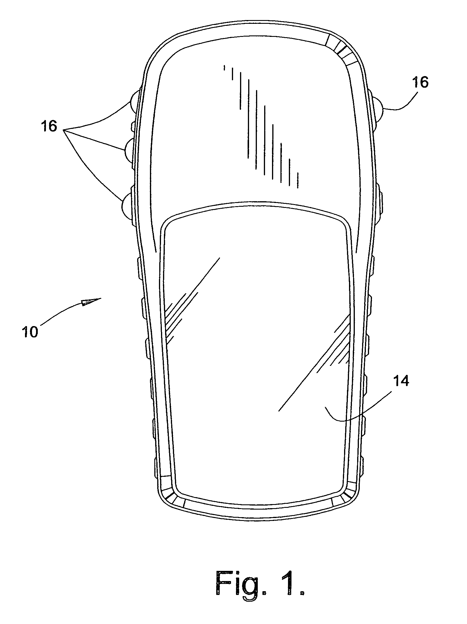
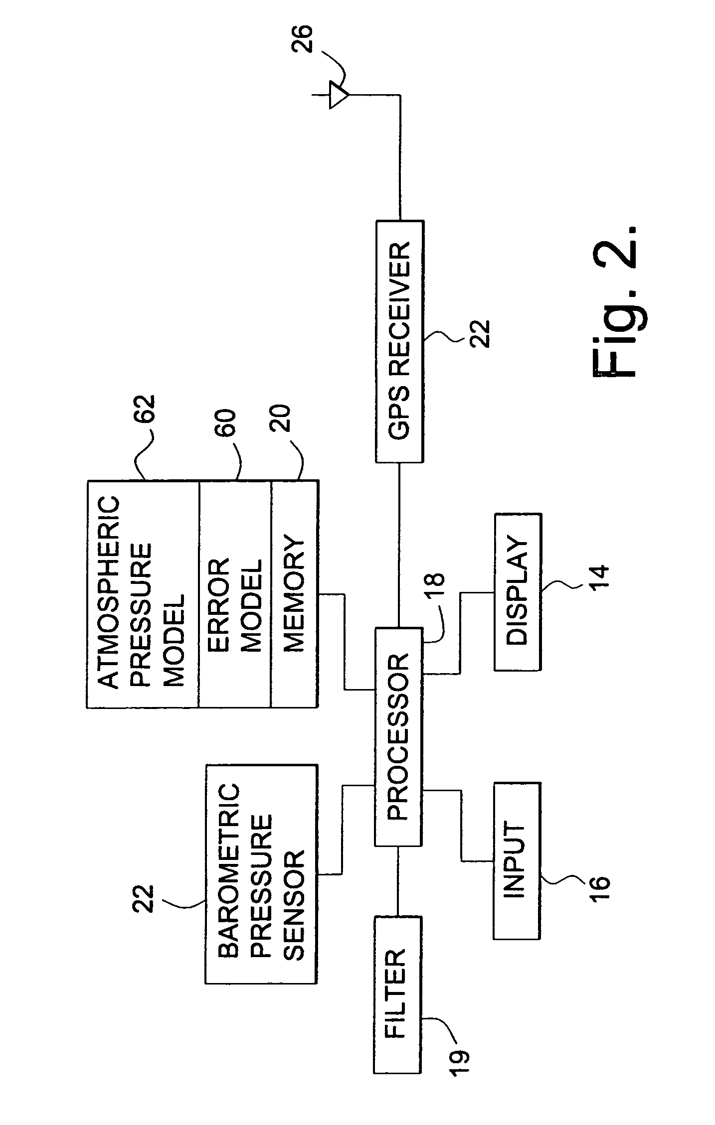
[0025]FIG. 1 illustrates a navigation device 10 that incorporates an embodiment of the present invention. Navigation device 10 includes a housing 12, a display 14, and an input 16, such as preferably a keypad input. Optionally, the input 16 may use a touchscreen. The housing 12 is preferably sized to be a portable unit, although the invention is not limited to portable units.

[0026]FIG. 2 illustrates the navigation device 10 in a block format. The navigation device 10 includes a processor 18 that is connected to memory 20, display 14, input 16 and a barometric pressure sensor 22. Additionally, a GPS receiver 24 is connected to the processor 18 to provide GPS data to the processor 18. A filter 19 may be part of or separate from the processor 18. The filter 19 filters a difference between the GPS and barometer derived altitudes. An antenna 26 is connected to the GPS receiver 24 to receive GPS signals. A power source, such as a battery, battery pack, AC / DC adapter and the like are provi...


PUM


Abstract

A navigation device and a method of calibrating the same are provided. The device includes a barometric pressure sensor and a GPS receiver. A processor calculates barometric and GPS derived altitudes and, based on a difference therebetween, corrects barometer altitude readings that would otherwise include drift errors. The processor uses a filter, such as a state feedback loop, to determine correction factors. The state feedback loop is adjustable to operate with different time constants. An error drift model is empirically determined and used to set the time constant. The time constant may be adjusted during operation based on a relation between the barometer correction quantity and an uncertainty in the vertical component of the GPS derived altitude. The method includes updating and recalibrating an atmospheric pressure model used to derive altitudes from the output of the barometric pressure sensor.

Description

CROSS REFERENCE TO RELATED APPLICATIONS[0001]This application is a continuation of application Ser. No. 09 / 891,002, filed Jun. 25, 2001, now U.S. Pat. No. 6,735,542 which claimed priority from Provisional Application No. 60 / 289,722, filed May 9, 2001, the complete subject matter of which is incorporated herein by reference in its entirety.BACKGROUND OF THE INVENTION[0002]At least one embodiment of the present invention generally relates to the use of a filter to obtain a correction quantity to correct barometric altimeter readings based on GPS and barometric measurements. At least one embodiment of the present invention generally relates to adjusting the filter between multiple filter gains to account for the rate at which local pressure factors change to correct for errors introduced into the barometric altimeter readings. At least one embodiment of the present invention generally relates to barometer correction based on statistical models that predict drift in the barometer output...

Claims


Application Information

Patent Timeline
IPC IPC(8): G01C5/06G01C25/00G01D18/00G01S5/14G01S19/42
CPCG01C5/06G01C25/00G01S19/42
Inventor BURGETT, SCOTTKRULL, JAY DEE
Owner GARMIN
Why Eureka
Try Eureka