
Off-road trail recording method and apparatus for navigation system

a technology of navigation system and trail recording, applied in the field of navigation method and system, can solve the problems of not being able to guide the user, he may not be able to go back to the road, and he may not be able to record trails more quickly, so as to reduce the resolution

Active Publication Date: 2006-02-21
ALPINE ELECTRONICS INC
View PDF10 Cites 22 Cited by
  • Summary
  • Abstract
  • Description
  • Claims
  • Application Information

AI Technical Summary

Benefits of technology

Enables reliable recording and display of off-road trails without user intervention, conserves memory by reducing data resolution, and allows users to safely return to original roads even when memory is limited.

Problems solved by technology

However, when the vehicle travels in an off-road area, such as mountains or desert, etc., where no road segments data is provided in the map data storage of the navigation system, it is not possible for the navigation system to guide the user.
Moreover, when the vehicle is away from the roads, and if the user does not remember the trail of the travel to the current position, he may not be able to go back to the roads.
However, this mode would exhaust the available memory space for trail recording more quickly compared to the driver's judicious use of the manual mode recording.
Also, in the automatic mode, if the vehicle runs on a rural highway in an area where the map database is not yet available, the trail memory can be exhausted in a short time.
Increasing the size of trail memory would raise the hardware cost, and may introduce another problem.
Deleting unwanted trail recordings would become time consuming because the user would have to review an excessive number of trails before deletion.
In the manual mode, in the case where the user forgets to turn on the off-road travel recording until he has already been driving far away from the roads, it is not possible to record the off-road trail from the roads to the current position.
Therefore, there arises a problem that not only the off-road trail data is incomplete, but also the user may not be able to return to the original road.
Further, in the '837 patent, when the trail memory has not a sufficient capacity such as when the memory is full or almost full, it is not possible to record the off-road trail.

Method used


Image

  • Off-road trail recording method and apparatus for navigation system
  • Off-road trail recording method and apparatus for navigation system
  • Off-road trail recording method and apparatus for navigation system

Examples


Embodiment Construction

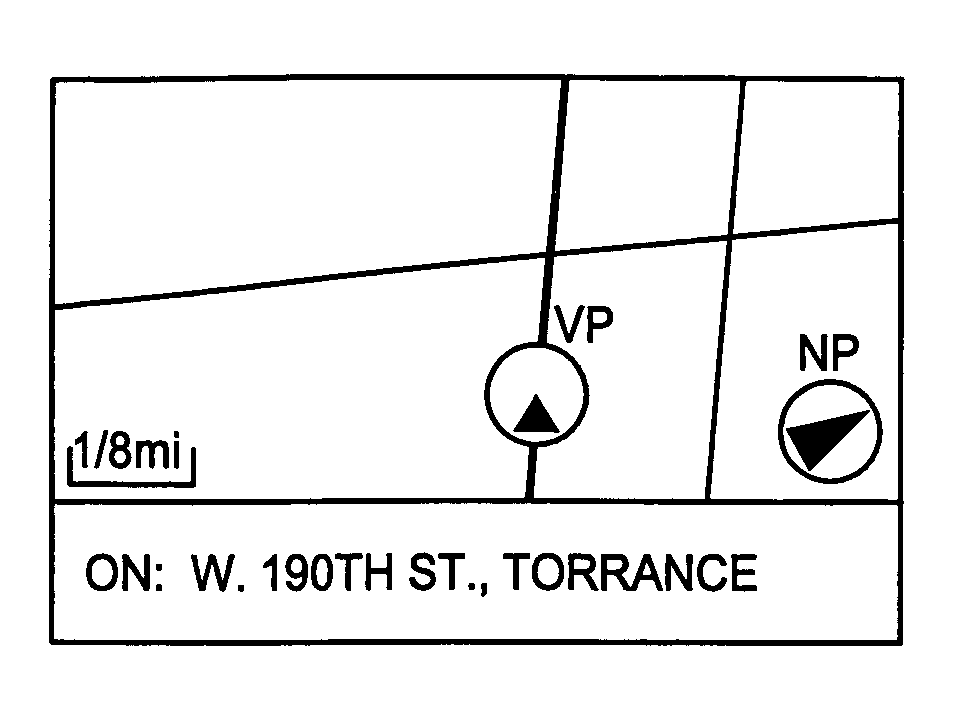
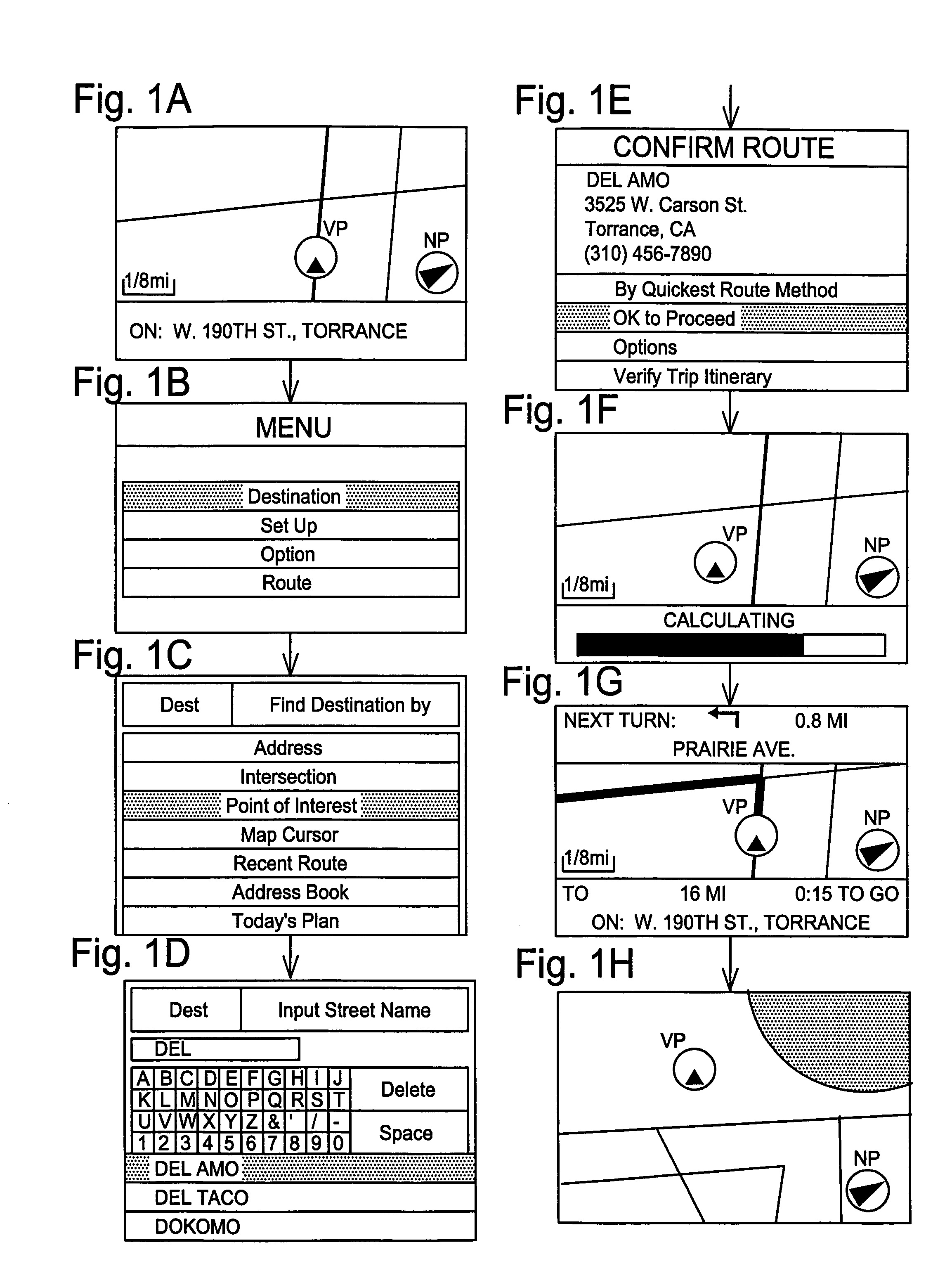
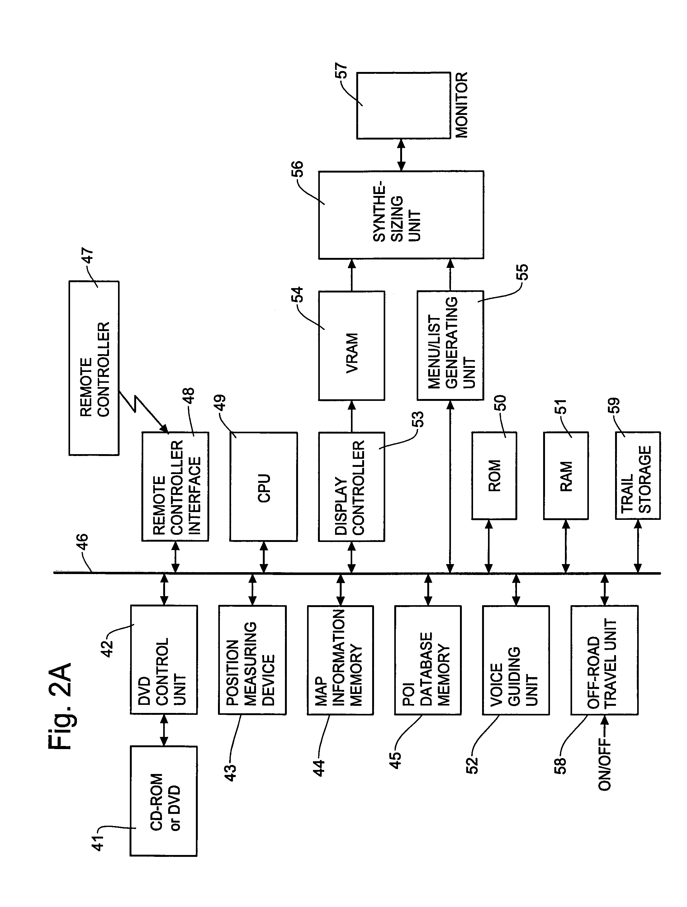
[0037]The present invention will now be described in more detail with reference to the accompanying drawings. The off-road trail recording of the present invention automatically records the off-road trail when the user or user's vehicle (hereafter “vehicle”) departs from the road (road segment in the map data) without regard to on / off states of the off-road trail recording function. When the off-road trail recording function is off, such recording is done in a background recording mode, and when the off-road trail recording function is on, the recording is done in a normal recording mode.

[0038]In the background recording mode, the navigation system detects that the vehicle has left the road and starts the off-road trail recording. The recorded off-road trail is not displayed on the navigation screen unless the off-road trail function is turned on by the user. When the off-road trail recording function is turned on by the user, the navigation system records the off-road trail in the ...


PUM


Abstract

An off-road trail recording method and apparatus for use with a navigation system for recording an off-road trail when a vehicle travels in an off-road area to safely return to the original road. The off-road trail recording is achieved without regard to on / off settings of the off-road trail recording function by the user. The navigation system automatically detects that the vehicle has left the road and starts recording the off-road trail in a background mode without display the off-road trail. When the user turns on the off-road trail recording function later, the navigation system prompts the user to decide whether the off-road trail recorded in the background should be recovered in a normal mode. The navigation system provides various means for recording the off-road trail with reduced resolution when the memory capacity is exhausted or insufficient.

Description

FIELD OF THE INVENTION[0001]This invention relates to a navigation method and system for guiding a user to destinations, and more particularly, to an off-road trail recording method and apparatus for automatically recording the trail when a vehicle travels in an off-road area away from road segments in the map data of the navigation system, thereby enabling the user to know the trail of his travel and come back to the roads with use of the recorded off-road trail.BACKGROUND OF THE INVENTION[0002]A navigation system performs travel guidance for enabling a user to easily and quickly reach the selected destination. A typical example is a vehicle navigation system where a user drives a car having a vehicle navigation system. Such a navigation system detects the position of the vehicle, reads out map data pertaining to an area at the current vehicle position from a data storage medium, for example, a CD-ROM (compact disc read-only memory), a DVD (digital versatile disc), or a hard disc. ...

Claims


Application Information

Patent Timeline
Patent Type & Authority Patents(United States)
IPC IPC(8): G01C21/26
CPCG01C21/26
Inventor YOKOTA, TATSUODE SILVA, ANDREW S.
Owner ALPINE ELECTRONICS INC
Learn More