

User selectable earth imagery on-line e-commerce and fulfillment system
- Summary
- Abstract
- Description
- Claims
- Application Information
AI Technical Summary
Benefits of technology
Problems solved by technology
Method used
Image

Examples
Embodiment Construction
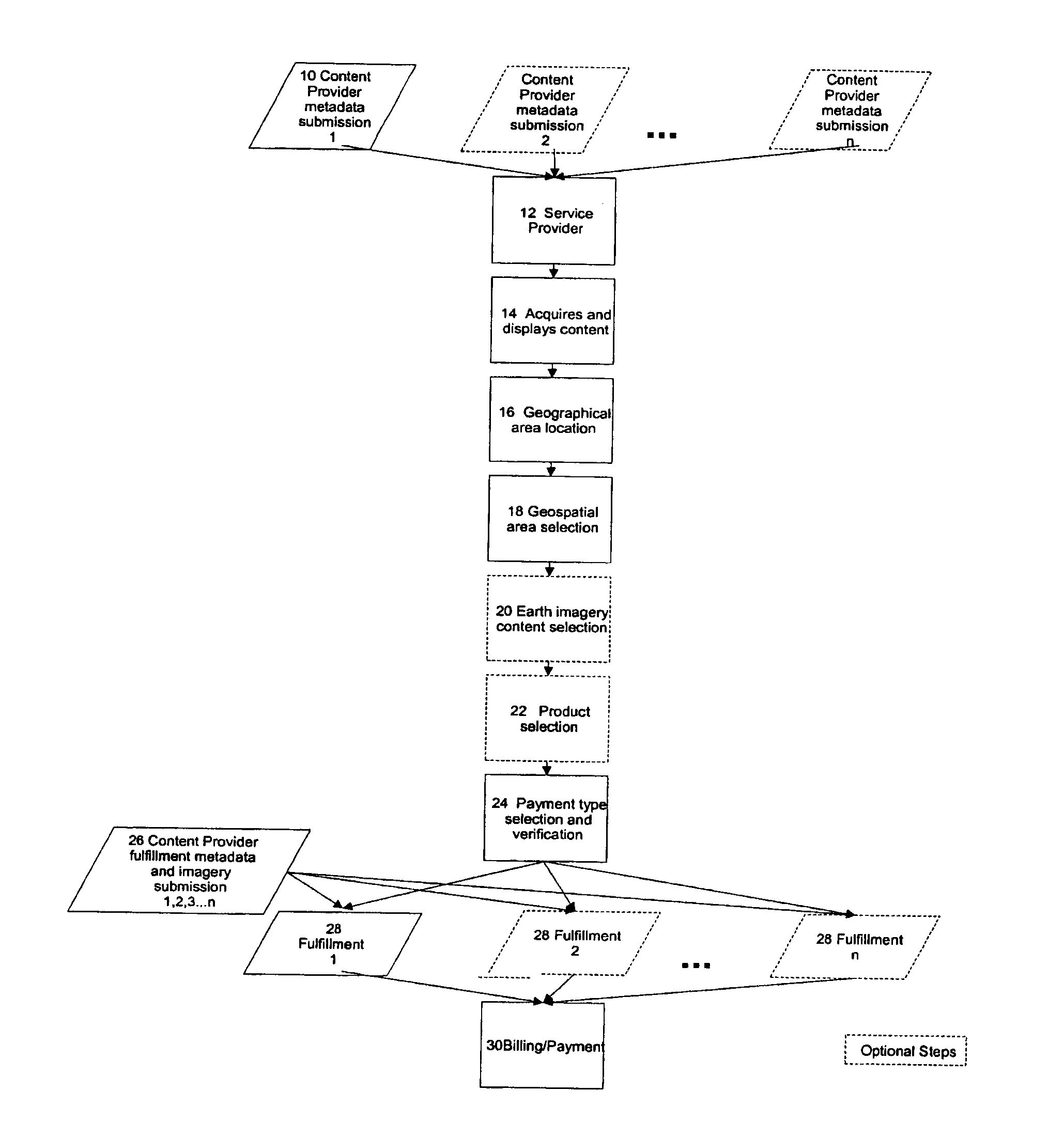
[0027]Turning first to FIG. 1 there is depicted a high-level flow chart of the process flow for method of the present invention. One or more content providers 10 are enabled by a service provider 12 to submit metadata, fulfillment metadata and imagery to a service provider site, the service provider being the entity aggregating and disseminating earth imaging data. The service provider 12 acquires such earth imagery content from a plurality of content providers 10 in a specified format and displays it as indicated by function box 14. The service provider 12 enables geospatial area location 16 by a user as indicated by function box 16. The service provider 12 further enables user-defined selection of desired geospatial area specified in function box 18. The user may optionally then be permitted selections of the desired earth imagery content and the desired product per function blocks 20 and 22 (shown in ghost to indicate such steps are optional), respectively. Next, payment type sel...
PUM
 Abstract
Description
Claims
Application Information