Method of DMO calculation for use in seismic exploration

a technology of seismic exploration and dmo calculation, applied in the field of seismic exploration, can solve the problems of multiple identification and removal of seismic data, dry holes, and methods, and achieve the effects of improving the overall efficiency of the conventional srme process, increasing process efficiency, and increasing efficiency

US7149630B2Inactive Publication Date: 2006-12-12BP CORP NORTH AMERICA INC
4 Cites 24 Cited by

Patent Information

Authority / Receiving Office
US · United States
Patent Type
Patents(United States)
Current Assignee / Owner
Publication Date
2006-12-12
Estimated Expiration
Not applicable · inactive patent

Smart Images

  • Figure 1
    Figure 1
  • Figure 2
    Figure 2
  • Figure 3
    Figure 3
Patent Text Reader

Abstract

According to a preferred aspect of the instant invention, there is provided herein a system and method for improving the computational efficiency of the DMO transformation that has many uses in the seismic processing arts. More particularly, the instant inventor has conceived and invented a faster method of calculating a log-stretch DMO transformation that utilizes multiple independent time windows, each with its own starting and ending time. A particularly preferred usage of the improved DMO method is as an element of a multiple attenuation program such as SRME.
Need to check novelty before this filing date? Find Prior Art

Description

RELATED CASES

[0001] This application claims the benefit of U.S. Provisional Patent Application Ser. No. 60 / 643,671 filed on Jan. 13, 2005, and incorporates said provisional application by reference into this disclosure as if fully set out at this point. Further this application is related to, and co-pending with, U.S. patent application Ser. No. 11 / 108,250 filed on Apr. 18, 2005 entitled “A method of multiple attenuation” filed contemporanteously herewith, the disclosure of which is incorporated herein by reference as if fully set out at this point.TECHNICAL FIELD

[0002] This invention relates to the general subject of seismic exploration and, in particular, to methods for processing seismic data to enhance the image of the subsurface obtained thereby.BACKGROUND OF THE INVENTION

[0003] A seismic survey represents an attempt to image or map the subsurface of the earth by sending sound energy down into the ground and recording the “echoes” that return from the rock layers below. The source...

Examples

Embodiment Construction

[0032]While this invention is susceptible of being embodied in many different forms, there is shown in the drawings, and will herein be described hereinafter in detail, some specific embodiments of the instant invention. It should be understood, however, that the present disclosure is to be considered an exemplification of the principles of the invention and is not intended to limit the invention to the specific embodiments or algorithms so described.

GENERAL ENVIRONMENT OF THE INVENTION

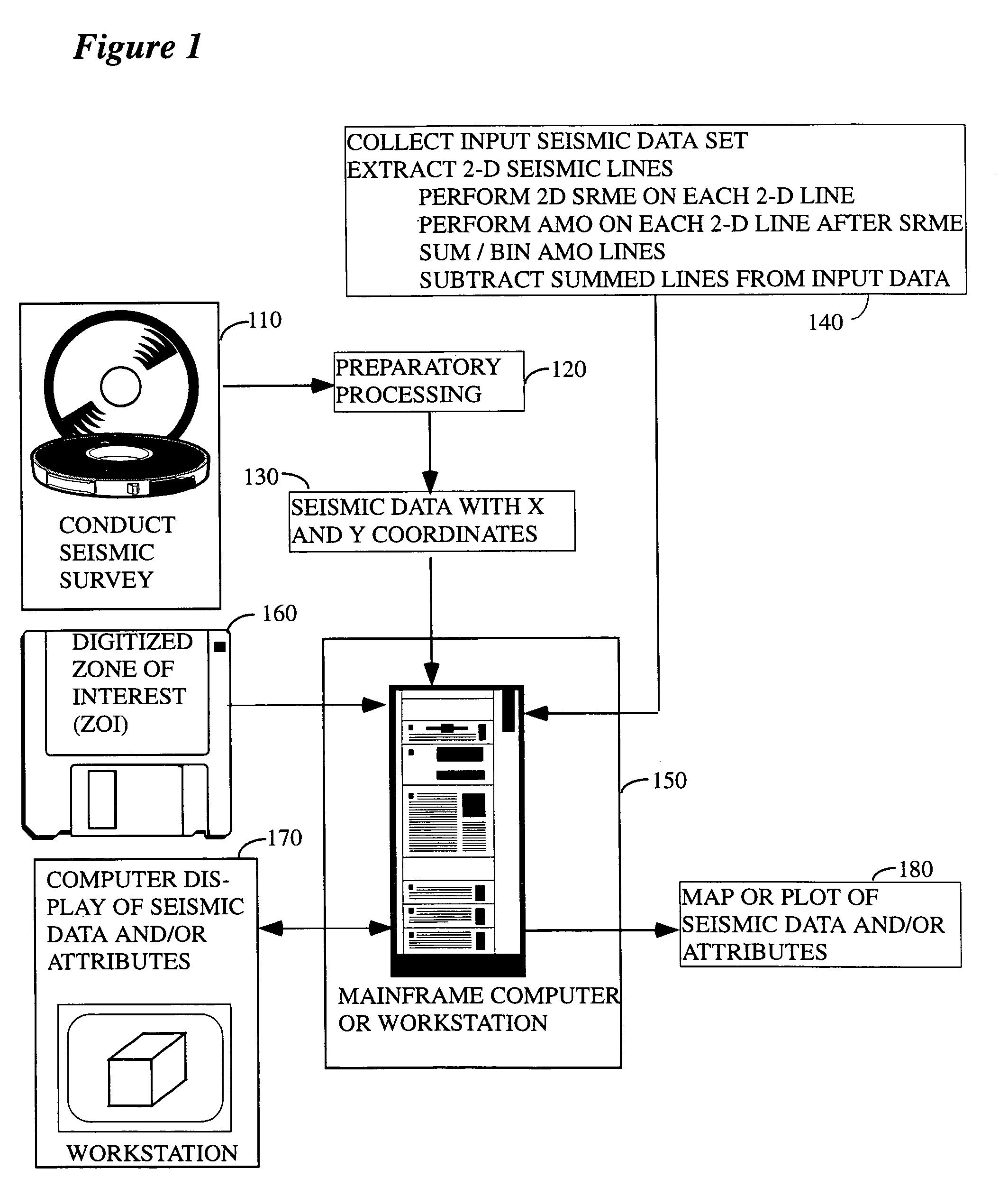
[0033]FIG. 1 illustrates the general environment in which the instant invention would typically be used. Seismic data 110 are collected in the field (e.g., the data might be from a land-based survey, a marine survey, some combination of the two, etc.) over a subsurface target of potential economic importance and are typically sent thereafter to a processing center, although substantial processing can be done in the field if such is desired. In the processing center a variety of preparatory processes 1...