Map (profile) of the earth's continents and methods of manufacturing world maps
- Summary
- Abstract
- Description
- Claims
- Application Information
AI Technical Summary
Benefits of technology
Problems solved by technology
Method used
Image
Examples
embodiment
Preferred Embodiment
FIG. 1—Earth's Continents
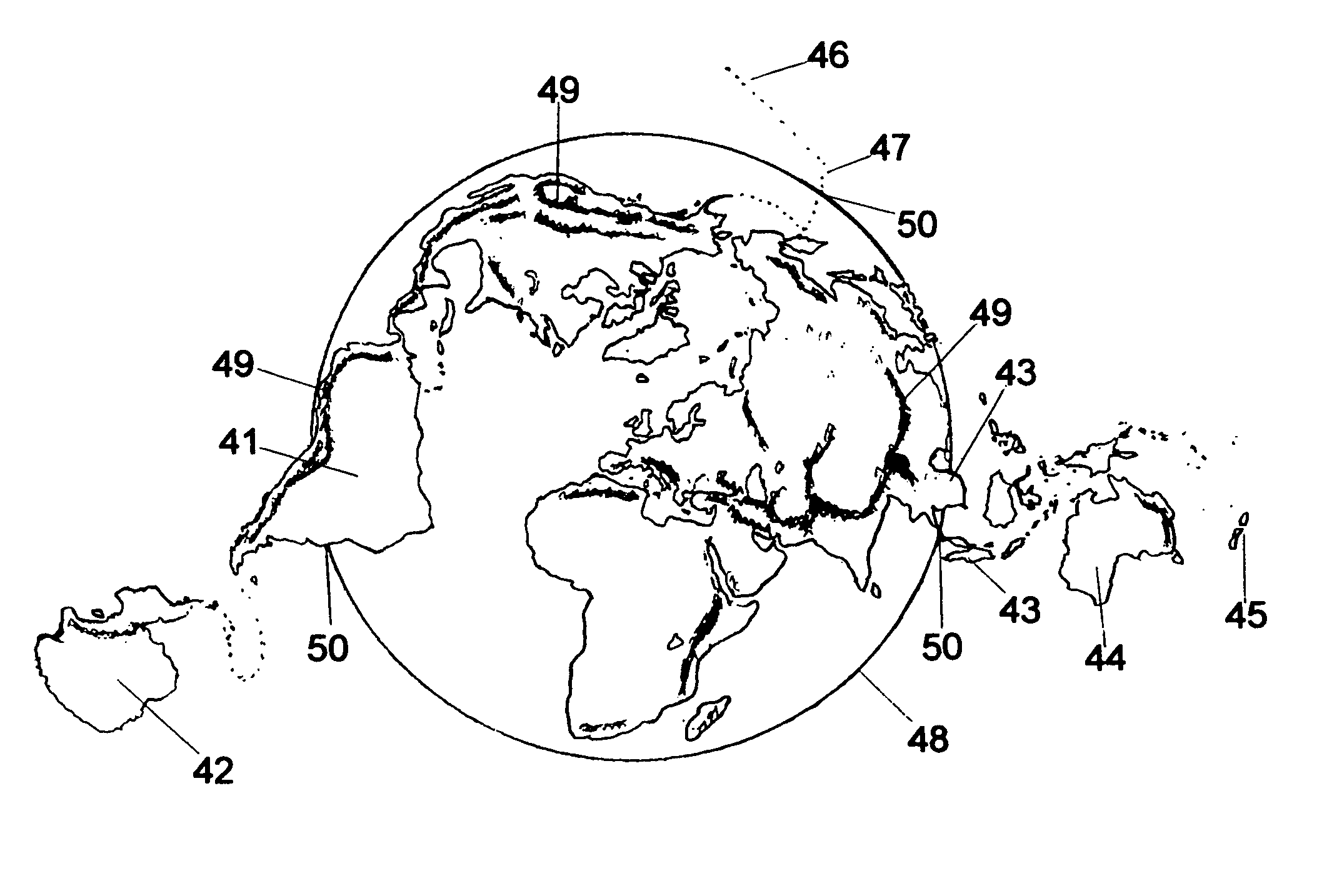
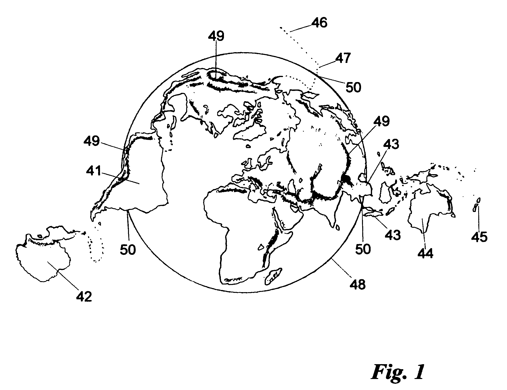
[0079]As mentioned, I believe that in the early stage of the earth's history, a gigantic meteor-like body (hereafter called “Yasoon”) broke up in the air and fell as chunks of lava onto a proto-earth covered solely by an ocean. The proto-earth is defined here as the earth without the continents. For this hypothesis, I provide the map of FIG. 1, which shows all of the earth's continents clearly. The shapes of the continents serve as evidence showing that the above process actually happened, in the same way that scientists can infer modes of living of lost creatures from shapes of footprints. I will discuss this in more detail later.
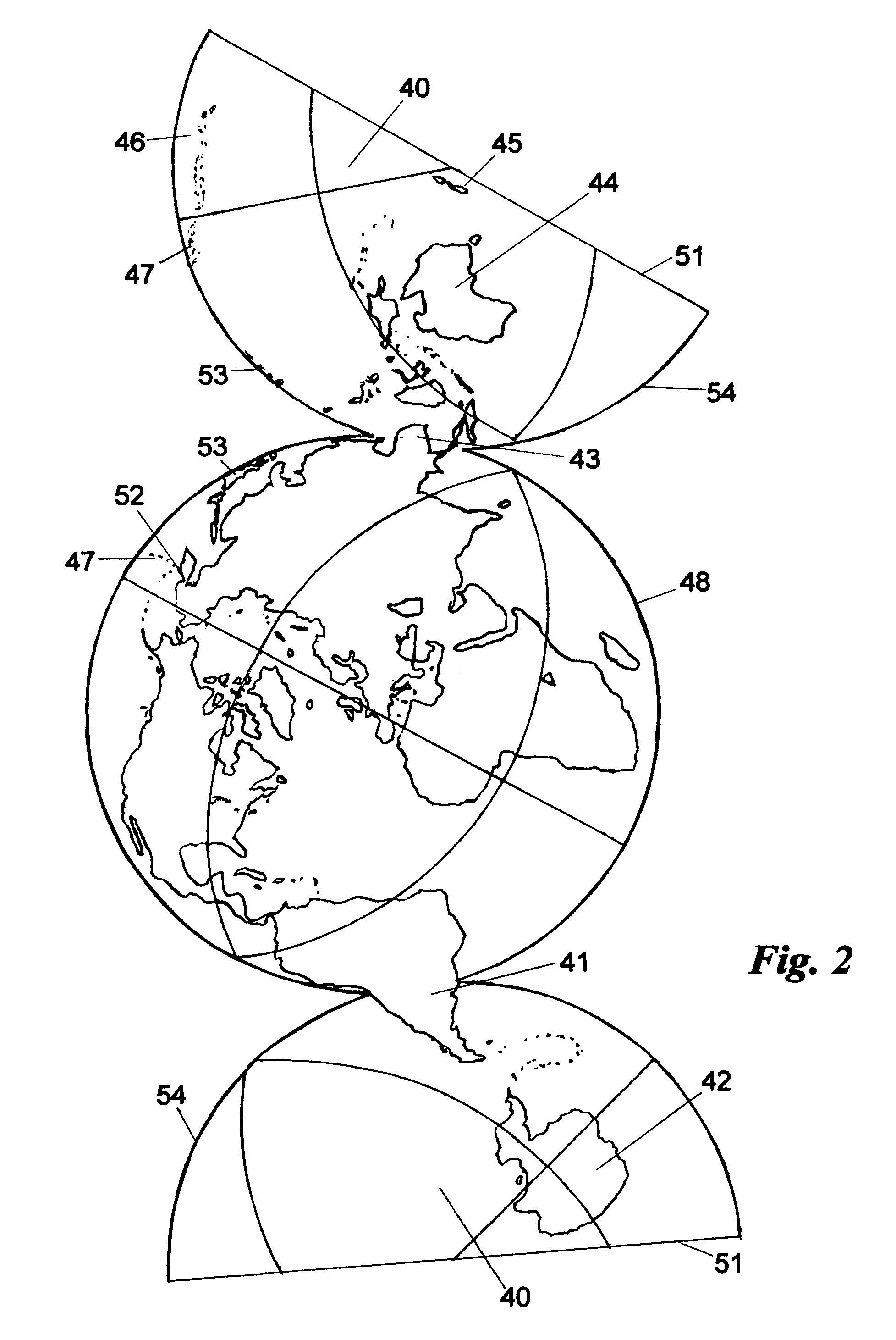
[0080]For the map of FIG. 1, oceanic hemisphere 40 of FIG. 2, which is discussed below, is divided into three sections; one contains parts of South America 41 and Antarctica 42; another contains parts of peninsulas and islands in South-East Asia 43, Australia 44, and New Zealand 45; the third section contains Ha...
PUM
 Abstract
Description
Claims
Application Information
 - R&D
- Intellectual Property
- Life Sciences
- Materials
- Tech Scout
- Unparalleled Data Quality
- Higher Quality Content
- 60% Fewer Hallucinations
Browse by: Latest US Patents, China's latest patents, Technical Efficacy Thesaurus, Application Domain, Technology Topic, Popular Technical Reports.
© 2025 PatSnap. All rights reserved.Legal|Privacy policy|Modern Slavery Act Transparency Statement|Sitemap|About US| Contact US: help@patsnap.com


