
Enhanced vertical situation display

a vertical situation and display technology, applied in the field of aircraft cockpit displays, can solve the problems of limited information, more cognitive effort in interpreting digital numbers than in interpreting analog or graphical data,

Active Publication Date: 2010-08-24
THE BOEING CO
View PDF37 Cites 29 Cited by
  • Summary
  • Abstract
  • Description
  • Claims
  • Application Information

AI Technical Summary

Benefits of technology

The invention is a display that shows information about a flight's path, including terrain, airspace, and map data. It uses an electronic display device and a computer connected to it. The display can show a variety of symbols and signs, such as an aircraft symbol, a side view of the flight path, a terrain symbol, and a target airspeed symbol. The invention can be used in different ways and can be combined with other features in different embodiments.

Problems solved by technology

Vertical information was incorporated into the navigational display, but it was limited.
Interpreting digital numbers consumes more cognitive effort that interpreting analog or graphical data, which can be important during critical phases of flight.
This information is also limited, however, because the elevation is given in general terms through color coding.

Method used


Image

  • Enhanced vertical situation display
  • Enhanced vertical situation display
  • Enhanced vertical situation display

Examples


Embodiment Construction

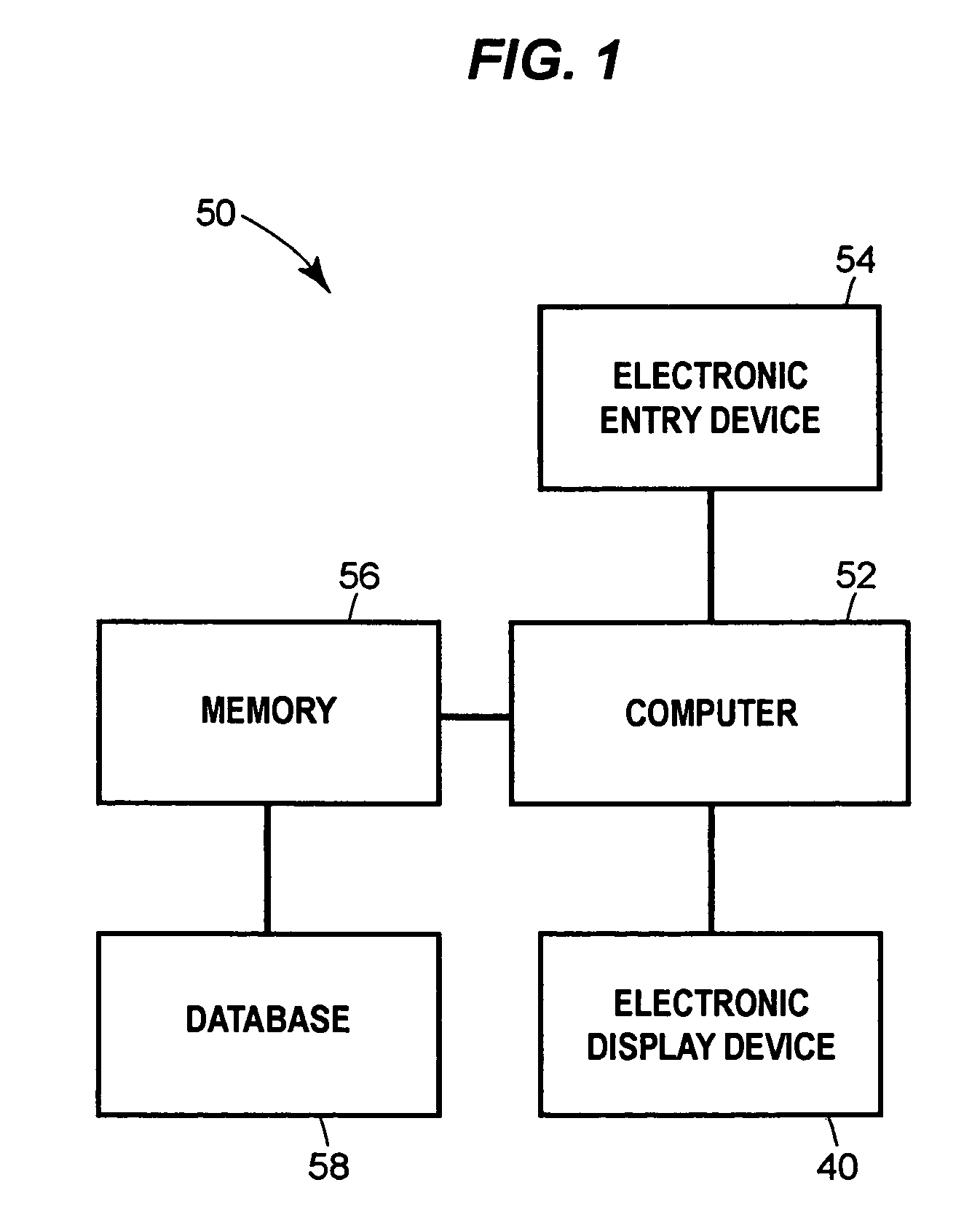
[0024]Referring now to the figures, FIG. 1 shows a schematic depiction of a flight information display system 50. The system 50 includes a computer 52 that may be operatively connected to an electronic entry device 54. The electronic entry device 54 may be used for user inputs. The user may also input information into the system 50 via other aircraft systems. For example, the user may use a flight management computer (FMC), not shown, to input information and preferences into the system 50. The computer 52 includes a memory 56, which stores a database 58. The database 58 may include information on terrain, airspace, flight routes, flight plans, waypoints, instrument approaches, runways and / or any other information that may be needed by an aircraft flight crew. The computer 52 may be programmed to use the information from the database 58 to generate a side view of an aircraft flight plan on an electronic display device 40.

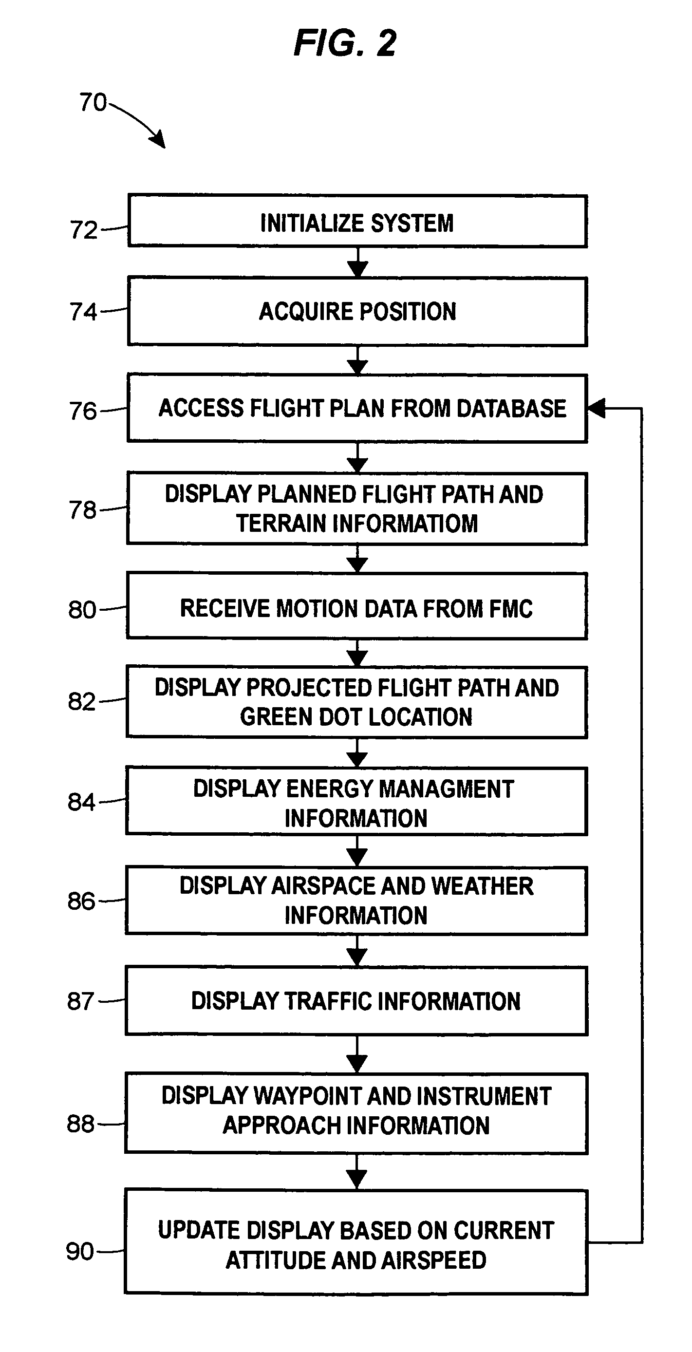
[0025]FIG. 2 shows a logic diagram 70 for an operation of the ...


PUM


Abstract

A vertical situation display system for use in a vehicle such as, for example, an aircraft, is provided. A side view of an intended route of flight may be shown with altitude restrictions, airspace and instrument approach information, a projected flight path and range to airspeed symbol. The system may show terrain, weather, and traffic information along the intended route of flight. The system may be used in conjunction with a navigational display to enhance situational awareness. The system includes a computer, an electronic display device, an electronic entry device, a memory and a database. The database may contain terrain, airspace and flight planning data and may be updatable.

Description

FIELD OF THE INVENTION[0001]The invention generally relates to aircraft cockpit displays and specifically relates to vertical displays of a planned or a projected flightpath.BACKGROUND[0002]As aircraft have become more technologically advanced, cockpit displays have evolved from mechanically driven gages to video display units. Modern video display units are capable of displaying many different types of information at the same time. Altitude, attitude and airspeed information were once displayed on three different instruments. Now, all three are incorporated into one display, the primary flight display (PFD). Navigational information was once derived from a compass, a radio beacon needle and a map. Now, flight path information, heading, groundspeed, wind direction, actual aircraft position and many other types of information may be displayed graphically on one display, the navigation display (ND).[0003]The navigation display was a quantum leap in avionics technology. The navigationa...

Claims


Application Information

Patent Timeline
Patent Type & Authority Patents(United States)
IPC IPC(8): G05D1/08G01C23/00G06G7/70G06F7/70G01C5/00G08B21/00
CPCG01C23/00
Inventor TUCKER, MICHAEL J.CHEN, SHERWIN S.WIEDEMANN, JOHNHAMMACK, JASON L.
Owner THE BOEING CO
Learn More