
Correlation position determination

a technology of correlation position and position determination, applied in the direction of distance measurement, navigation instruments, instruments, etc., can solve the problems of inability to see satellites, inability to use gps, and inability to obtain gps signals in desired locations

Active Publication Date: 2013-10-08
HONEYWELL INT INC
View PDF21 Cites 151 Cited by
  • Summary
  • Abstract
  • Description
  • Claims
  • Application Information

AI Technical Summary

Benefits of technology

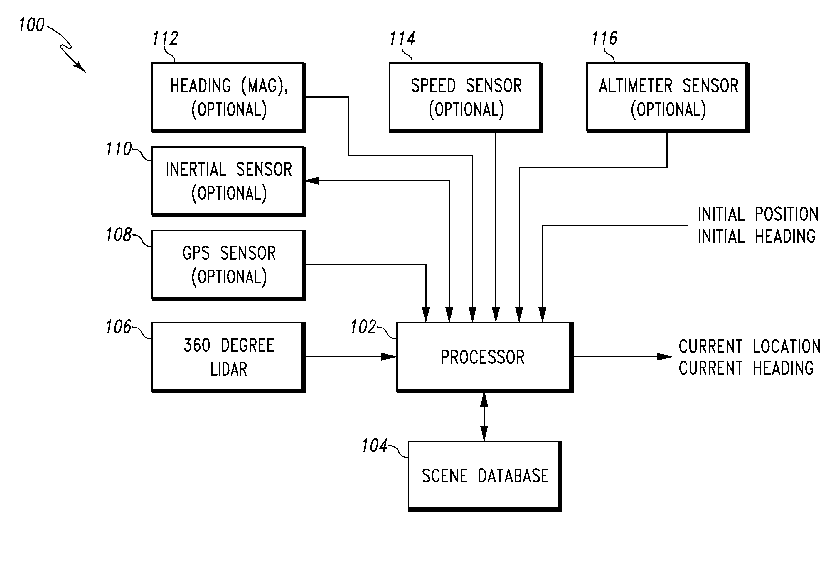
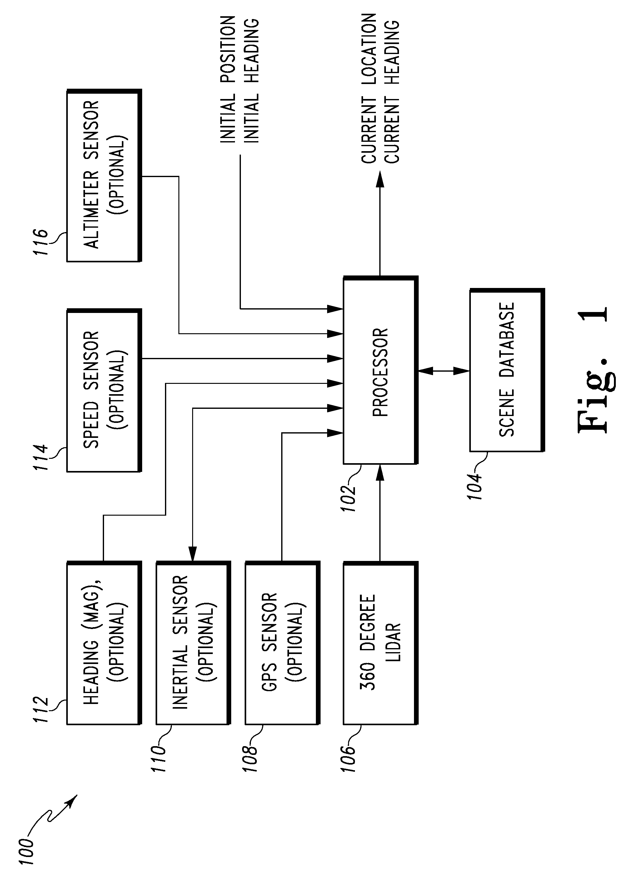
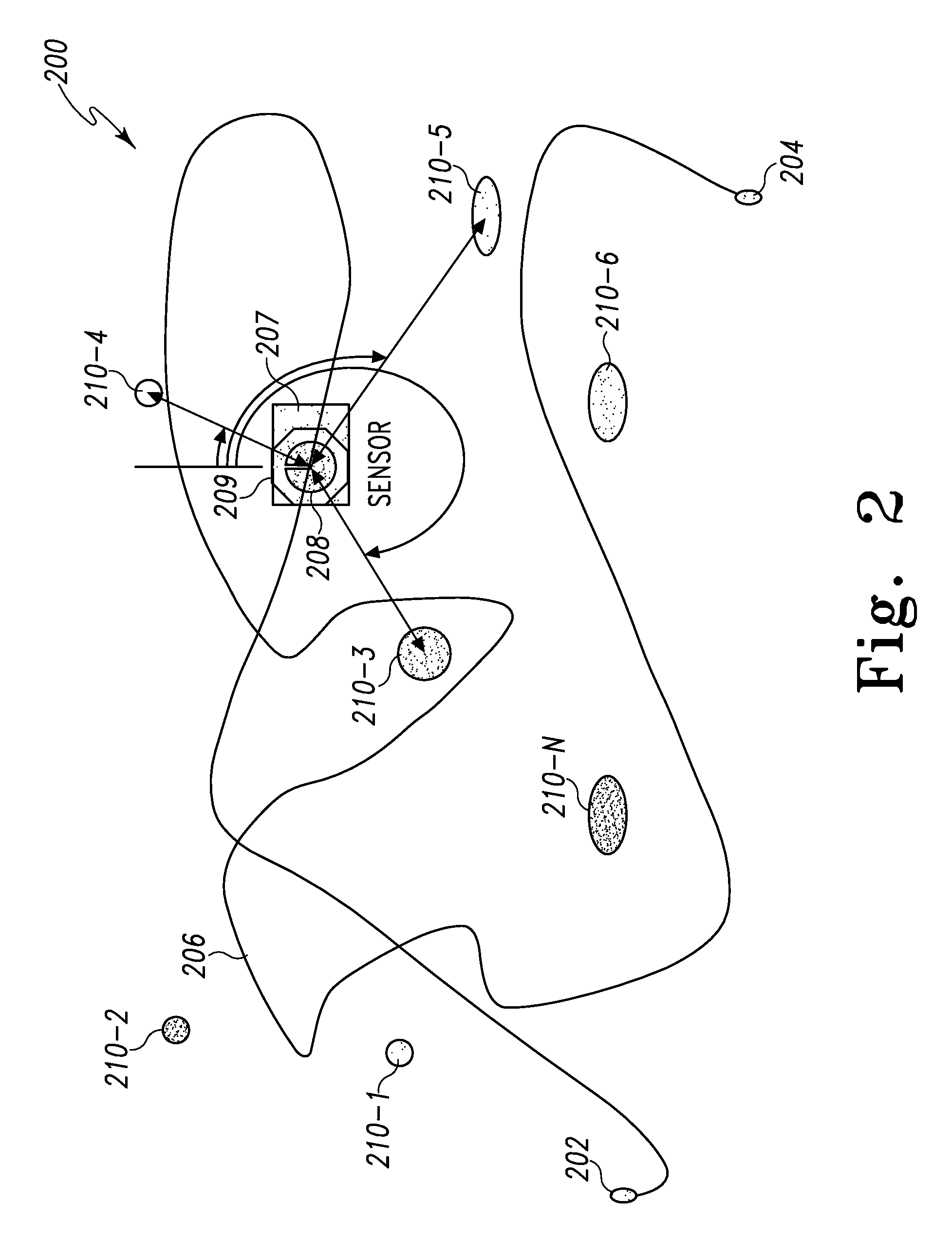
The present invention provides a method for navigating in a specific area by using correlation between data and statistical accuracy information. The method involves storing data of ranges and associated angles of objects in the area and measuring the ranges and angles during a subsequent traverse through the area. The correlations between the measured ranges and angles and the stored data are used to reconstruct the ranges and angles of the objects. The method then uses these redeveloped ranges and angles to determine the current location and heading of the observer in the area. This allows for more accurate navigation in the select area.

Problems solved by technology

The use GPS, however, has some limitations.
For example, GPS signals may not available in the desired locations where visibility of satellites is impossible.

Method used


Image

  • Correlation position determination
  • Correlation position determination
  • Correlation position determination

Examples


Embodiment Construction

[0018]In the following detailed description, reference is made to the accompanying drawings, which form a part hereof, and in which is shown by way of illustration specific embodiments in which the inventions may be practiced. These embodiments are described in sufficient detail to enable those skilled in the art to practice the invention, and it is to be understood that other embodiments may be utilized and that logical, mechanical and electrical changes may be made without departing from the spirit and scope of the present invention. The following detailed description is, therefore, not to be taken in a limiting sense, and the scope of the present invention is defined only by the claims and equivalents thereof.

[0019]Embodiments of the present invention provide a method of determining a location of a device in a selected area. In embodiments, a ranging device is used to first measure and store the distance and angles to objects as a vehicle that includes the ranging device is trave...


PUM


Abstract

Methods and apparatus for navigating with the use of correlation within a select area are provided. One method includes, storing data required to reconstruct ranges and associated angles to objects along with statistical accuracy information while initially traversing throughout the select area. Measuring then current ranges and associated angles to the objects during a subsequent traversal throughout the select area. Correlating the then current ranges and associated angles to the objects to reconstructed ranges and associated angles to the objects from the stored data. Determining at least one of then current location and heading estimates within the select area based at least in part on the correlation and using the least one of the then current location and heading estimates for navigation.

Description

BACKGROUND[0001]The ability to determine a location of a moving vehicle within an area has many applications. For example, the use of Global Positioning Systems (GPS) to determine the location of a vehicle on a map has become common place. The ability to traverse through an area without human intervention is also desired. For example, operator-less vehicles for lawn mowing operations, mining truck operations or any activity where you have a relatively repetitive travel pattern would be useful. The use GPS, however, has some limitations. For example, GPS signals may not available in the desired locations where visibility of satellites is impossible.[0002]For the reasons stated above and for other reasons stated below which will become apparent to those skilled in the art upon reading and understanding the present specification, there is a need in the art for an efficient and effective method of determining a location of a vehicle as it traverses through an area.SUMMARY OF INVENTION[0...

Claims


Application Information

Patent Timeline
Patent Type & Authority Patents(United States)
IPC IPC(8): G01C21/00G01S13/88G01S17/86G01S17/87G01S17/875
CPCG01S17/023G01S17/87G01S17/875G01S19/45G01S19/48G01S19/53G05D1/0231G05D1/0274G01C21/005G05D2201/0208G05D2201/021G01S17/86
Inventor HARTMAN, RANDOLPH G.
Owner HONEYWELL INT INC
Learn More