Guided navigation through geo-located panoramas

a geo-located panorama and navigation technology, applied in the field of three-dimensional graphics, can solve the problems of difficult navigation between different views of an image in a three-dimensional environment, unappealing to users, inaccurate or visually acceptable representations of image content displayed by the gis, etc., to improve rendering results, improve user experience, and improve visual quality

Active Publication Date: 2014-09-02
GOOGLE LLC
View PDF4 Cites 4 Cited by
  • Summary
  • Abstract
  • Description
  • Claims
  • Application Information

AI Technical Summary

Benefits of technology

[0008]A capability for guided navigation in an interactive virtual three-dimensional environment is provided. Such a capability may enhance user experience by providing the feeling of free-form navigation to a user. It may be necessary to constrain the user to certain areas of good visual quality, and subtly guide the user towards viewpoints with better rendering results without disrupting the metaphor of freeform navigation. Additionally, such a capability may enable users to “drive” down a street, follow curving roads, and turn around intersections within the interactive virtual three-dimensional environment. Further, this capability may be applicable to image-based rendering techniques in addition to any three-dimensional graphics system that incorporates navigation based on road networks and / or paths.
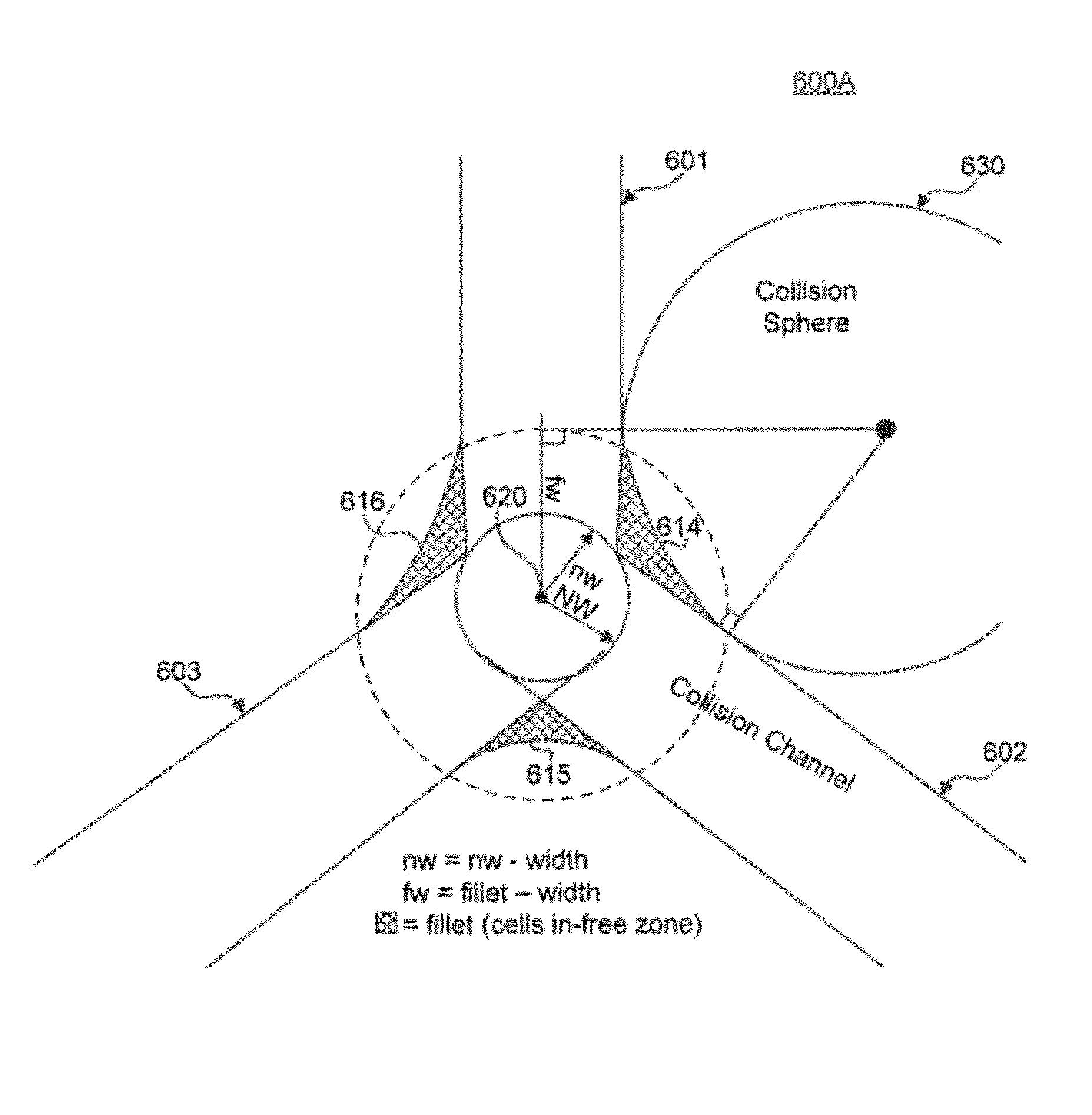
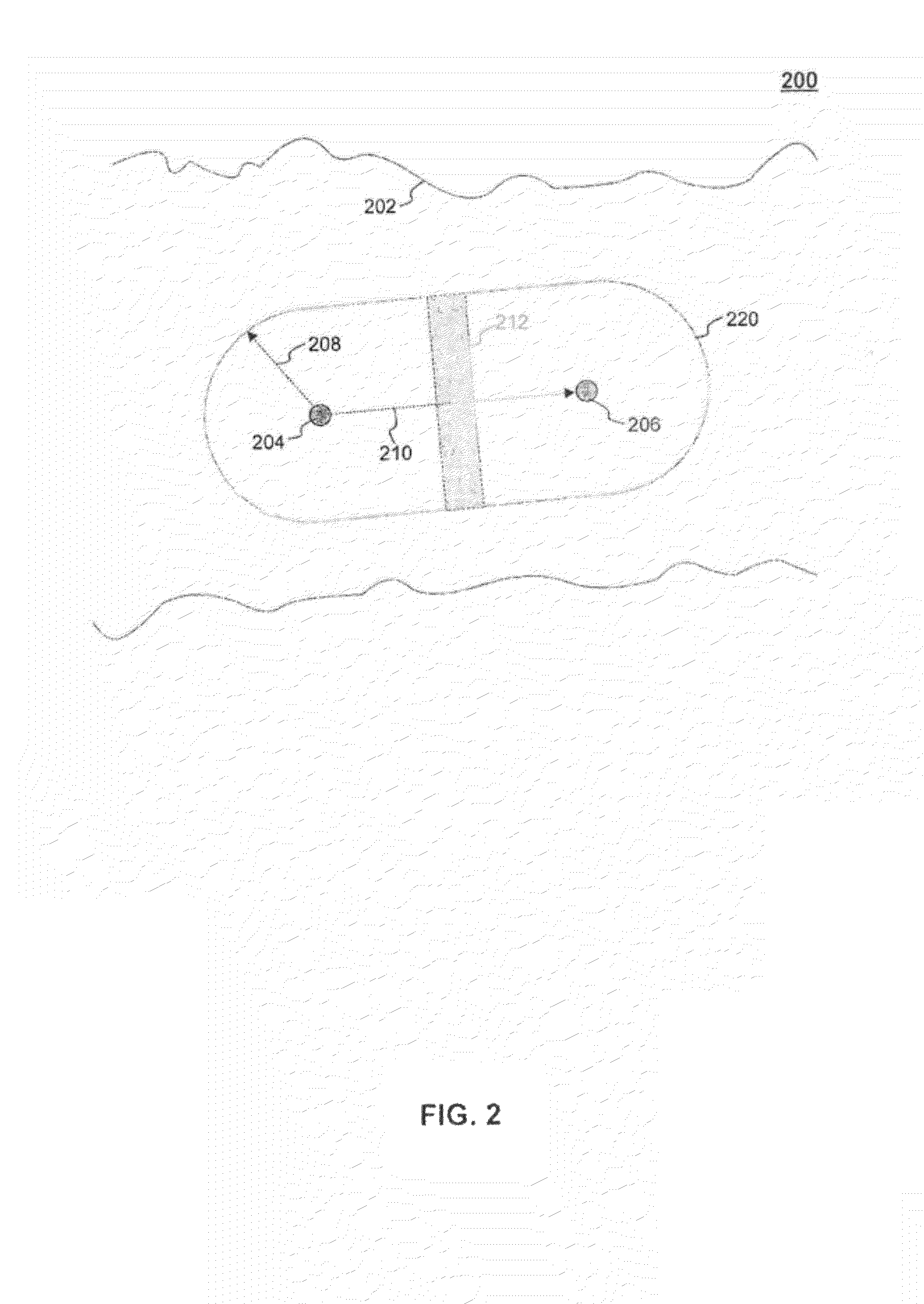
[0009]In an embodiment, a three-dimensional mesh of polygons for a first panoramic image and a second panoramic image is generated based on depth values associated with various points within a scene represented in the respective first and second panoramic images. The first panoramic image includes a link to the second panoramic image. The link represents an obstruction-free path (e.g., a street) that connects the panoramic images in three-dimensional space. A region of sufficient visual quality for each of the first and second panoramic images in the three-dimensional mesh is determined. The region of sufficient visual quality can be based on the depth values and may correspond to viewpoints from which the three-dimensional mesh can be rendered so as to be a visually accurate representation of the image objects in the first and second panoramic images. A navigation radius is then calculated for each of the first and second panoramic images based on the determined region of visual quality of each of the first and second panoramic images. A navigation channel relative to a path between the first and second panoramic images in the three-dimensional mesh is created based on the calculated navigation radius of each of image. The navigation channel is used to define a bounded volume of space within the three-dimensional environment in which a virtual camera can be moved. The navigation channel ensures that visual quality is maintained as the virtual camera moves between different viewpoints in the three-dimensional environment.

Problems solved by technology

However, some views of the model may not be accurate or visually acceptable representations of the image content displayed by the GIS.
In conventional systems, navigating between different views of an image in a three-dimensional environment may become difficult and visually unappealing to a user.

Method used


Image

  • Guided navigation through geo-located panoramas
  • Guided navigation through geo-located panoramas
  • Guided navigation through geo-located panoramas

Examples


Embodiment Construction

[0024]Embodiments relate to guided navigation in an interactive virtual three-dimensional environment. While the present invention is described herein with reference to illustrative embodiments for particular applications, it should be understood that embodiments are not limited thereto. Other embodiments are possible, and modifications can be made to the embodiments within the spirit and scope of the teachings herein and additional fields in which the embodiments would be of significant utility. Further, when a particular feature, structure, or characteristic is described in connection with an embodiment, it is submitted that it is within the knowledge of one skilled in the relevant art to effect such feature, structure, or characteristic in connection with other embodiments whether or not explicitly described.

[0025]It would also be apparent to one of skill in the relevant art that the embodiments, as described herein, can be implemented in many different embodiments of software, h...


PUM


Abstract

A capability for guided navigation in an interactive virtual three-dimensional environment is provided. Such a capability may enhance user experience by providing the feeling of free-form navigation to a user. It may be necessary to constrain the user to certain areas of good visual quality, and subtly guide the user towards viewpoints with better rendering results without disrupting the metaphor of freeform navigation. Additionally, such a capability may enable users to “drive” down a street, follow curving roads, and turn around intersections within the interactive virtual three-dimensional environment. Further, this capability may be applicable to image-based rendering techniques in addition to any three-dimensional graphics system that incorporates navigation based on road networks and / or paths.

Description

CROSS-REFERENCE TO RELATED APPLICATIONS[0001]This patent application claims the benefit of U.S. Provisional Patent Application No. 61 / 417,120, filed Nov. 24, 2010, entitled “Guided Navigation Through Geo-Located Panoramas”, which is incorporated herein by reference in its entirety.BACKGROUND[0002]1. Field[0003]Embodiments relate generally to three-dimensional graphics.[0004]2. Background[0005]Systems exist for navigating through a three-dimensional environment to display three-dimensional data. The three dimensional environment includes a virtual camera that defines what three dimensional data to display. The virtual camera has a perspective according to its position and orientation. By changing the perspective of the virtual camera, a user can navigate through the three dimensional environment.[0006]A geographic information system is one type of system that uses a virtual camera to navigate through a three-dimensional environment. A geographic information system is a system for sto...

Claims


Application Information

Patent Timeline
Patent Type & Authority Patents(United States)
IPC IPC(8): G06T15/20G06T19/00G06F3/0481
CPCG06T19/00G06T15/20
Inventor BARCAY, DANIELVARADHAN, GOKUL
Owner GOOGLE LLC
Why Eureka
Try Eureka