Early radar warning method based on GIS
A radar and radar echo technology, applied in the application field of Doppler weather radar information, can solve the problems such as the lack of judgment and analysis of rainfall conditions and the lack of identification of non-rainfall clutter.
- Summary
- Abstract
- Description
- Claims
- Application Information
AI Technical Summary
Problems solved by technology
Method used
Image

Examples
Embodiment Construction
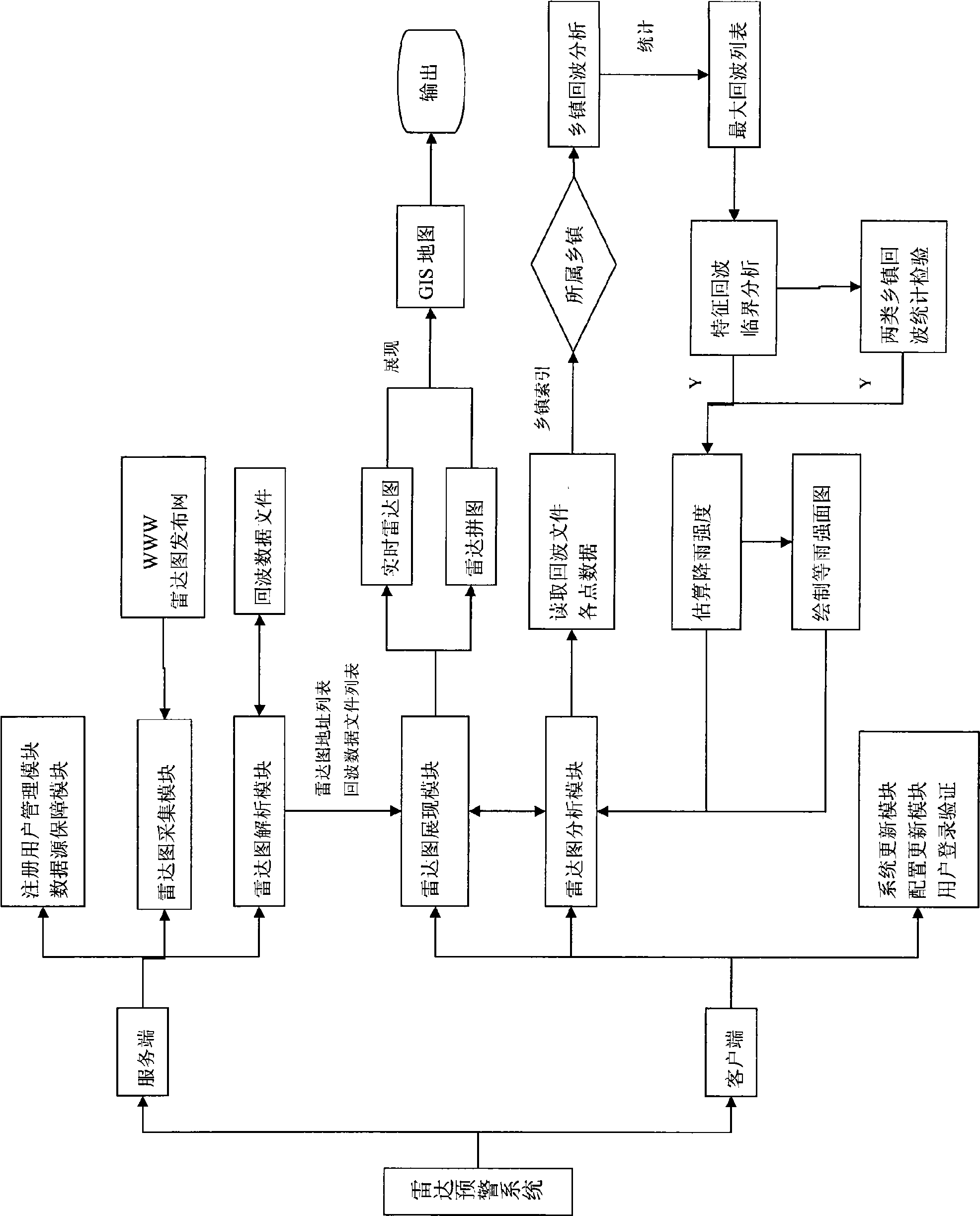
[0015] The radar early warning method based on GIS of the present invention comprises the following steps:
[0016] (1) Analyze the original picture of the radar echo to obtain the radar echo information;
[0017] (2) Calculate the maximum radar echo value of each township within the coverage area of the radar map at the specified time;
[0018] (3) Identify whether the radar echo is a rain echo or a ground object echo, and exclude the ground object echo;
[0019] (4) Quantitatively estimate the rainfall in a certain time range in the future according to the maximum radar echo value;
[0020] (5) The method of vector superposition is adopted on the radar mosaic. For the area where the range overlaps, the larger echo value is used as the echo at that place.
[0021] The implementation method of step (1) is: establish a radar echo and color correspondence table; traverse the pixels of the original image of the radar echo line by line, and use the color information of the pix...
PUM
 Abstract
Description
Claims
Application Information
 - R&D Engineer
- R&D Manager
- IP Professional
- Industry Leading Data Capabilities
- Powerful AI technology
- Patent DNA Extraction
Browse by: Latest US Patents, China's latest patents, Technical Efficacy Thesaurus, Application Domain, Technology Topic.
© 2024 PatSnap. All rights reserved.Legal|Privacy policy|Modern Slavery Act Transparency Statement|Sitemap