SAR (synthetic aperture radar) image polynomial orthorectification method
An ortho-correction, polynomial technology, applied in the direction of using re-radiation, reflection/re-radiation of radio waves, measurement devices, etc., can solve problems such as difficult to apply SAR image correction, large image deformation, etc. Effect
- Summary
- Abstract
- Description
- Claims
- Application Information
AI Technical Summary
Problems solved by technology
Method used
Image
Examples
Embodiment Construction
[0019] In order to make the object, technical solution and advantages of the present invention clearer, specific embodiments of the present invention will be described in detail below in conjunction with the accompanying drawings.
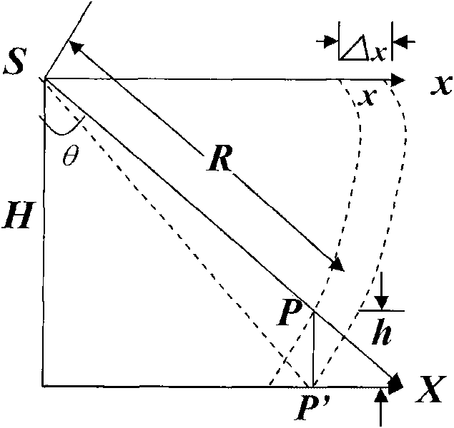
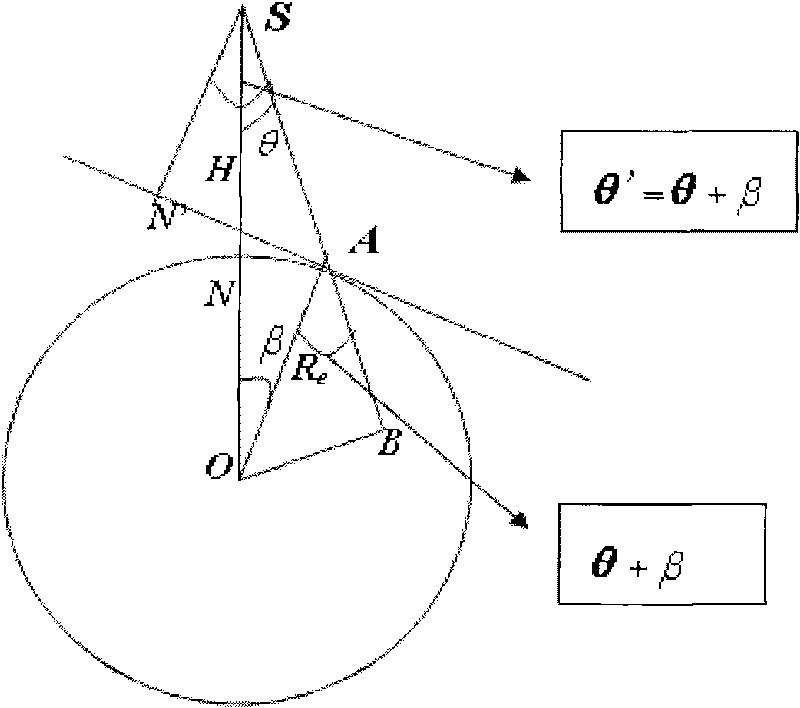
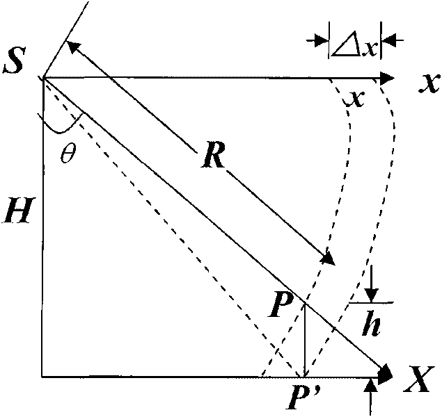
[0020] figure 1 It is a schematic diagram of the influence of terrain fluctuations on radar images according to the present invention; figure 2 It is a schematic diagram of SAR image tilt correction according to the present invention.
[0021] The image point displacement caused by terrain fluctuations in the radar image is as follows: figure 1 shown. Let the elevation on the ground point P be h, and its image coordinate be X p =λR, where λ is the imaging scale, P′ is the projection point of point P on the ground datum plane, and its slant distance can be approximately expressed as:
[0022] R′≈R+hcosθ
[0023] Here θ is the imaging angle of point P'. Then the corresponding displacement due to terrain undulation is:
[0024] ΔX=X p -X p′ ...
PUM
 Abstract
Description
Claims
Application Information
 - R&D
- Intellectual Property
- Life Sciences
- Materials
- Tech Scout
- Unparalleled Data Quality
- Higher Quality Content
- 60% Fewer Hallucinations
Browse by: Latest US Patents, China's latest patents, Technical Efficacy Thesaurus, Application Domain, Technology Topic, Popular Technical Reports.
© 2025 PatSnap. All rights reserved.Legal|Privacy policy|Modern Slavery Act Transparency Statement|Sitemap|About US| Contact US: help@patsnap.com


