Travel information service system

An information service system and map technology, applied in special data processing applications, instruments, electronic digital data processing, etc., can solve problems that affect tourism development, insufficient integration, and need to be improved and perfected, and achieve the effect of powerful spatial information management

Inactive Publication Date: 2010-07-14
肖迪
View PDF0 Cites 6 Cited by
  • Summary
  • Abstract
  • Description
  • Claims
  • Application Information

AI Technical Summary

Problems solved by technology

However, due to the lack of integration with geospatial information, the support of the system in terms of publicity and marketing, tourism personalized services, tourism enterprise services and display, as well as tourism industry management and decision support needs to be improved and perfected; at the same time, these systems are developed by tourism enterprises. The characteristics also determine that they are not well integrated with the government, which affects the development of tourism to a certain extent.

Method used


Image

  • Travel information service system
  • Travel information service system
  • Travel information service system

Examples


Embodiment Construction

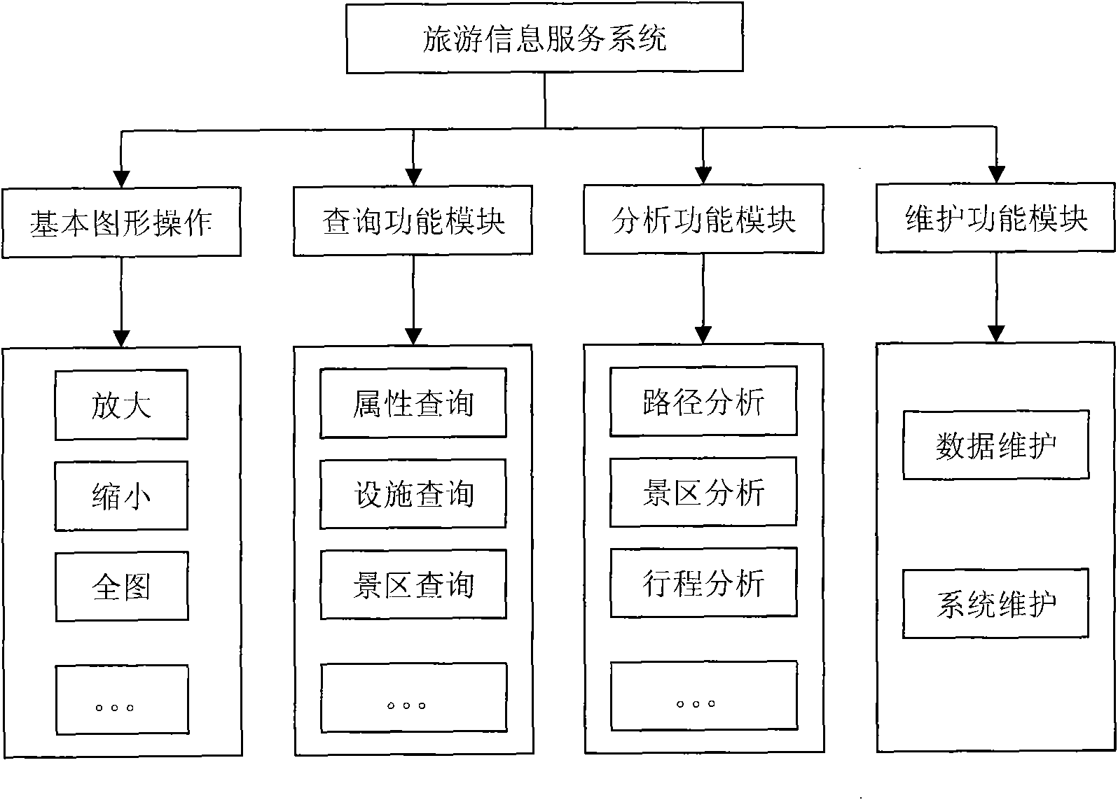
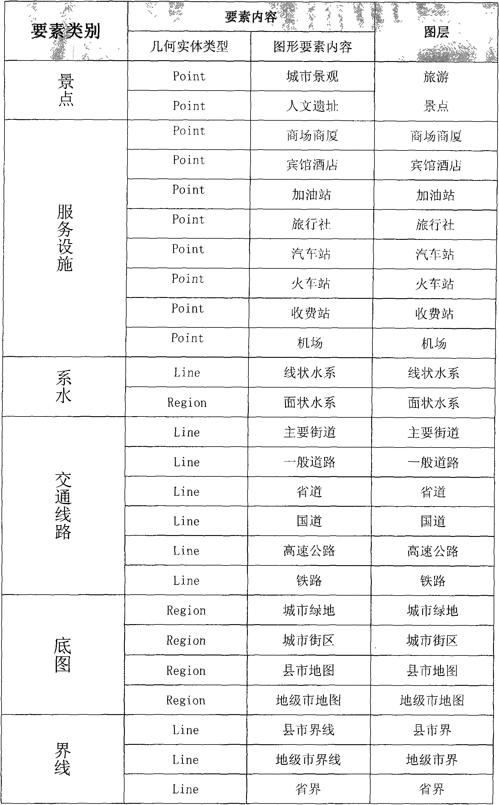
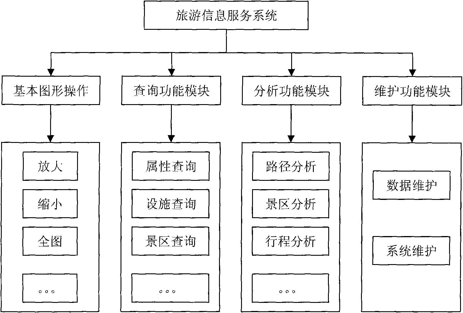
[0013] Below in conjunction with accompanying drawing, the present invention will be further described:

[0014] This system uses a series of software from SuperMap Company as the GIS platform, and the programming language is Microsoft Visual C#2005. The entire technical solution is based on the selected GIS platform and database. Build a visual layer selection interface, dynamically generate a printed map that meets the user's settings according to the layer selected by the user and the display scale of each layer of the original map, and dynamically restore the style of the base map, so that you can use it in different places. The selection of the printing layer is completed under the premise of destroying the base map. Judge the shape of the printing area selected by the user, add different templates, ensure that one direction of the layout is always filled with the map through the discriminant algorithm, and then dynamically calculate the appropriate size and placement pos...


PUM


Abstract

The invention discloses a travel information service system, which is divided into five main modules according to functions: a map basic operation module, a maintenance module, a query module, a travel service module and a map printing module. The travel information service system uses spatial information processing as a core geographic information system technique, and because the travel information service system has strong functions of spatial information management, spatial information analysis, spatial information query, three-dimensional image display and the like, the travel information service system plays an irreplaceable role in information-based construction of the travel industry. The travel information service system introduces the geographic information system technique and a multimedia production to travel services to realize effective management of tourist resources and multimedia expression of travel information, provide a brand-new visual field management and propaganda mode for an administering authority and bring unprecedented conveniences and brand-new services to tourists.

Description

Technical field: [0001] The invention relates to the processing of tourism information data, in particular to the integration of tourism information in multiple technical fields such as MIS, spatial data visualization, spatial data engine, massive spatial data organization, and spatial analysis. Background technique: [0002] At present, the construction of tourism destination marketing systems in all provinces of the country has begun to take shape, which has played an important role in tourism promotion and promotion. However, due to the lack of integration with geospatial information, the support of the system in terms of publicity and marketing, tourism personalized services, tourism enterprise services and display, as well as tourism industry management and decision support needs to be improved and perfected; at the same time, these systems are developed by tourism enterprises. The characteristics also determine that they are not well integrated with the government, whi...

Claims


Application Information

Patent Timeline
Patent Type & Authority Applications(China)
IPC IPC(8): G06F17/30
Inventor 肖迪蔡忠祥刘宏建
Owner 肖迪
Why Eureka
Try Eureka