Terrain elevation value-based texture synthesis method
A technology of texture synthesis and terrain elevation, applied in 2D image generation, image data processing, filling planes with attributes, etc., can solve problems such as low efficiency, limited application of texture synthesis technology, and underdevelopment
- Summary
- Abstract
- Description
- Claims
- Application Information
AI Technical Summary
Problems solved by technology
Method used
Image

Examples
Embodiment Construction
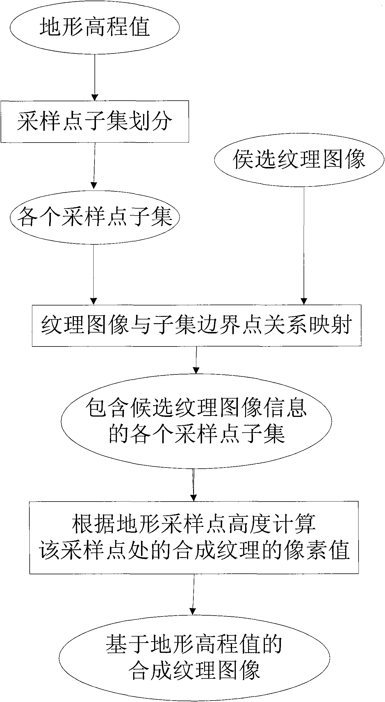
[0038] The present invention will be further described below in conjunction with the accompanying drawings and specific embodiments.
[0039] a) Subset of terrain sampling points
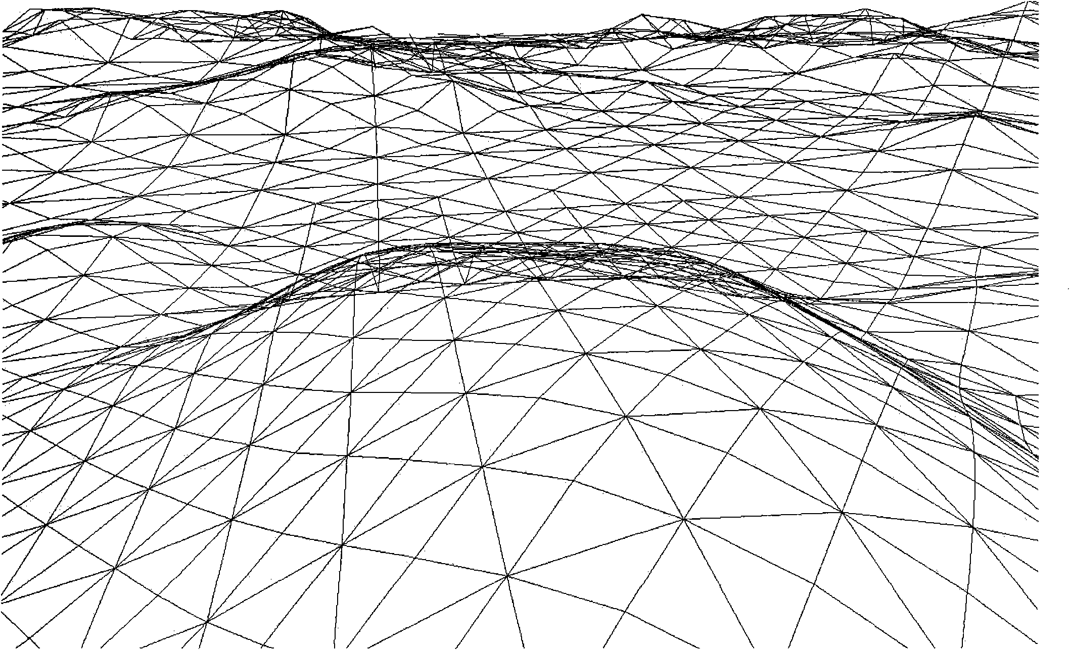
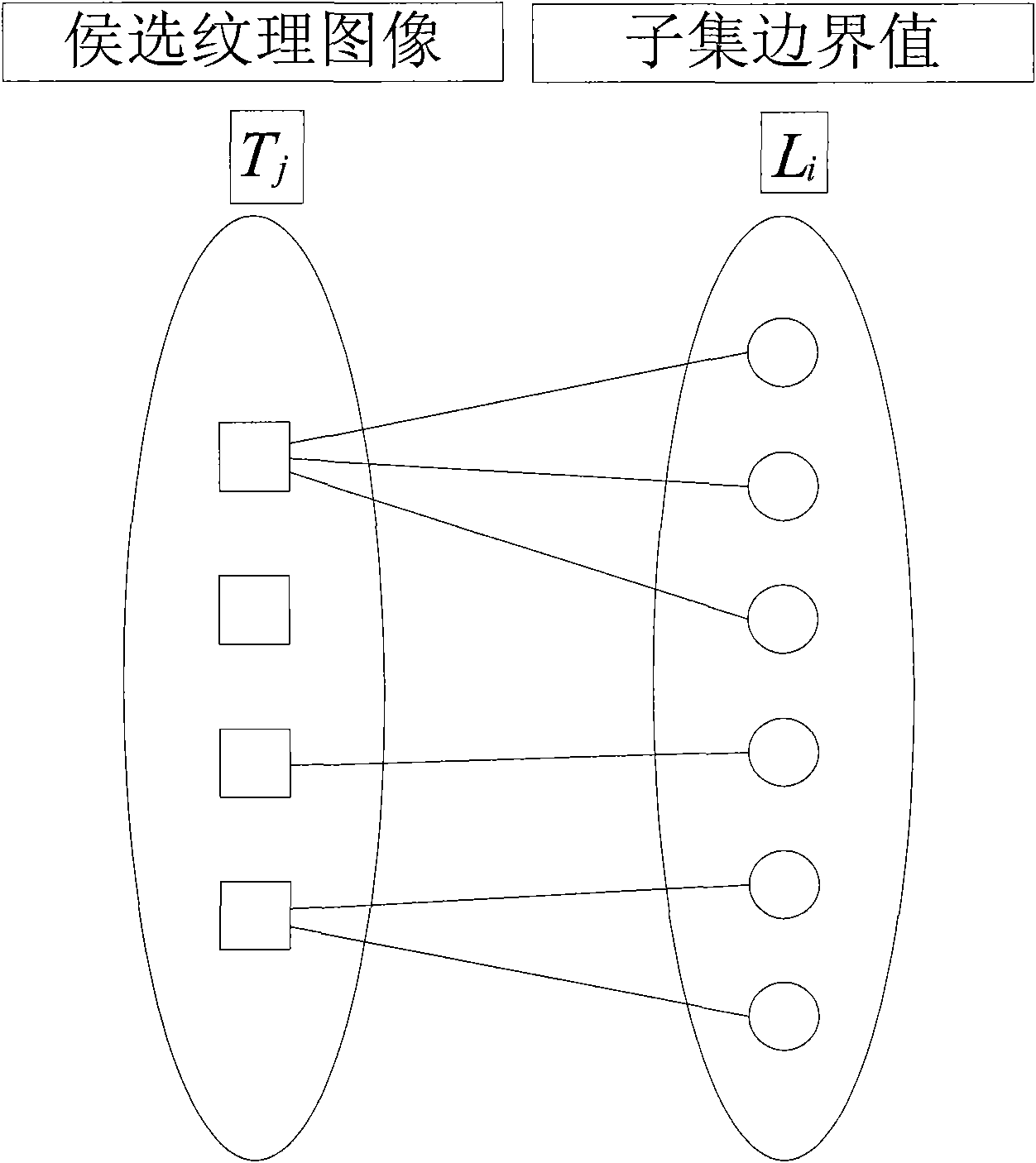
[0040] Divide the sampling points in the terrain model into n subsets H according to the actual needs i (1≤i≤n), the sampling points are obtained from the terrain model (terrain model such as figure 1 shown), first obtain the maximum value h of the heights of all sampling points in the terrain max and minimum h min The difference, and then divide this difference into n intervals on average, the length of each interval is The smallest left value in all intervals is h min , the largest rvalue is h max (The smallest left value in the sampling interval is the minimum value in the height value of the sampling point). For example, if the maximum height among the terrain sampling points is 256 and the minimum height is 0, then the difference is 256-0=256. If n=4 is set (dividing the height value in...
PUM
 Abstract
Description
Claims
Application Information
 - R&D Engineer
- R&D Manager
- IP Professional
- Industry Leading Data Capabilities
- Powerful AI technology
- Patent DNA Extraction
Browse by: Latest US Patents, China's latest patents, Technical Efficacy Thesaurus, Application Domain, Technology Topic.
© 2024 PatSnap. All rights reserved.Legal|Privacy policy|Modern Slavery Act Transparency Statement|Sitemap