
System for predicting geologic hazard based on rainfall intensity, moisture content of slope soil and deformation

A technology for soil water content and geological disasters, applied in the field of geological disaster monitoring and prediction systems, can solve the problems of rough monitoring methods, insufficient information, and only monitoring.

Active Publication Date: 2011-04-13
ZHEJIANG UNIV OF TECH
View PDF10 Cites 99 Cited by
  • Summary
  • Abstract
  • Description
  • Claims
  • Application Information

AI Technical Summary

Problems solved by technology

[0008] In order to overcome the existing monitoring and forecasting methods of geological disasters, the means are relatively single, and the information is insufficient, which makes the forecasting model inaccurate; the causal relationship between geological disasters is not considered, resulting in unclear causal relationships; monitoring instruments are expensive, and monitoring methods are relatively rough As a result, only a certain local geological disaster situation can be monitored, and it is difficult to grasp the essence of geological disasters from the overall and overall perspective; the mechanism and the whole process of geological disasters are not fully decomposed, resulting in differences in the macro, meso and micro levels. It is difficult to grasp the main key core points in terms of forecasting and forecasting of different angles and monitoring of various key time points in the disaster occurrence process. The present invention provides a comprehensive monitoring means, accurate forecasting, high degree of intelligence, and real-time online Geological Hazard Prediction System Based on Rainfall, Slope Soil Water Content and Deformation

Method used


Image

  • System for predicting geologic hazard based on rainfall intensity, moisture content of slope soil and deformation
  • System for predicting geologic hazard based on rainfall intensity, moisture content of slope soil and deformation
  • System for predicting geologic hazard based on rainfall intensity, moisture content of slope soil and deformation

Examples


Embodiment Construction

[0083] The present invention will be further described below in conjunction with the accompanying drawings.

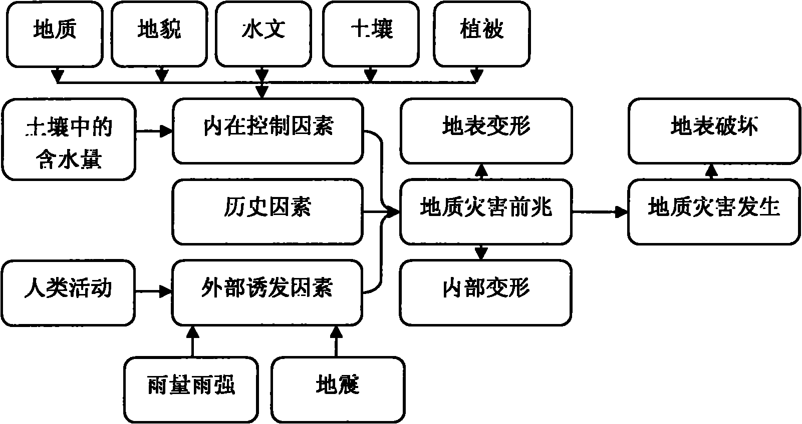
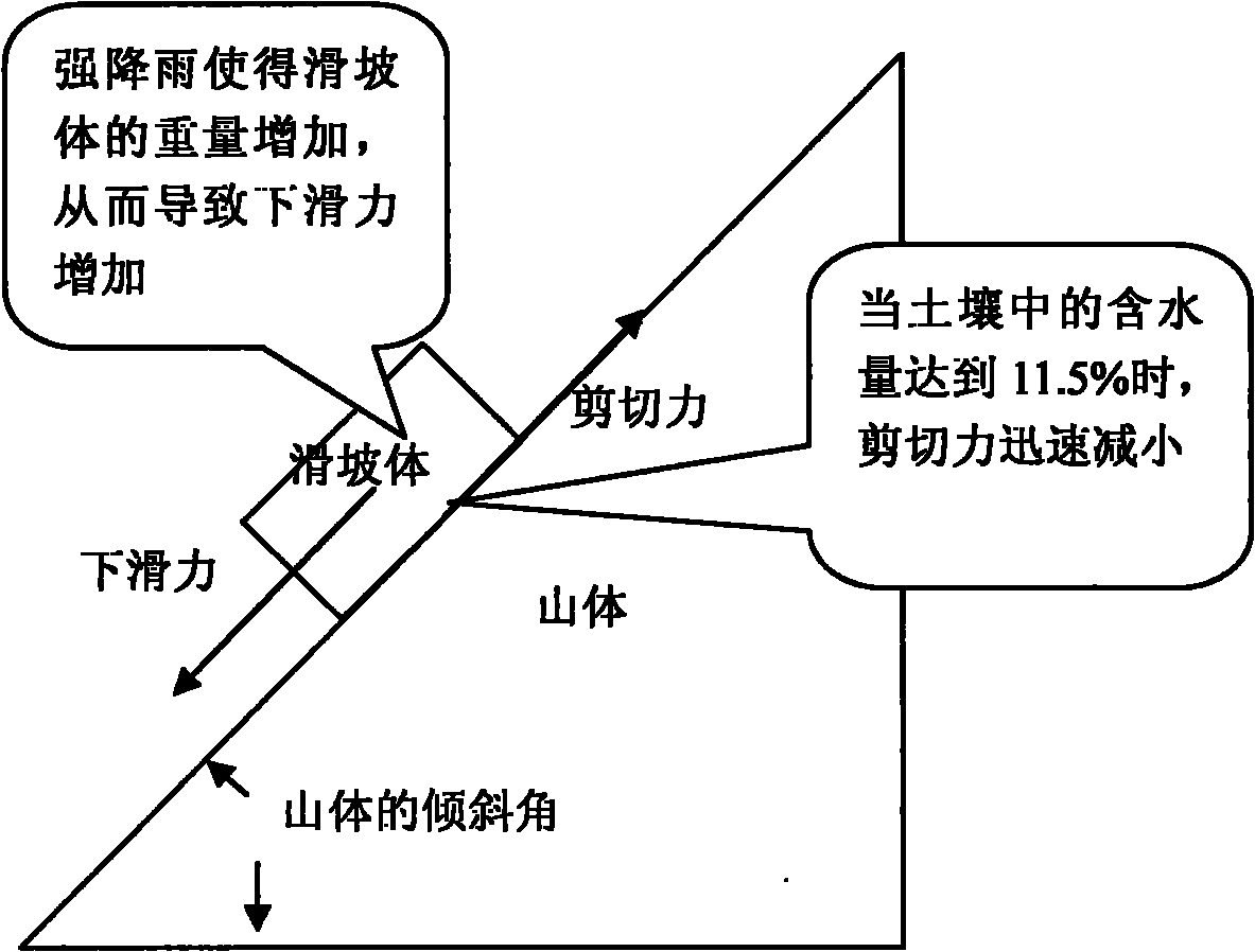
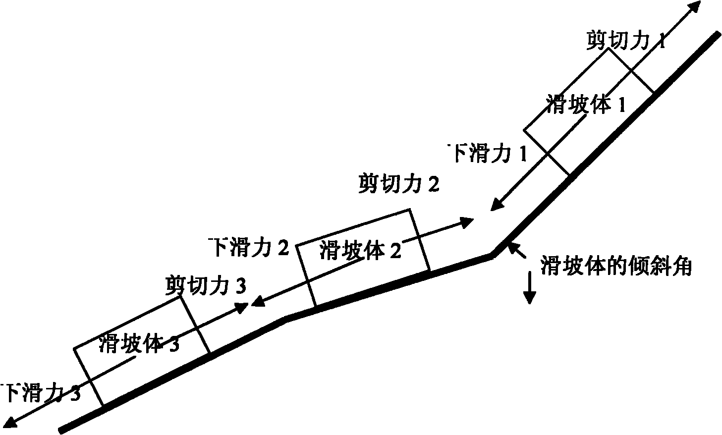
[0084] refer to Figure 1 to Figure 13 , a geological disaster prediction system based on rainfall, slope soil moisture content and deformation, including automatic rain gauges for monitoring the rainfall and intensity of geological disaster points, soil moisture sensors for monitoring soil moisture in geological disaster points, and Omni-directional tilt sensors for detecting surface and internal deformations of geological disaster points, omni-directional visual sensors for evaluating the scale of geological disasters, embedded systems for wireless transmission of video and various monitoring data, and for geological disaster prediction The monitoring center computer of forecast, the solar energy power supply unit that is used to supply power to described omnidirectional visual sensor, described soil moisture sensor and described automatic rain gauge; Described omnid...


PUM


Abstract

The invention discloses a system for predicting geologic hazard based on rainfall intensity, moisture content of slope soil and deformation. The system comprises an automatic rainfall gauge, a soil moisture sensor, an omnibearing tilt sensor, an omnibearing vision sensor, an embedded system and a monitoring center computer, wherein the automatic rainfall gauge is used for monitoring rainfall and rainfall intensity of a geologic hazard point; the soil moisture sensor is used for monitoring moisture in soil at the geologic hazard point; the omnibearing tilt sensor is used for detecting earth surface deformation and internal deformation of the geologic hazard point; the omnibearing vision sensor is used for evaluating geologic hazard scale; the embedded system is used for wirelessly transmitting video and monitoring data; and the monitoring center computer is used for predicting and forecasting the geologic hazard and comprises a communication module, a data receiving module, a rainfall and rainfall intensity-based geologic hazard prediction module, a slope displacement-time curve-based geologic hazard prediction module, a soil moisture, rainfall and rainfall intensity-based geologichazard prediction module and a soil moisture content and slope deformation-based geologic hazard prediction module. The system has the advantages of complete monitoring means, accurate prediction andforecast, high intelligence and on-line real time.

Description

technical field [0001] The invention relates to a geological disaster monitoring and forecasting system based on materials mechanics, statics, dynamics, computer software and hardware, sensing detection and other technologies. Background technique [0002] Due to the variability of the geological environment, the complexity of the occurrence mechanism of geological disasters, the randomness of time and space evolution, and the suddenness of the process, human beings cannot effectively predict and forecast geological disasters. The most fundamental reason is the technical means used. It does not yet have the ability to effectively perceive the environment. [0003] It was learned from the Office of the National Disaster Reduction Committee that in the first half of 2010, the natural disaster situation in my country showed the characteristics of "frequent occurrence of major disasters and huge losses from disasters". From January to June this year, 19,522 geological disasters ...

Claims


Application Information

Patent Timeline
IPC IPC(8): G08B21/10G01W1/14G01N27/22G01B21/32G01C9/00
CPCY02A90/10
Inventor 汤一平俞立田贤园宗明理何熊熊孙福顶孟炎叶良波吴立娟陈才国
Owner ZHEJIANG UNIV OF TECH
Learn More