
Urban green land classification method based on high-resolution remote sensing image

A high-resolution, remote sensing image technology, applied in image analysis, image data processing, instruments, etc., can solve problems such as heavy workload, and achieve the effect of reducing workload and accurate results

Inactive Publication Date: 2011-05-04
住房和城乡建设部城乡规划管理中心
View PDF0 Cites 17 Cited by
  • Summary
  • Abstract
  • Description
  • Claims
  • Application Information

AI Technical Summary

Problems solved by technology

[0004] The present invention provides a method for classifying urban green spaces based on high-resolution remote sensing images to solve the problem of large workload in the process of confirming the social attributes of existing urban green spaces. The method includes:

Method used


Image

  • Urban green land classification method based on high-resolution remote sensing image
  • Urban green land classification method based on high-resolution remote sensing image
  • Urban green land classification method based on high-resolution remote sensing image

Examples


Embodiment Construction

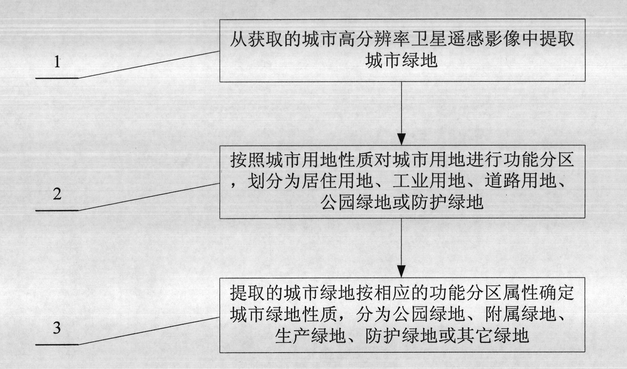
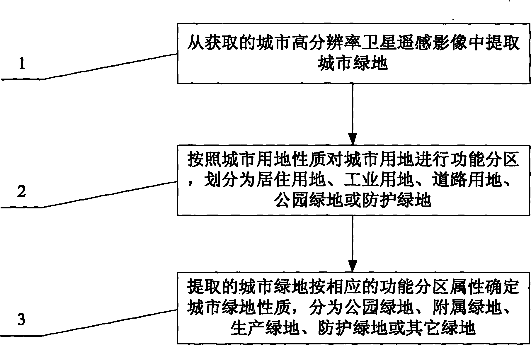
[0011] The specific embodiment of the present invention provides a method for classifying urban green space based on high-resolution remote sensing images. Divide different functions, and then assign the attributes of the functional divisions to the green space in the area. Such as figure 1 As shown, the method may specifically include:

[0012] Step 1. Extract urban green space from the acquired high-resolution satellite remote sensing images of the city.

[0013] Specifically, the corresponding urban high-resolution satellite remote sensing images can choose QuickBird satellite data or IKONOS satellite data and other data. QuickBird satellite is a high-resolution commercial satellite launched by Digital Globe on October 18, 2001. Its outstanding features are: panchromatic resolution of 0.61m, multispectral resolution of 2.44m, multispectral Four bands of red, green, blue, and near-infrared, with an image width of 16.5km.

[0014] Since the leaves of green plants have str...


PUM


Abstract

The invention provides an urban green land classification method based on a high-resolution remote sensing image so as to solve the problem of greater workload in the existing urban green land confirmation method. The method comprises the following steps of: extracting urban green land from the obtained urban high-resolution satellite remote sensing image; carrying out function division on urban land according to urban land characters, and dividing the urban land into residential land, industrial land, land for roads, park green land or protective green land; and determining the green land characters of the extracted urban green land according to the function division, wherein the green land can be divided into park green land, appendage green land, production green land, protective green land or other green land. The urban green land in the urban high-resolution satellite remote sensing image is firstly divided according to the urban land characters, and then the corresponding green land attributes are given to divided regions, thus the method can quickly divide the types of the urban green land and reduce the workload and has the advantage of accurate result.

Description

technical field [0001] The invention relates to a method for classifying urban green spaces based on high-resolution remote sensing images. Background technique [0002] Using remote sensing technology, that is, to obtain high-resolution satellite remote sensing images of urban built-up areas, determine the area of ​​various green spaces in the city, and then calculate green indicators such as urban green space rate, green coverage rate, per capita park green space, etc., which can provide relevant decision-making information for relevant urban authorities. Support and promote urban landscaping construction. It is a relatively mature technology to extract vegetation information by using multispectral information of remote sensing images. The problem is how to divide the extracted urban green space information into different types based on social attributes. [0003] The traditional method of classifying according to social attributes is to face the green space, that is, to...

Claims


Application Information

Patent Timeline
Patent Type & Authority Applications(China)
IPC IPC(8): G06T7/00G06Q50/00G06Q50/26
Inventor 龚威平张雁汪波张舰林俞先孙越刘佳福张芳任晓静崔丽娜
Owner 住房和城乡建设部城乡规划管理中心
Learn More