Measurement method of relative position of two ships based on laser range finder

A laser range finder and relative position technology, applied in measurement devices, instruments, positioning and other directions, can solve problems such as inability to detect ship targets, and achieve the effects of good real-time performance, high precision and large measurement range

Inactive Publication Date: 2011-12-07
HARBIN ENG UNIV
View PDF4 Cites 6 Cited by
  • Summary
  • Abstract
  • Description
  • Claims
  • Application Information

AI Technical Summary

Problems solved by technology

However, the bottleneck of infrared imaging technology li

Method used


Image

  • Measurement method of relative position of two ships based on laser range finder
  • Measurement method of relative position of two ships based on laser range finder
  • Measurement method of relative position of two ships based on laser range finder

Examples


Embodiment Construction

[0020] The present invention is described in more detail below in conjunction with accompanying drawing example:

[0021] combine Figure 1-8 , the present invention comprises the following steps:

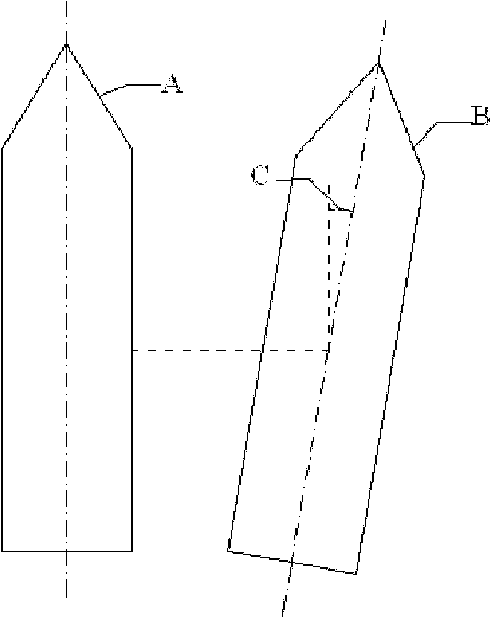
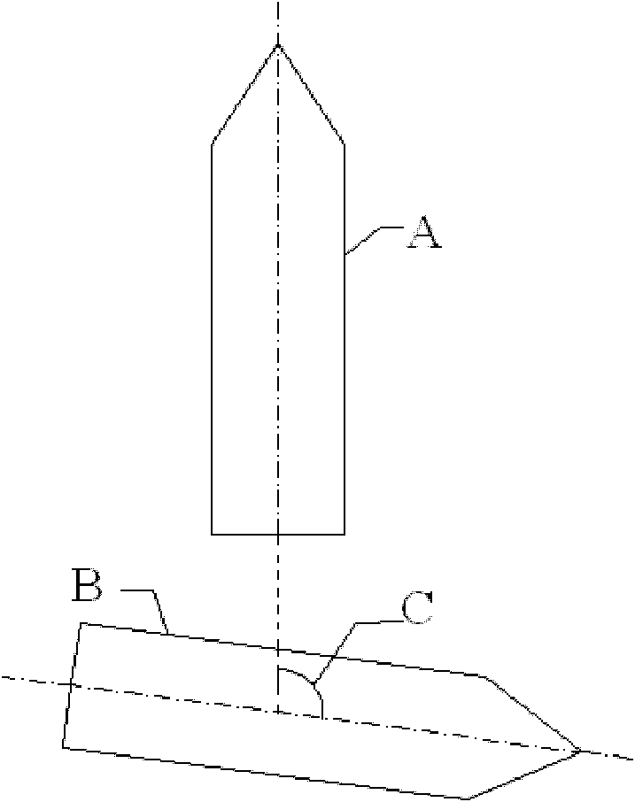
[0022] For different tasks, the laser range finder is installed in different positions. In order to realize all-round scanning of the rescue ship, the laser rangefinder is installed at a specific position of the rescue ship. When implementing the parallel approach scheme, the laser range finder is installed in the middle of the left and right sides of the rescue ship, and the bisector of the scanning opening angle is perpendicular to the central axis of the rescue ship. When implementing the stern approaching scheme, the laser range finder is installed on the stern side of the rescue ship, and the bisector of the scanning opening angle coincides with the central axis of the rescue ship.

[0023] The real-time measurement data (including the measurement data of each azimuth) of t...


PUM


Abstract

The purpose of the invention is to provide a laser range finder-based method for determining a relative position between two boats. The method comprises the following steps that: a laser range finder is installed on a rescue boat; when the rescue boat approaches in parallel a rescued boat, the laser range finder is installed in the middle of the left and right gunnels of the rescue boat and scansan angular bisector of an open angle, wherein the angular bisector is perpendicular to a central axis of the rescue boat; and when a stern of the rescue boat approaches the rescued boat, the laser range finder is installed on a gunnel of the stern of the rescue boat and scans an angular bisector of an open angle, wherein the angular bisector is superposed on a central axis of the rescue boat; data of all azimuthal angles are real-time measured by the laser range finder and the data is processed by eliminating gross errors; median filtering processing is carried out on the data that has been processed by eliminating the gross errors by utilizing a quicksort method; and a relative position between the rescue boat and the rescued boat is obtained by employing sine and cosine theorems. According to the invention, a laser range finder, which is utilized as a measuring sensor, has advantages of high precision, good real-time performance and large measuring range, so that a measured result can meet a tracking requirement.

Description

technical field [0001] The invention relates to a relative position determination method. Background technique [0002] In the process of sea rescue, it has become an urgent requirement to realize the tracking of the rescue ship to the rescued ship. At present, there is no ship tracking technology that can be practically applied in China, and there are almost no papers published in this area. Wang Zhong, a graduate student of Harbin Engineering University, proposed the concept of tracking control for dynamic positioning of relatively floating ships in his master's thesis "Research on Tracking Control Method for Dynamic Positioning of Relatively Floating Ships". In this paper, the positioning ship is required to track a target ship floating freely on the sea surface, so that the two ships always maintain a relatively fixed position and heading. However, its article focuses on the control part and the thrust part, but does not mention the measurement method of the relative p...

Claims


Application Information

Patent Timeline
IPC IPC(8): G01S5/16
Inventor 付明玉丁福光刘扬李晓光王丹丹
Owner HARBIN ENG UNIV
Why Eureka
Try Eureka