Pseudorange difference location method and device

A positioning method and position positioning technology, which is applied in the direction of location information-based services, transmission monitoring, electrical components, etc., can solve the problems of cumbersome workload and low positioning accuracy

Active Publication Date: 2012-07-04
BEIJING UNIV OF POSTS & TELECOMM +1
View PDF3 Cites 24 Cited by
  • Summary
  • Abstract
  • Description
  • Claims
  • Application Information

AI Technical Summary

Problems solved by technology

[0023] In order to solve the problems of low positioning accuracy and cumbersome workload in the existing positioning methods, the embodiment of the present invention provides a pseudorange difference positioning method and device

Method used


Image

  • Pseudorange difference location method and device
  • Pseudorange difference location method and device
  • Pseudorange difference location method and device

Examples


Embodiment 1

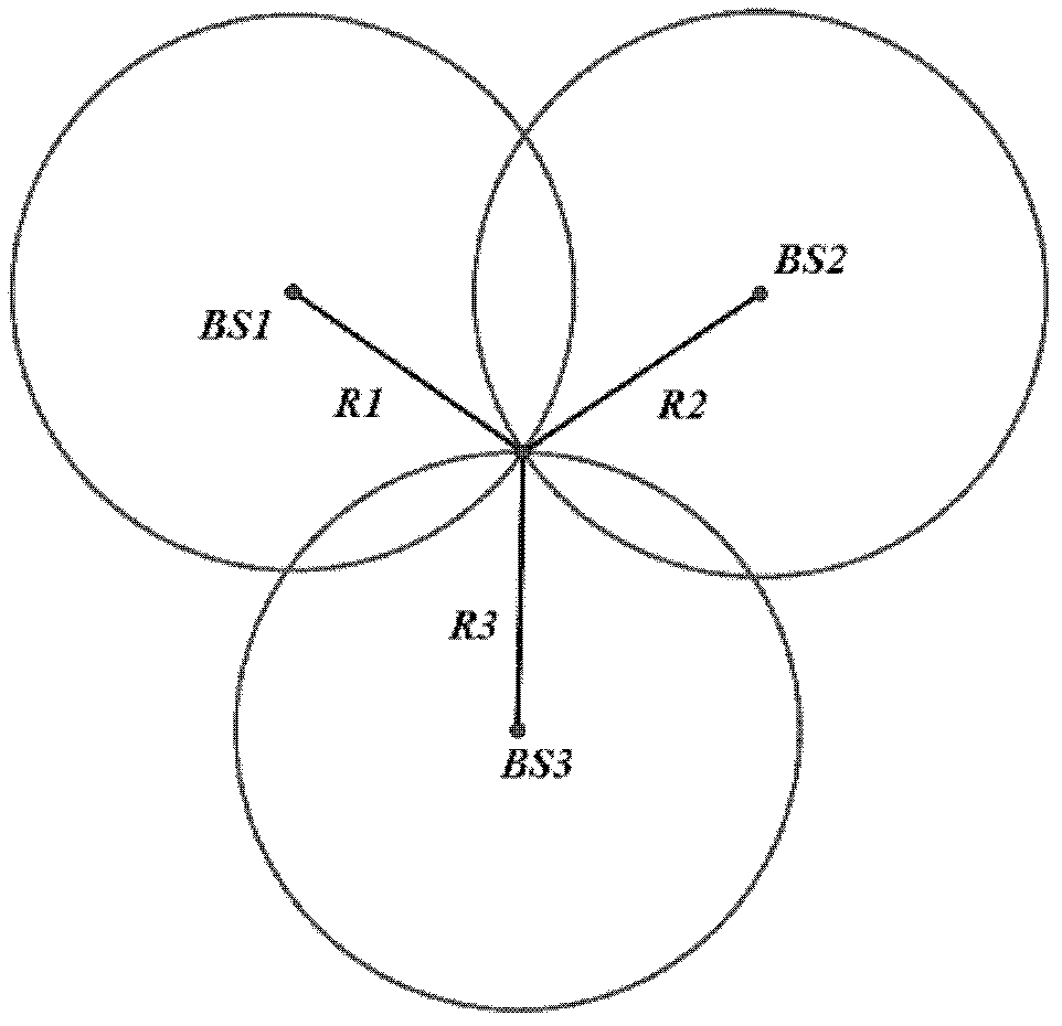
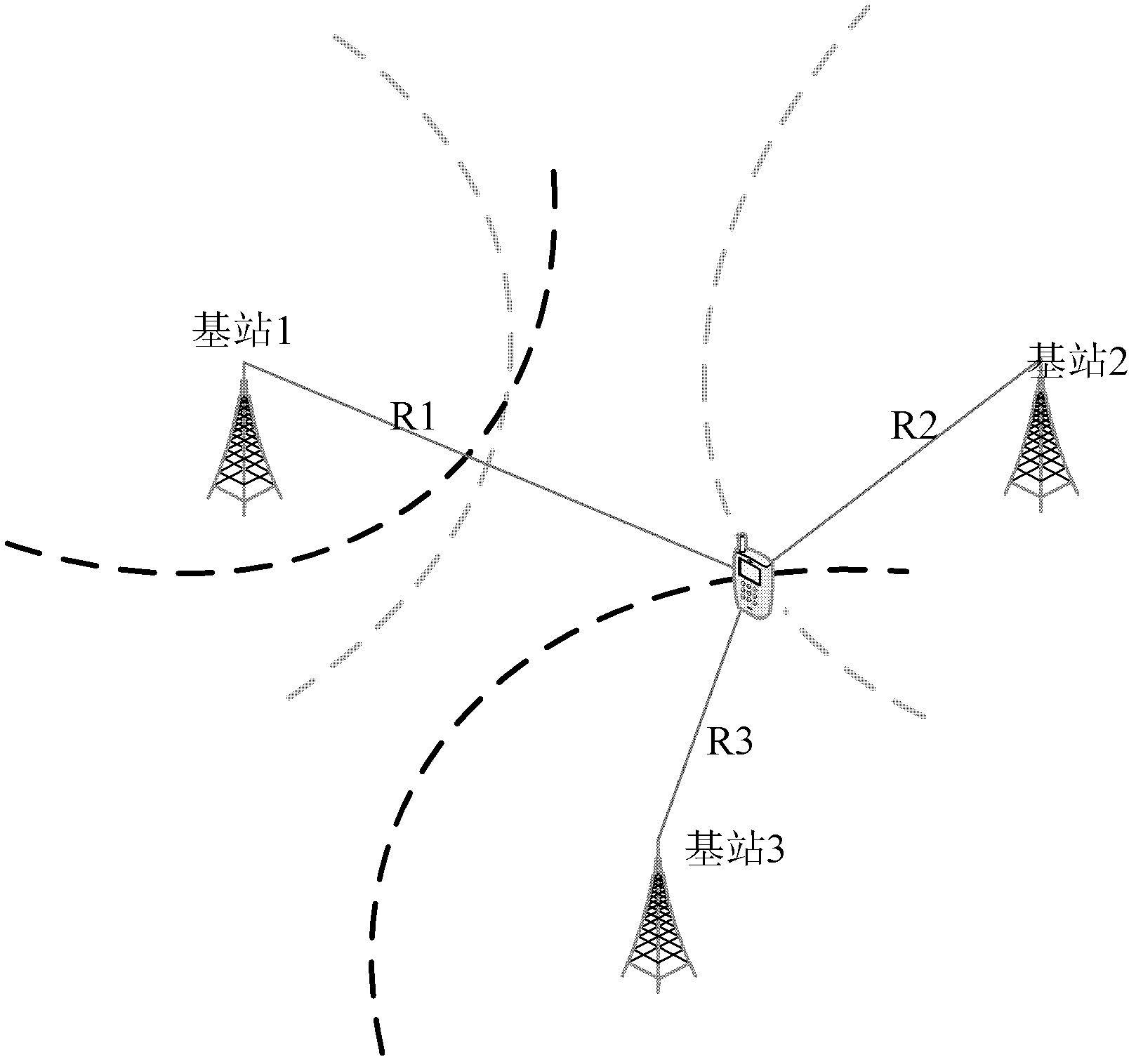
[0090] Embodiment 1 of the present invention provides a pseudorange difference positioning method, such as Figure 6 As shown, the method includes the following steps:

[0091] Step 10, selecting a calibration point, and pre-determining the coordinates of the calibration point and the corresponding TDOA value.

[0092] User positioning is a systematic work, and the primary task is to select a small number of calibration points in the entire positioning area as the reference point of the positioning area. The selection of calibration points can be carried out according to actual needs, and the number of calibration points can be selected according to the workload that can be tolerated.

[0093] After the calibration points are selected, the coordinates of the calibration points and the corresponding TDOA values ​​need to be determined in advance. The measurement of the coordinates can be carried out according to positioning methods such as GPS, and the measurement of the TDOA...

Embodiment 2

[0121] In Embodiment 2 of the present invention, the method of first measuring the grid points in the above-mentioned Embodiment 1 is used to locate the user, wherein,

[0122] Firstly, the calibration points are selected at certain intervals, and the coordinates of the calibration points and the corresponding TDOA values ​​at the calibration points are determined in advance.

[0123] Then generate grid point coordinates required for positioning according to predetermined rules. The predetermined rule can be that the grid points are distributed at equal intervals, or can be divided irregularly according to information such as indoor room coordinates.

[0124] Then, generate the TDOA value of the grid point according to the required grid point coordinates, calibration point coordinates, base station coordinates, and calibration point pre-stored TDOA values. The generation rules are as follows:

[0125] Find three calibration points A, B, and C, and satisfy the following condi...

Embodiment 3

[0130] In Embodiment 3 of the present invention, the method of user positioning without measuring grid points in the above-mentioned Embodiment 1 is adopted, wherein,

[0131] Firstly, the calibration points are selected at certain intervals, and the coordinates of the calibration points and the corresponding TDOA values ​​at the calibration points are determined in advance.

[0132] Then find three calibration points A, B, and C according to the method of finding calibration points based on the grid points in the above two embodiments, and satisfy the following conditions: the triangular area surrounded by the three calibration points contains the estimated user The position coordinates, and the sum of the distances from the three calibration points to the position point is the minimum. The coordinates of the marked calibration points are (x A ,y A ), (x B ,y B ), (x C ,y C ).

[0133] Let the n TDOA values ​​measured at points A, B, and C be T A1 , T A2 ......T An ...


PUM


Abstract

The invention discloses a pseudorange difference location method, and belongs to the technical field of user location. The method comprises the following steps of: selecting a calibration point, and measuring the coordinates and a corresponding time difference of arrival (TDOA) value of the calibration point in advance; selecting three calibration points according to a location to be located, acquiring TDOA values of the three calibration points, and calculating corresponding TDOA not line of sight corrected values; calculating a TDOA not line of sight corrected value of the location to be located according to the TDOA not line of sight corrected values of the three calibration points; and calculating a TDOA value according to a coordinate value and the TDOA not line of sight corrected value of the location to be located, or calculating the coordinate value according to the TDOA value and TDOA not line of sight corrected value of the location to be located. By the method, a small number of calibration points can be measured at a large distance interval in advance, and grid point characteristic information with high density can be virtualized and generated on the basis of the TDOA values of the calibration points by adopting a pseudorange difference model, so that location not line of sight errors are reduced, and the amount of acquired grid information is effectively decreased.

Description

technical field [0001] The invention relates to the technical field of user positioning, in particular to a pseudorange difference positioning method and device. Background technique [0002] LBS (Location Based Service) is a value-added service that obtains the location information (latitude and longitude coordinates) of mobile users through the operator's mobile communication network, and provides corresponding services for users with the support of the electronic map platform. For example, the positioning service can find the current geographic location of the mobile phone user, and then find the names and addresses of hotels, theaters, libraries, gas stations, etc. within 1 kilometer of the mobile phone user's current location. The platform of this service can span mobile terminals, websites, call centers, other mobile devices, etc. Generally speaking, LBS is to use the Internet or wireless network to complete the two functions of positioning and service between fixed u...

Claims


Application Information

Patent Timeline
Patent Type & Authority Applications(China)
IPC IPC(8): H04W4/02H04W64/00H04B17/00
Inventor 邓中亮余彦培来奇峰张遂征
Owner BEIJING UNIV OF POSTS & TELECOMM
Why Eureka
Try Eureka