Remote sensing data processing system
A technology of remote sensing data and processing system, applied in the field of remote sensing communication, can solve problems such as loss, delay in the application of remote sensing data, and failure of timely processing of remote sensing data, and achieve the effect of ensuring processing efficiency
- Summary
- Abstract
- Description
- Claims
- Application Information
AI Technical Summary
Problems solved by technology
Method used
Image

Examples
Embodiment Construction
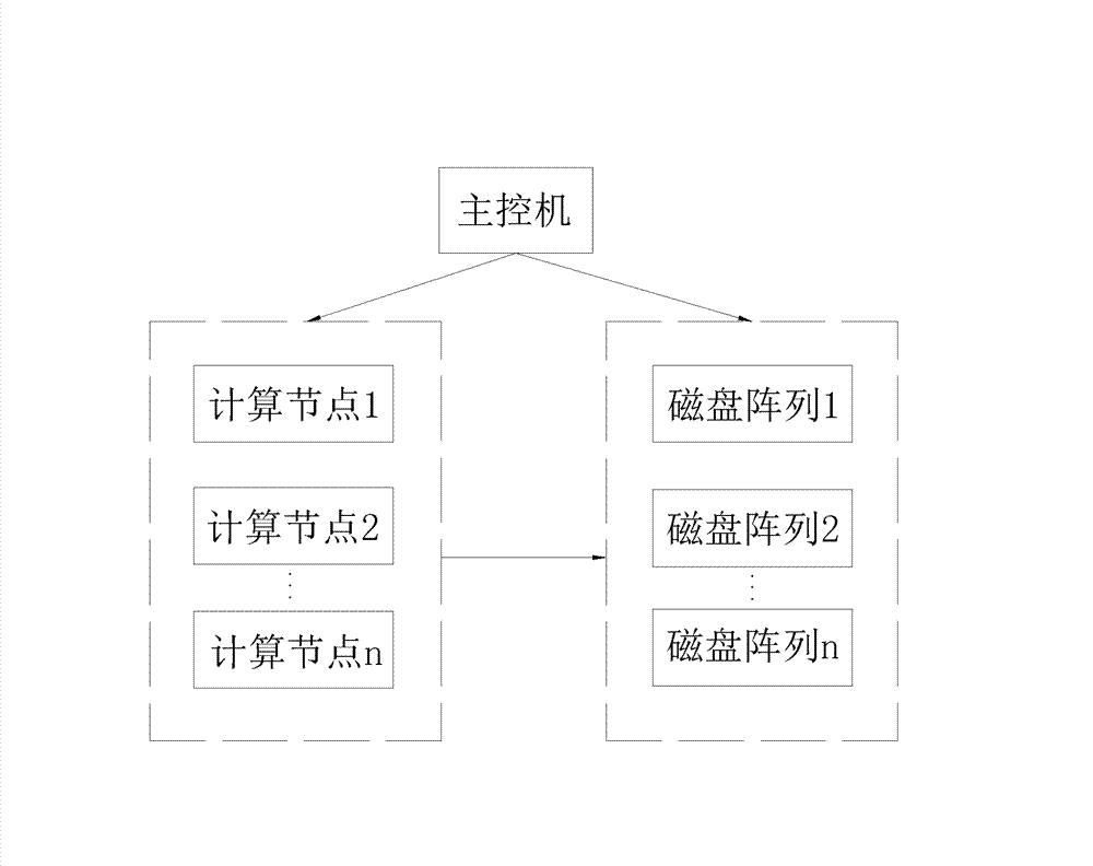
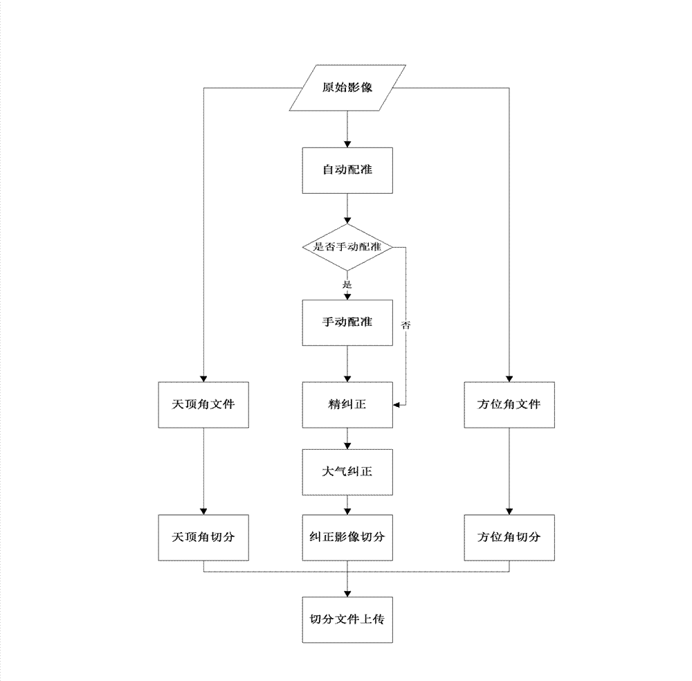
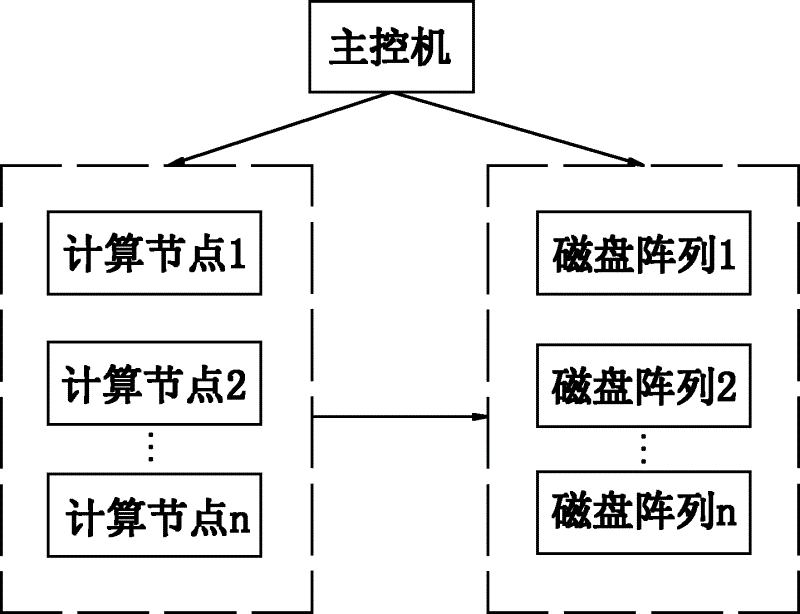
[0016] Such as figure 1 As shown, the remote sensing data processing system of the present invention includes a main control computer, a plurality of computing nodes and a disk array, the main control computer includes a data selection module, a data preprocessing module and a data management module, and the data selection module is used for producing The type of remote sensing product, and the required remote sensing raw data is retrieved from the disk array. The data preprocessing module divides the original remote sensing image data into small pieces of 1000*1000, and the data management module performs unified storage and management of the original data and the sliced data. Name the image. And all the slices cut from an original image are placed in the same folder of the disk array, and the naming method of the folder is: satellite\sensor\year\month\day\orbit number\slice level. The data management module can preview the data of the disk array 3, view its detailed info...
PUM
 Abstract
Description
Claims
Application Information
 - R&D
- Intellectual Property
- Life Sciences
- Materials
- Tech Scout
- Unparalleled Data Quality
- Higher Quality Content
- 60% Fewer Hallucinations
Browse by: Latest US Patents, China's latest patents, Technical Efficacy Thesaurus, Application Domain, Technology Topic, Popular Technical Reports.
© 2025 PatSnap. All rights reserved.Legal|Privacy policy|Modern Slavery Act Transparency Statement|Sitemap|About US| Contact US: help@patsnap.com