

Method for reducing positioning drift of Big Dipper satellite navigating and positioning device
A technology of navigation and positioning and Beidou satellites, which is applied in the field of satellite positioning, can solve the problems of inaccurate positioning of Beidou navigation and positioning devices, and achieve the effect of improving accuracy and reducing positioning drift
- Summary
- Abstract
- Description
- Claims
- Application Information
AI Technical Summary
Problems solved by technology
Method used
Image

Examples
Embodiment Construction
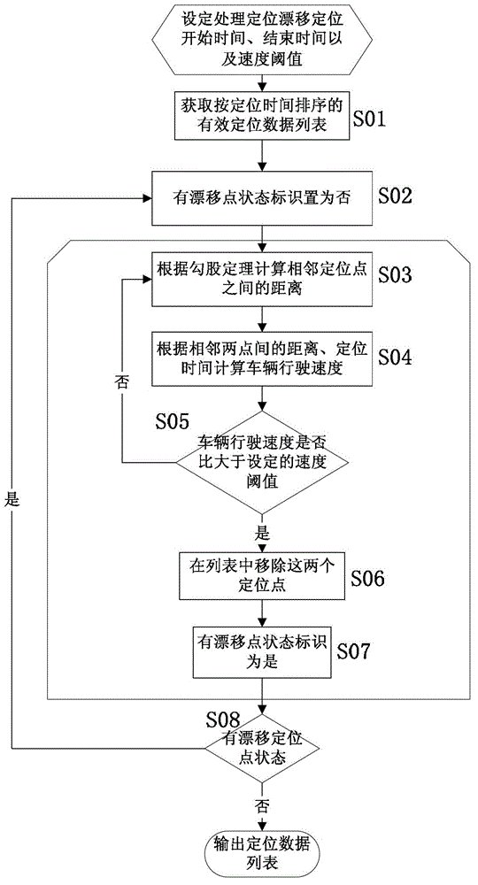
[0014] see figure 1 , first, after setting the start time, end time, and speed threshold for processing positioning drift, perform step (S01) to obtain valid positioning data information sorted by positioning time within this period of time, and save them in the list.
[0015] Execute step (S02) set the status flag of drift point in the positioning list to No, execute step (S03) calculate the distance between two adjacent points according to the adjacent Pythagorean theorem, and execute step S04 according to the distance between two points and the positioning time Calculate the driving speed of the vehicle between adjacent anchor points at intervals. Execute step S05 to judge whether the speed of two adjacent positioning points is greater than the set speed threshold (100m / s), if it is less than the speed threshold, execute step (S03), and when it is greater than the speed threshold, execute step (S06 ) to delete the two positioning points, and then perform step (S07) to modi...
PUM
 Abstract
Description
Claims
Application Information